MyTopo
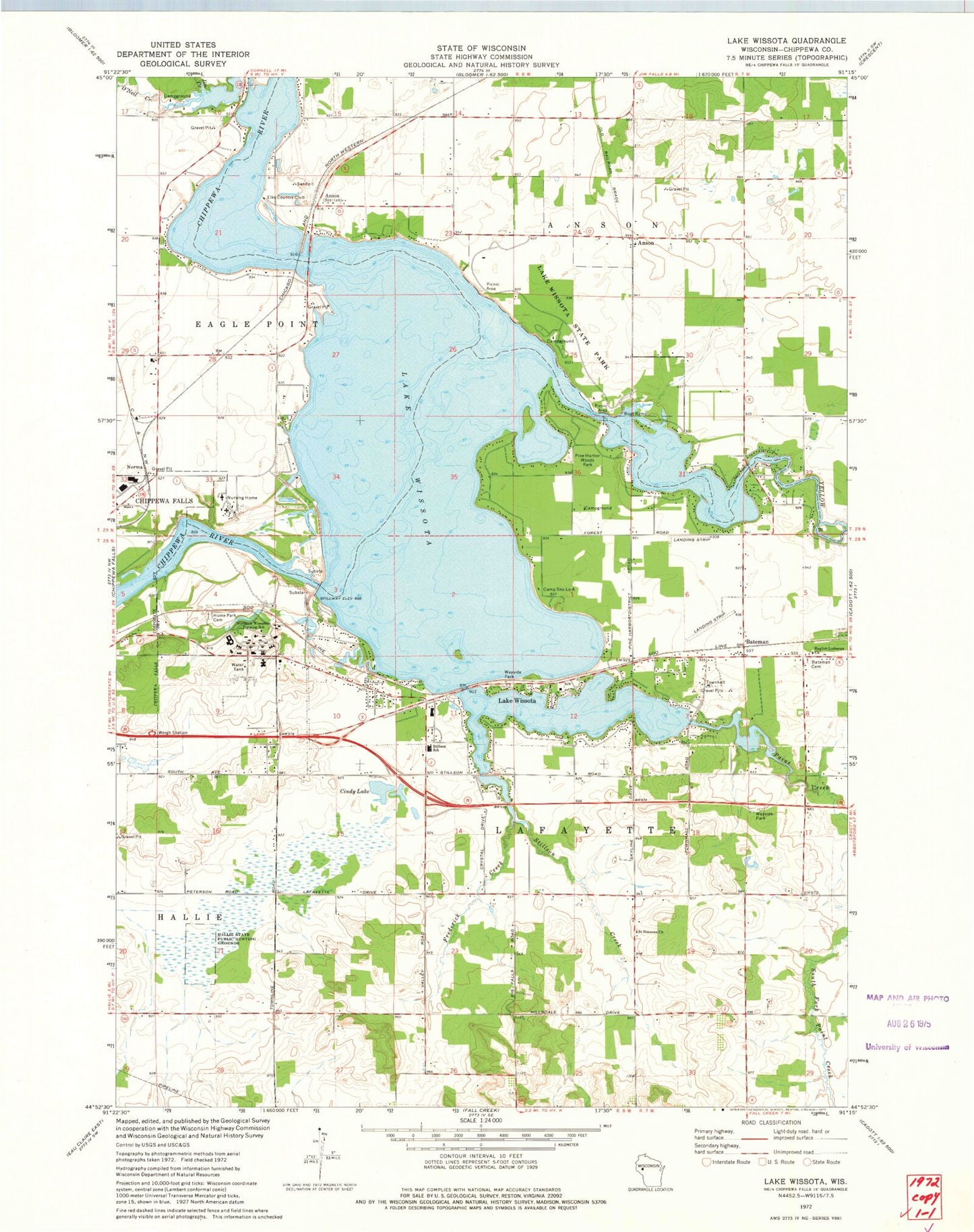
Classic USGS Lake Wissota Wisconsin 7.5'x7.5' Topo Map
Couldn't load pickup availability
Historical USGS topographic quad map of Lake Wissota in the state of Wisconsin. Map scale may vary for some years, but is generally around 1:24,000. Print size is approximately 24" x 27"
This quadrangle is in the following counties: Chippewa.
The map contains contour lines, roads, rivers, towns, and lakes. Printed on high-quality waterproof paper with UV fade-resistant inks, and shipped rolled.
Contains the following named places: Amber Farm, Anson, Anson Station, Bateman, Bateman Cemetery, Butak Farms, Camp Sko-Lo-A, Chippewa Fire District Station 3, Cindy Lake, Colony Pit, Eagle School, Elks Country Club, Elm Grove School, English Lutheran Church, Frederick Creek, Frederick School, Hallie State Public Hunting Grounds, Home Park Cemetery, Jim Creek, Lake Wissota, Lake Wissota 5548, Lake Wissota Census Designated Place, Lake Wissota State Park, Liberty Christian School, Norma, Northern Wisconsin Center, O'Neil Creek, Paint Creek, Pine Harbor Woods Park, Saint Joseph's Hospital, Saint Simeons Church, Stillson Creek, Stillson Elementary School, T-Bo Field, Timber Terrace Golf Course, Town of Hallie, Town of Lafayette, Wissota Airport, Wissota Hydro Generating Station, Wissota WP37 Dam, Yellow River