MyTopo
Classic USGS Lake Michigan 7.5'x7.5' Topo Map
Couldn't load pickup availability
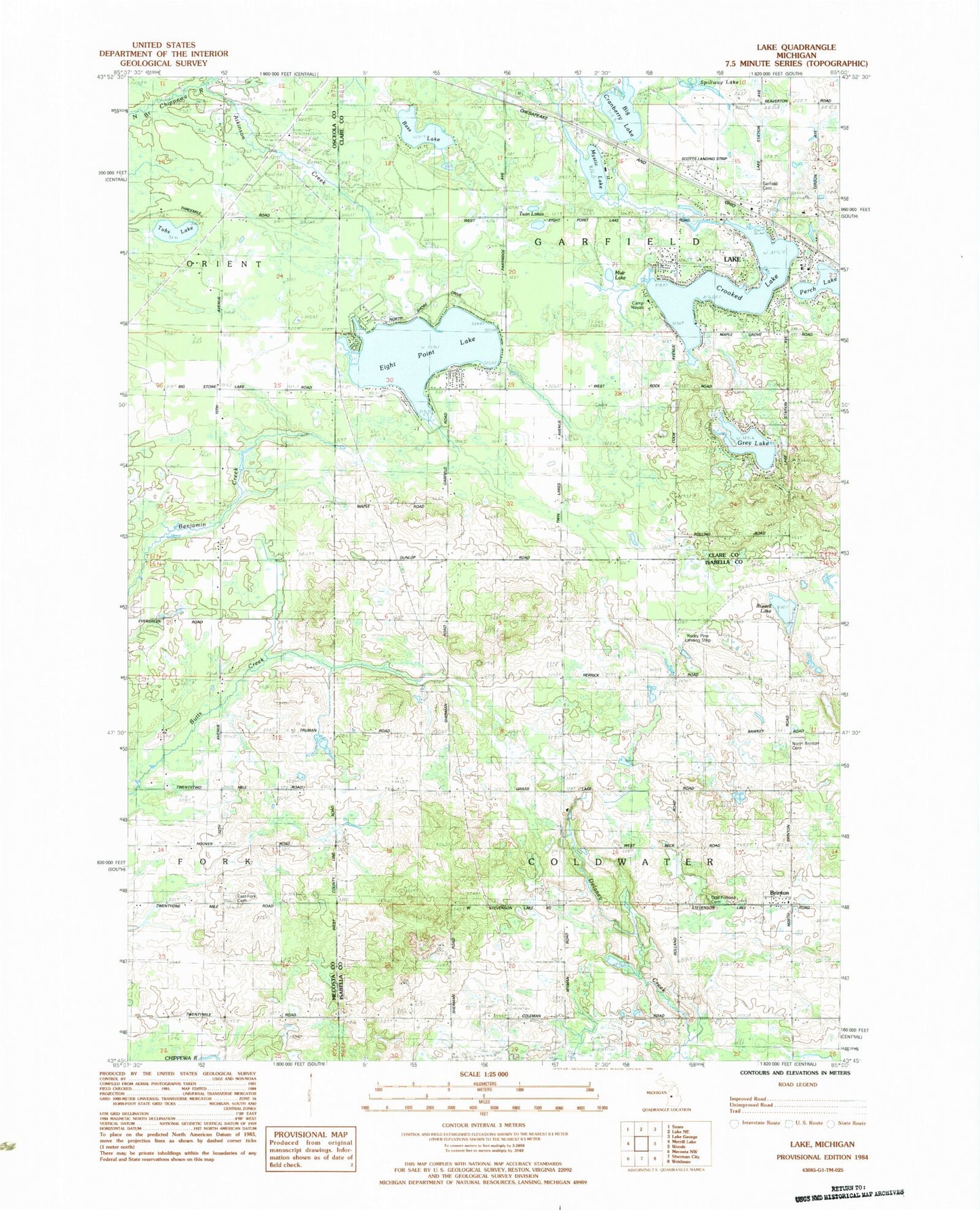
Historical USGS topographic quad map of Lake in the state of Michigan. Map scale may vary for some years, but is generally around 1:24,000. Print size is approximately 24" x 27"
This quadrangle is in the following counties: Clare, Isabella, Mecosta, Osceola.
The map contains contour lines, roads, rivers, towns, and lakes. Printed on high-quality waterproof paper with UV fade-resistant inks, and shipped rolled.
Contains the following named places: Atkinson Creek, Bass Lake, Bethany Baptist Church, Boyles Creek, Brinton, Brinton Post Office, Camp Neyati, Crooked Lake, Delaney Creek, Eight Point Lake, Fork Cemetery, Garfield Cemetery, Garfield Township Fire Department, Gray Lake, Lake, Lake Baptist Church, Lake Post Office, Lake Station, Muir Lake, Mystic Lake, North Brinton Cemetery, Odd Fellows Cemetery, Perch Lake, Rocky Pine Airport, Russell Lake, Scott Airstrip, Township of Coldwater, Township of Garfield, Tubs Lake, Twin Lakes, ZIP Code: 48632