MyTopo
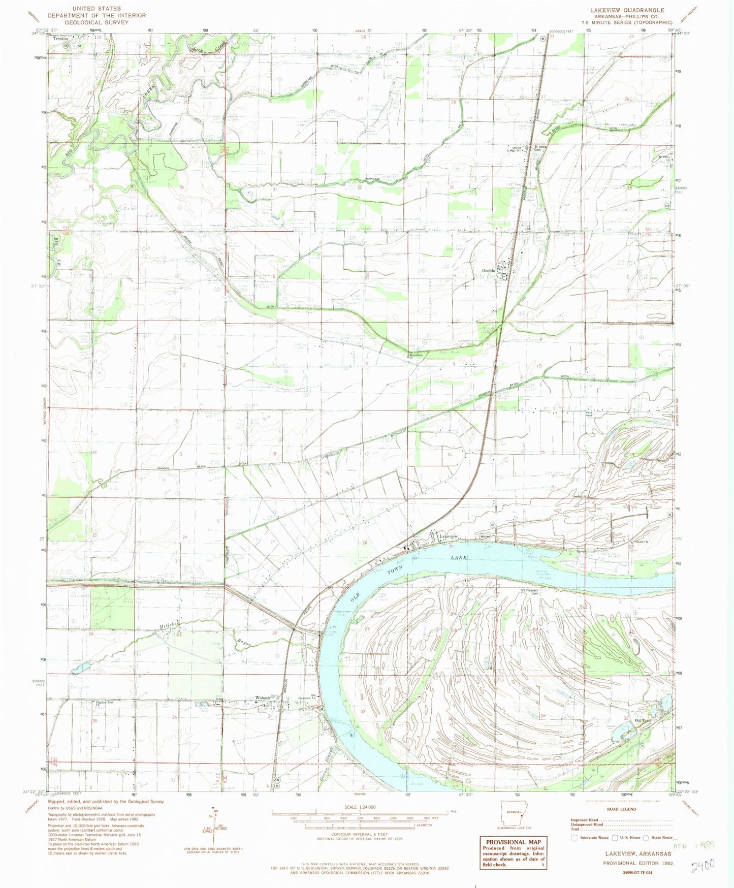
Classic USGS Lakeview Arkansas 7.5'x7.5' Topo Map
Couldn't load pickup availability
Historical USGS topographic quad map of Lakeview in the state of Arkansas. Map scale may vary for some years, but is generally around 1:24,000. Print size is approximately 24" x 27"
This quadrangle is in the following counties: Phillips.
The map contains contour lines, roads, rivers, towns, and lakes. Printed on high-quality waterproof paper with UV fade-resistant inks, and shipped rolled.
Contains the following named places: Beaver Bayou Ditch, C V White High School, Church of God, City of Lake View, Hugo, Johnson Bayou Ditch, Key Store, Lake View Church, Lake View Elementary School, Lake View Police Department, Lakeview, Lakeview Elementary School, Lakeview Fire Department, Lick Creek, Macedonia Church, McGehee Bayou, Morning Star Church, Mount Olive Cemetery, Mount Olive Church, Mount Pleasant Cemetery, Mount Pleasant Church, Mount Pleasant School, Old Jerusalem Church, Old Town, Oneida, Oneida Census Designated Place, Oneida Junior High School, Oneida Post Office, Phillips County, Pilgrims Rest, Pilgrims Rest Church, Saint James Church, Saint Johns Cemetery, Saint Johns Church, Salem Cemetery, Salem School, Township of James R Bush, Township of Searcy, Trenton, Wabash, Wabash Post Office, Wabash Volunteer Fire Department, ZIP Code: 72355