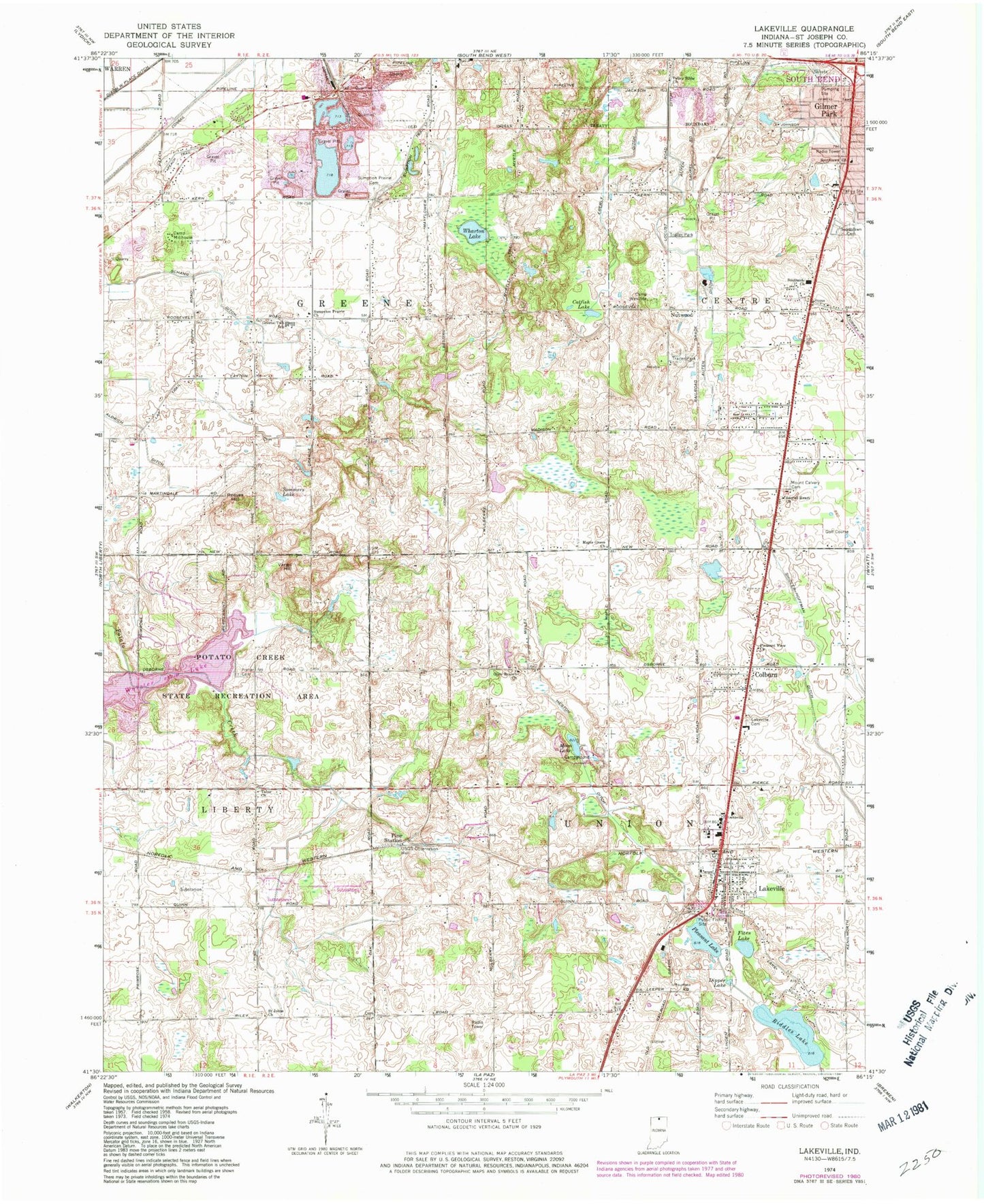
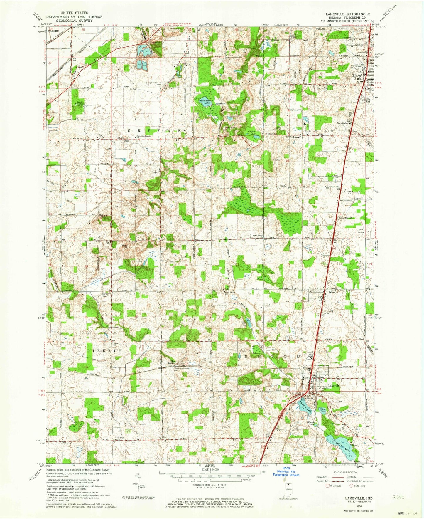
MyTopo
Classic USGS Lakeville Indiana 7.5'x7.5' Topo Map
Couldn't load pickup availability
Historical USGS topographic quad map of Lakeville in the state of Indiana. Typical map scale is 1:24,000, but may vary for certain years, if available. Print size: 24" x 27"
This quadrangle is in the following counties: St. Joseph.
The map contains contour lines, roads, rivers, towns, and lakes. Printed on high-quality waterproof paper with UV fade-resistant inks, and shipped rolled.
Contains the following named places: Authen Ditch, Camp Millhouse, Camp Wakinda, Catfish Lake, Colburn, Dipper Lake, Dixon West Place Ditch, Eberly Ditch, Fites Lake, Gilmer Park, Greene Elementary School, Heston Ditch, Lakeville, Lakeville Cemetery, Maple Grove Church, Moon Lake, Mount Calvary Cemetery, Nutwood, Olive Branch Church, Pine Station, Pleasant Lake, Pleasant View Church, Porter Cemetery, Potato Creek State Park, Reeves Hill, Riddles Lake, Sacred Heart Church, Saint Johns Church, Schang Ditch, Shidler - Hoffman Ditch, Sommers Lake, Southlawn Cemetery, Southside Church, Sumption Prairie Cemetery, Sumption Prairie Church, Suthlawn Church, Tabor Church, Valley Bible Church, Vargo Hill, Wharton Lake, Township of Greene, Township of Centre, Saint Joseph County, Worster Lake, Lakeville Elementary School, Potato Creek Reservoir Dam, Township of Union, Town of Lakeville, Centre Township Fire Department, Lakeville Union Township Fire Department, Union North Ambulance Service, South Bend Sandpit, Lakeville Police Department, Lakeville Post Office