MyTopo
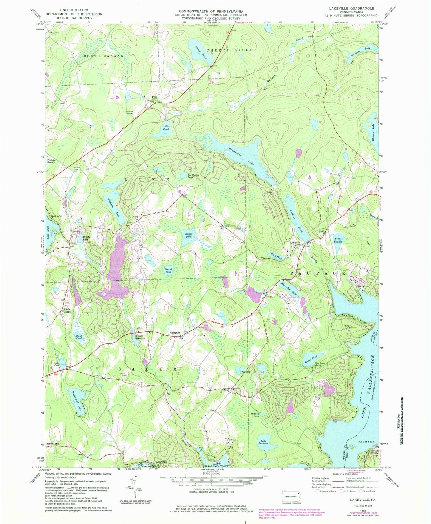
Classic USGS Lakeville Pennsylvania 7.5'x7.5' Topo Map
Couldn't load pickup availability
Historical USGS topographic quad map of Lakeville in the state of Pennsylvania. Typical map scale is 1:24,000, but may vary for certain years, if available. Print size: 24" x 27"
This quadrangle is in the following counties: Pike, Wayne.
The map contains contour lines, roads, rivers, towns, and lakes. Printed on high-quality waterproof paper with UV fade-resistant inks, and shipped rolled.
Contains the following named places: Beaver Lake, Beaver Lake Dam, Deer Lake, Deer Lake Dam, Roaming Woods Lake, Roaming Woods Lake Dam, Craft Pond Dam, Locklin Pond Dam, Lake Ellyn Dam, Lake Ariel Dam, Wildwood Lake Dam, Lake Paupackan Dam, Mang Dam, Mang Pond, Arlington School, Centerville School (historical), Ammermanton School, Ariel Creek, Arlington, Avoy, Big Spring Pond, Briar Hill, Brooks Lake, Butler Pond, Clemo Pond, Cobb Pond, Cooks Pond, Craft Pond, Finn Swamp, Lake Genero, Goose Pond, Hidden Lake, Lakeville, Little Chapel, Locklin Pond, Marsh Pond, Paupackan Lake, Purdy Creek, Saint Marys Church, Tisdale Cemetery, Wangum Lake, Waynewood Lake, Whitney Lake, Wildwood Lake, Lake Lacawac, Moc-a-Tek Lake, Kipp Island, Pink, Purdytown, Five Mile Point, Lake Clemo Dam, Janoske Dam, C H Mack Dam, Herrman Dam, Hazzard Dam, Croft Dam, Lake Moc a tek Dam, Kuehners Pond, Township of Paupack, Township of Salem, The Hideout Census Designated Place, Wallenpaupack Lake Estates Census Designated Place, The Hideout, Wallenpaupack Lake Estates, Lakeville Volunteer Fire Department, Ledgedale Volunteer Fire Department