MyTopo
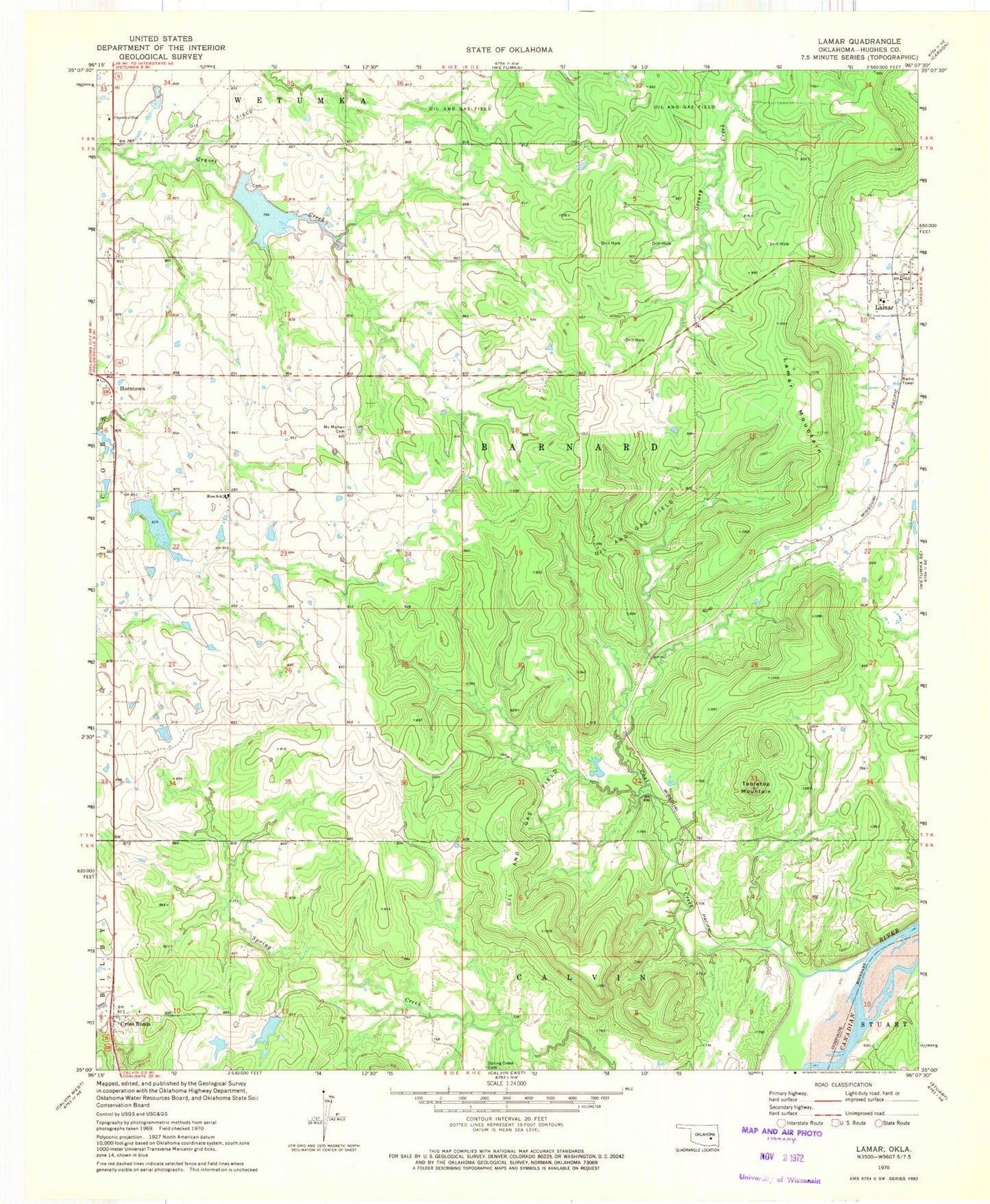
Classic USGS Lamar Oklahoma 7.5'x7.5' Topo Map
Couldn't load pickup availability
Historical USGS topographic quad map of Lamar in the state of Oklahoma. Map scale may vary for some years, but is generally around 1:24,000. Print size is approximately 24" x 27"
This quadrangle is in the following counties: Hughes.
The map contains contour lines, roads, rivers, towns, and lakes. Printed on high-quality waterproof paper with UV fade-resistant inks, and shipped rolled.
Contains the following named places: Coal Creek, Cross Roads, Crossroads Cemetery, Hack Black Junior Dam, Hack Black Junior Reservoir, Horntown, Horntown Fire Department, Hughes County Emergency Medical Services Station 2, Lamar, Lamar Mountain, Lamar Volunteer Fire Department, Little Wewoka Creek Site 13 Dam, Little Wewoka Creek Site 13 Reservoir, Little Wewoka Creek Site 14 Dam, Little Wewoka Creek Site 14 Reservoir, McMahan Cemetery, Moss Elementary School, Moss High School, Oknoname 063025 Dam, Oknoname 063025 Reservoir, Oknoname 063026 Dam, Oknoname 063026 Reservoir, Spring Creek Cemetery, Tabletop Mountain, Town of Horntown, Township of Barnard