MyTopo
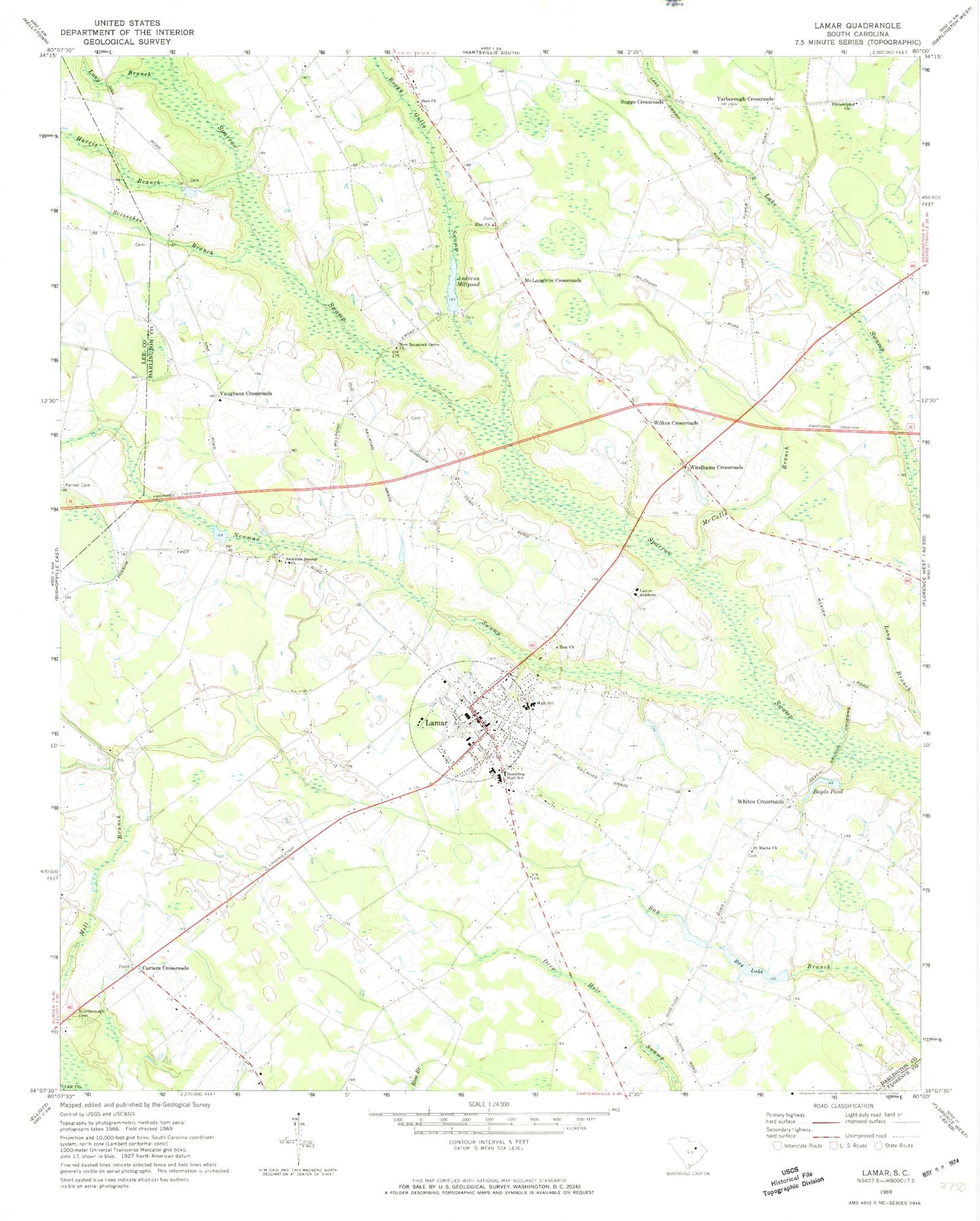
Classic USGS Lamar South Carolina 7.5'x7.5' Topo Map
Couldn't load pickup availability
Historical USGS topographic quad map of Lamar in the state of South Carolina. Map scale may vary for some years, but is generally around 1:24,000. Print size is approximately 24" x 27"
This quadrangle is in the following counties: Darlington, Florence, Lee.
The map contains contour lines, roads, rivers, towns, and lakes. Printed on high-quality waterproof paper with UV fade-resistant inks, and shipped rolled.
Contains the following named places: A L Howell Dam D-3525, Andrews Mill, Andrews Millpond, Asbury Church, Asbury School, Bay Lake, Boggy Gully Swamp, Boyds Pond, Carters Crossroads, Elim Church, Galilee School, Harris Branch, Joe Jeffords Pond Dam D-3526, Lake Swamp Division, Lamar, Lamar Academy, Lamar Airport, Lamar Division, Lamar Elementary School, Lamar High School, Lamar Police Department, Long Branch, McCalls Branch, McLaughlin Crossroads, Mount Tabor School, New Savannah Grove Church, Newman Swamp, Newman Swamp Church, Newman Swamp School, Newman Swamp Southern Methodist Church, Oats Church, Parnell Cemetery, Philadelphia Church, Philadelphia School, Quietude School, Saint Marks Church, Saint Marks School, Scarborough Cemetery, Screeches Branch, Sity Oxidization Pond D-3527 Dam, South Carolina Noname 16019 D-3528 Dam, Spaulding Elementary School, Spaulding High School, Suggs Crossroads, Town of Lamar, Town of Lamar Fire Department, Vaughans Crossroads, Whites Crossroads, Wilkes Crossroads, Windhams Crossroads, Windlamtown School, Yarborough Crossroads, Zion Church, ZIP Code: 29069


