MyTopo
Classic USGS Lamkin Texas 7.5'x7.5' Topo Map
Regular price
$16.95
Regular price
Sale price
$16.95
Unit price
per
Couldn't load pickup availability
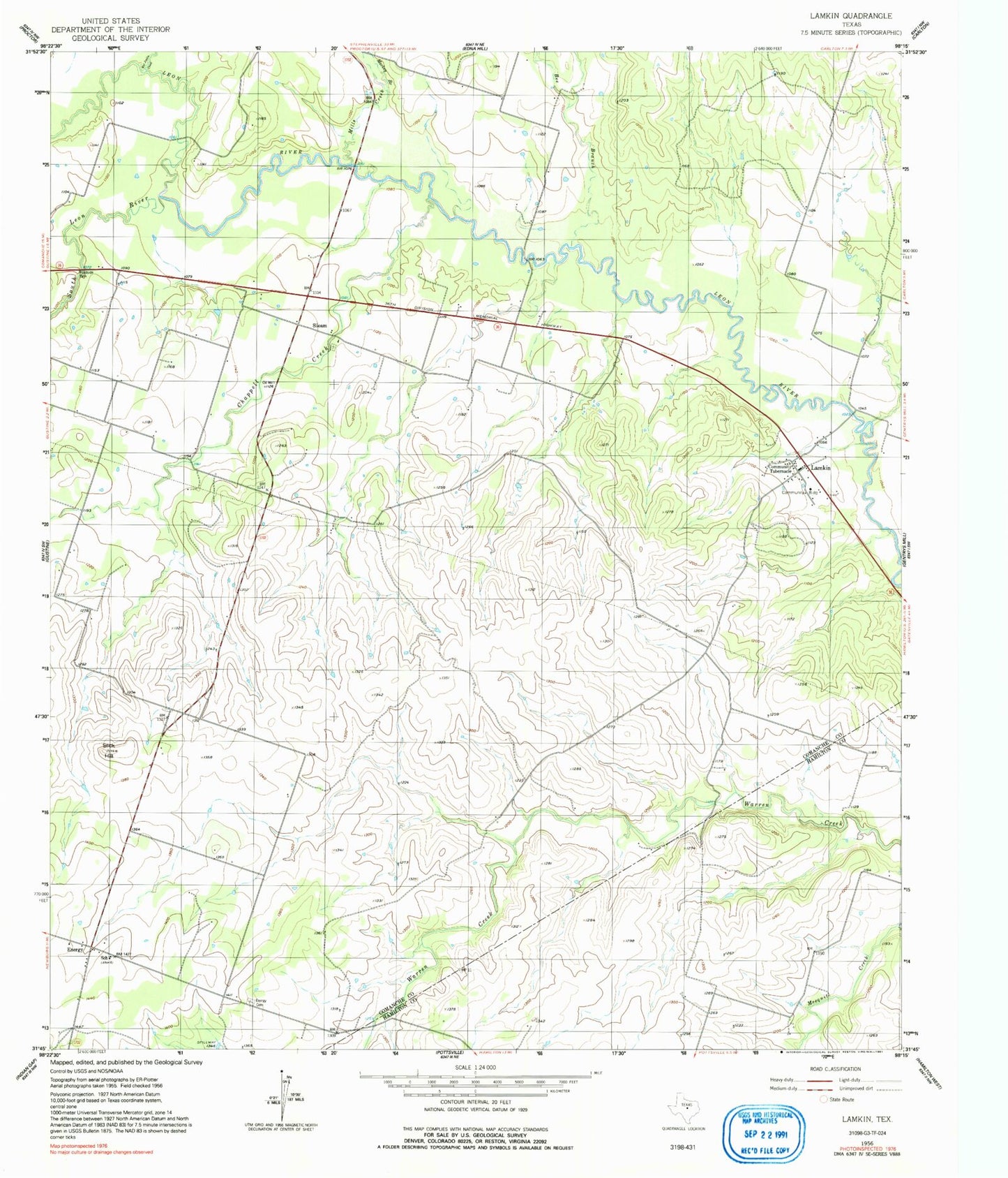
Historical USGS topographic quad map of Lamkin in the state of Texas. Map scale may vary for some years, but is generally around 1:24,000. Print size is approximately 24" x 27"
This quadrangle is in the following counties: Comanche, Hamilton.
The map contains contour lines, roads, rivers, towns, and lakes. Printed on high-quality waterproof paper with UV fade-resistant inks, and shipped rolled.
Contains the following named places: Bee Branch, Chappell Creek, Energy, Energy Cemetery, Energy Post Office, Energy Volunteer Fire Department, Gustine Division, Harley White Field Airport, Lamkin, Lamkin Census Designated Place, Mackey Branch, Mills Creek, Siloam, Slick Hill, South Leon River, Wet Joplin Creek