MyTopo
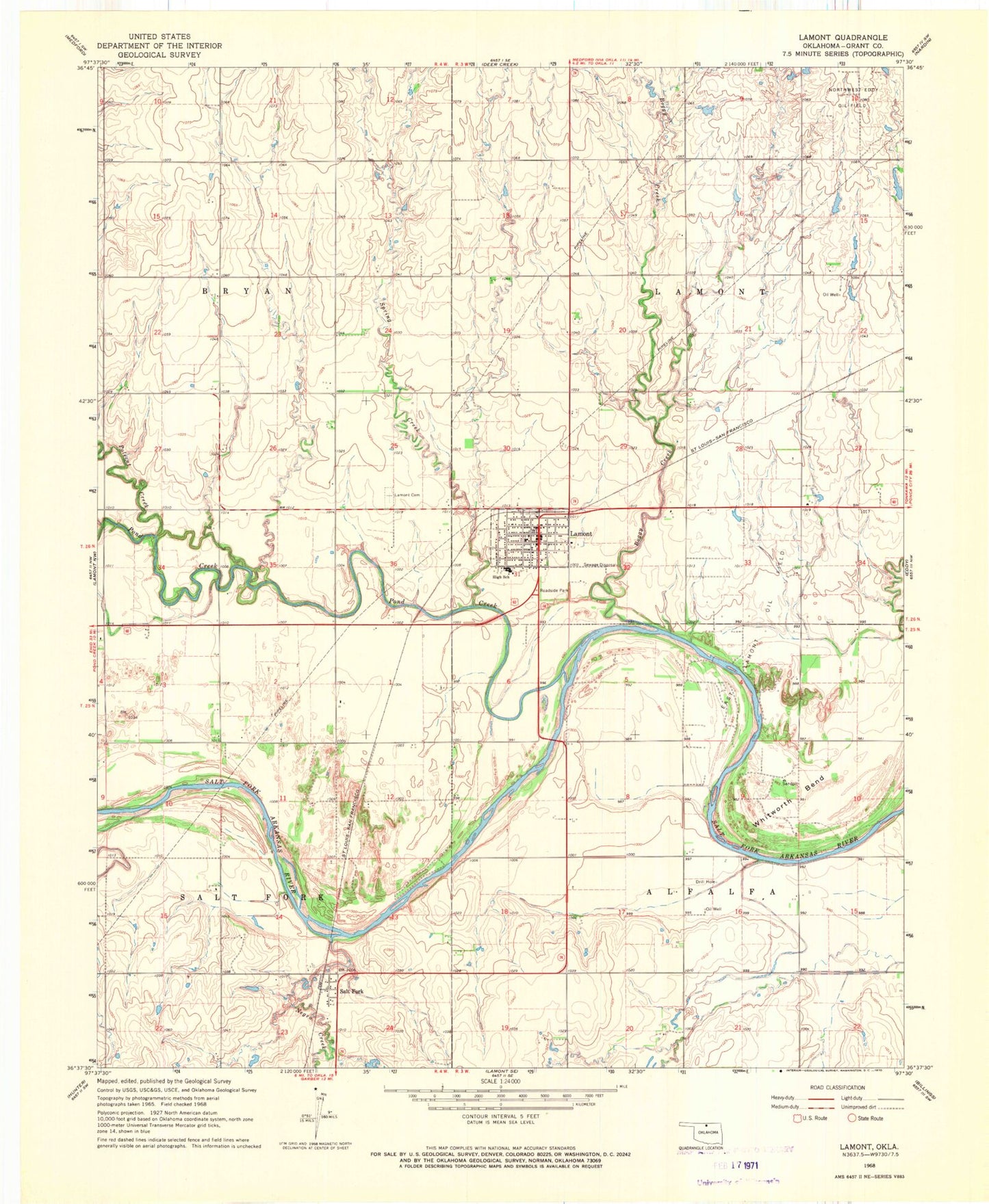
Classic USGS Lamont Oklahoma 7.5'x7.5' Topo Map
Couldn't load pickup availability
Historical USGS topographic quad map of Lamont in the state of Oklahoma. Map scale may vary for some years, but is generally around 1:24,000. Print size is approximately 24" x 27"
This quadrangle is in the following counties: Grant.
The map contains contour lines, roads, rivers, towns, and lakes. Printed on high-quality waterproof paper with UV fade-resistant inks, and shipped rolled.
Contains the following named places: Boggy Creek, Coyote Run Airport, Deer Creek - Lamont High School, East Lamont Oil Field, Lamont, Lamont Cemetery, Lamont Division, Lamont Fire Department, Lamont Police Department, Lamont Post Office, Negro Creek, Northwest Eddy Oil Field, Polecat Creek, Pond Creek, Salt Fork, Spring Creek, Town of Lamont, Township of Alfalfa, Township of Lamont, Township of Salt Fork, Whitworth Bend, ZIP Code: 74643