MyTopo
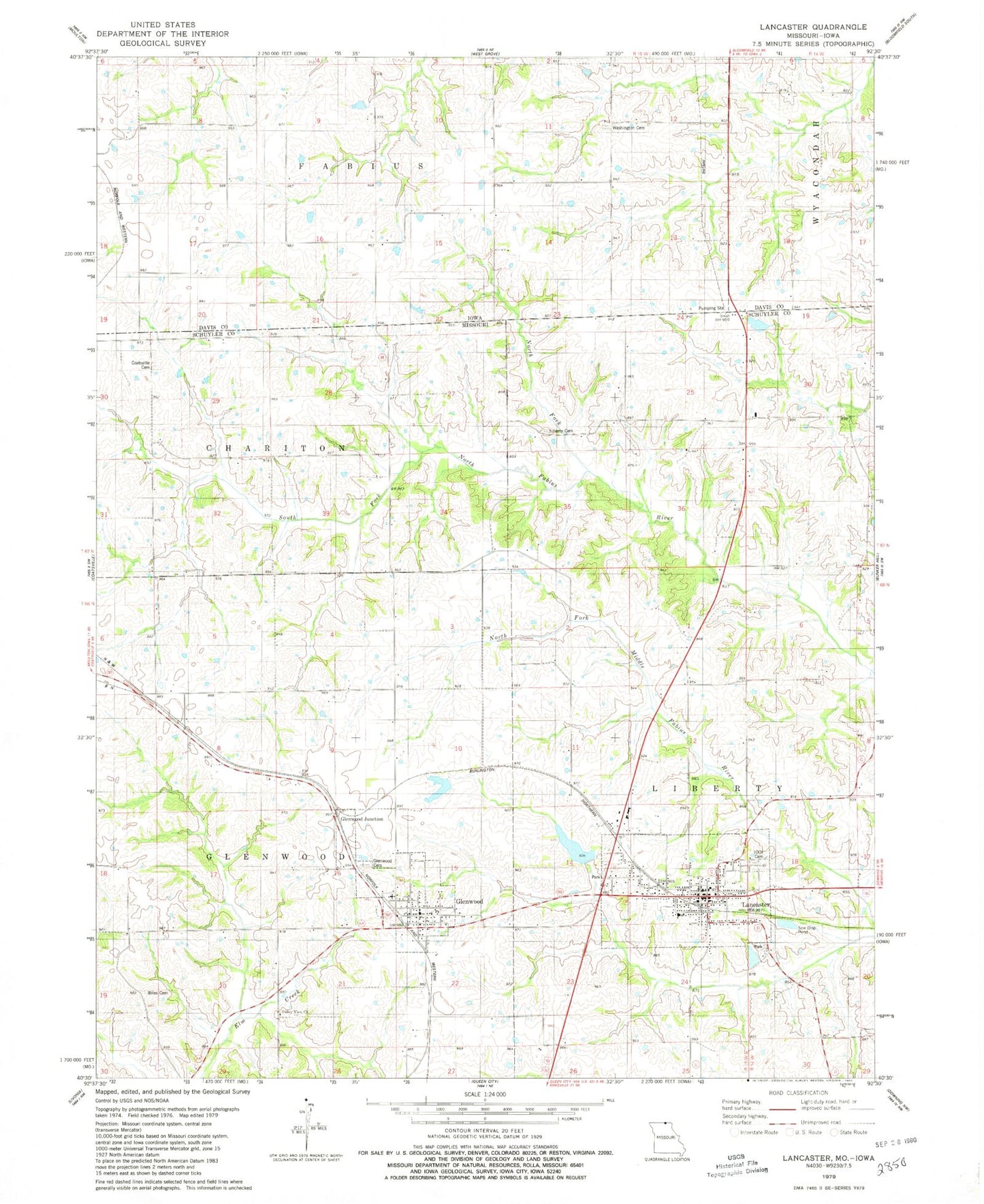
Classic USGS Lancaster Missouri 7.5'x7.5' Topo Map
Couldn't load pickup availability
Historical USGS topographic quad map of Lancaster in the states of Missouri, Iowa. Map scale may vary for some years, but is generally around 1:24,000. Print size is approximately 24" x 27"
This quadrangle is in the following counties: Davis, Schuyler.
The map contains contour lines, roads, rivers, towns, and lakes. Printed on high-quality waterproof paper with UV fade-resistant inks, and shipped rolled.
Contains the following named places: Ailshire School, Biles Cemetery, City of Lancaster, Coatesville Cemetery, Glenwood, Glenwood Cemetery, Glenwood Junction, Glenwood Post Office, Helmick Lake Dam, Hickory Mound School, Independent Order of Odd Fellows Cemetery, Lancaster, Lancaster City Dam, Lancaster City Lake, Lancaster Fire Rescue, Lancaster Lake Dam, Lancaster Post Office, Liberty Cemetery, Liberty School, Melvin School, Mount Tabor School, Mount Vernon School, Newton Cemetery, North Fork of South Fork of North Fabius River, Number 39 Dam, Schuyler County Sheriff's Office, Siding, Township of Glenwood, Township of Liberty, Ursel Gingerich Dam, Ursel Gingerich Lake, Valley View Church, Village of Glenwood, Washington Cemetery