MyTopo
Classic USGS Lancer Kentucky 7.5'x7.5' Topo Map
Couldn't load pickup availability
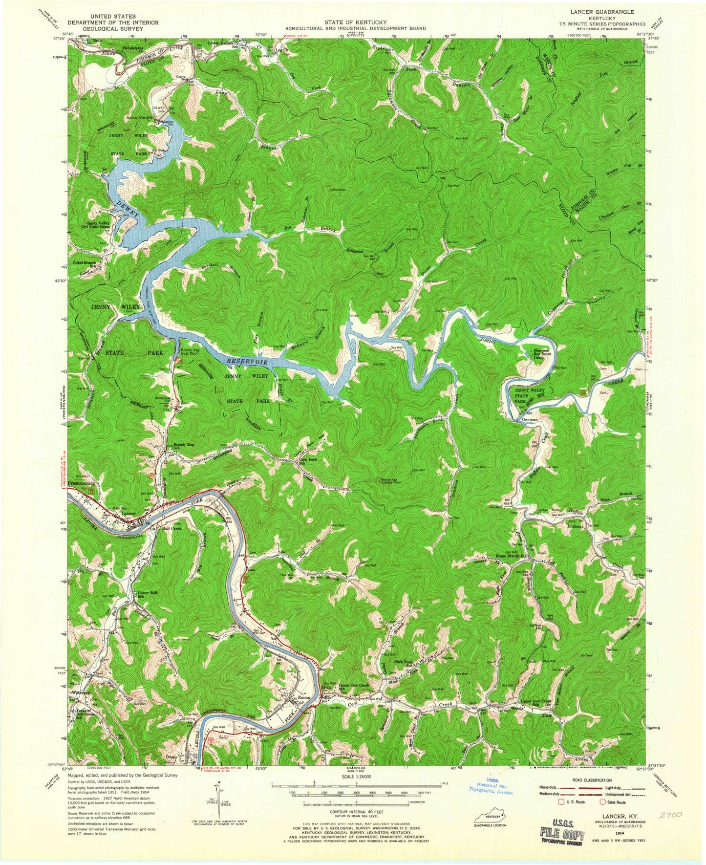
Historical USGS topographic quad map of Lancer in the state of Kentucky. Map scale may vary for some years, but is generally around 1:24,000. Print size is approximately 24" x 27"
This quadrangle is in the following counties: Floyd, Johnson, Martin.
The map contains contour lines, roads, rivers, towns, and lakes. Printed on high-quality waterproof paper with UV fade-resistant inks, and shipped rolled.
Contains the following named places: Akers Branch, Alvin, Ax Handle Branch, Bear Water Branch, Benedict Church, Big Branch, Big Sandy Regional Airport, Brandy Keg Boat Dock, Brandy Keg Dike, Brushy Fork, Buffalo Creek, Bull Creek, Burchett Branch, Calf Creek, Clarks Branch, Copperas Creek, Corn Fork, Corn Fork Church, Corn Fork Hollow, Cow Creek, Cow Creek Volunteer Fire Department, Crooked Branch, Daniels Creek, Dewey Dam, Dewey Lake, Dial Branch, Dicks Creek, Dodson Branch, Dog Fork, Dwale Census Designated Place, Emma, Endicott, Endicott Church, Endicott Church Cemetery, Flax Branch, Gobel Branch, Hayden Branch, Home Branch, Home Branch School, Jenny Wiley State Park, Johns Branch, Knottly Hollow, Lancer, Left Fork Daniels Creek, Left Fork Home Branch, Lockhart Cemetery, Long Branch, Marshall Branch, Mayo Cemetery, McGuire Branch, Moss Canif Branch, Mutton Fork, Nero, Old Home Branch, Philadelphia Church, Pleasant Home Church, Prophet Hollow, Right Fork Home Branch, Sand Branch, Sandy Valley Girl Scout Camp, Shade Branch Johns Creek, Shady Branch, Shawnee Campground, Slick Rock Branch, Souders Branch, Spicewood Branch, Still House Branch, Stonecoal Branch, Stratton Branch, Sugarloaf Branch, Sycamore Branch, Sycamore Creek, Tailings Pond, The Old Log Church, Thompson Fork, Tom Sellers Branch, Toms Branch, Trans Star Ambulance Service, Trimble Chapel, Twin Branch, Watergap, Whiskey Hollow, Wills Branch, Woods, Woods Branch, ZIP Codes: 41265, 41621