MyTopo
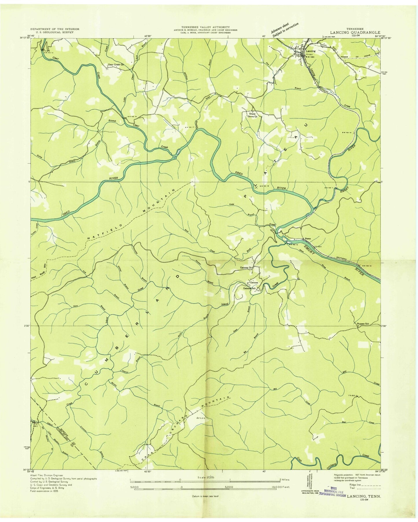
Classic USGS Lancing Tennessee 7.5'x7.5' Topo Map
Couldn't load pickup availability
Historical USGS topographic quad map of Lancing in the state of Tennessee. Typical map scale is 1:24,000, but may vary for certain years, if available. Print size: 24" x 27"
This quadrangle is in the following counties: Cumberland, Morgan.
The map contains contour lines, roads, rivers, towns, and lakes. Printed on high-quality waterproof paper with UV fade-resistant inks, and shipped rolled.
Contains the following named places: Snow Branch, Susan Branch, Turkey Creek, White Horse Branch, Bear Branch, Big Branch, Bluffy Branch, Camp Branch, Clark Cemetery, Clayton Branch, Dismal Branch, Galbreth Branch, Grammer Branch, Gut Branch, Hall Cemetery, Hamby Cemetery, Hatfield Mountain, Howard Cemetery, Island Creek, Jones Branch, Jones Branch, Kubly Cemetery, Laurel Creek, Lick Branch, Lilly Bridge, Little Clear Creek, Little Meadow Branch, Meadow Branch, Melton Mill Branch, Milligan Branch, Murphy Branch, Nelson Cemetery, North Fork Melton Mill Branch, Panther Branch, Pennykin Branch, Price Branch, Rock Creek, Scott Hickman Spring Branch, Obed River, Campground Creek, Clear Creek, Clear Creek Church, Lancing, Camel Rock Rapids, Canoe Hole Rapids, Catoosa School (historical), Chestnut Branch, Clear Creek Junction, Jacks Rock Falls, Jett Bridge, Lancing Elementary School (historical), Lilly Rapids, Nemo Bridge, Nemo Rapids, Ohmigod Rapids, Rock Garden Rapids, Ruppee School (historical), Shady Grove Church, The Grunch Rapids, Widow Maker Rapids, Wootens Folly Rapids, Alley Ford, Catoosa, Howard Mill, Nemo, Shady Grove, Ruppe (historical), Canady Cemetery, Clear Creek Cemetery, Nitzschke Cemetery, Zumstein Cemetery, Lancing Post Office, Commissioner District 2, Snow Branch, Susan Branch, Turkey Creek, White Horse Branch, Bear Branch, Big Branch, Bluffy Branch, Camp Branch, Clark Cemetery, Clayton Branch, Dismal Branch, Galbreth Branch, Grammer Branch, Gut Branch, Hall Cemetery, Hamby Cemetery, Hatfield Mountain, Howard Cemetery, Island Creek, Jones Branch, Jones Branch, Kubly Cemetery, Laurel Creek, Lick Branch, Lilly Bridge, Little Clear Creek, Little Meadow Branch, Meadow Branch, Melton Mill Branch, Milligan Branch, Murphy Branch, Nelson Cemetery, North Fork Melton Mill Branch, Panther Branch, Pennykin Branch, Price Branch, Rock Creek, Scott Hickman Spring Branch, Obed River, Campground Creek, Clear Creek, Clear Creek Church, Lancing, Camel Rock Rapids, Canoe Hole Rapids, Catoosa School (historical), Chestnut Branch, Clear Creek Junction, Jacks Rock Falls, Jett Bridge, Lancing Elementary School (historical), Lilly Rapids, Nemo Bridge, Nemo Rapids, Ohmigod Rapids, Rock Garden Rapids, Ruppee School (historical), Shady Grove Church, The Grunch Rapids, Widow Maker Rapids, Wootens Folly Rapids, Alley Ford, Catoosa, Howard Mill, Nemo, Shady Grove, Ruppe (historical), Canady Cemetery, Clear Creek Cemetery, Nitzschke Cemetery, Zumstein Cemetery, Lancing Post Office, Commissioner District 2


