MyTopo
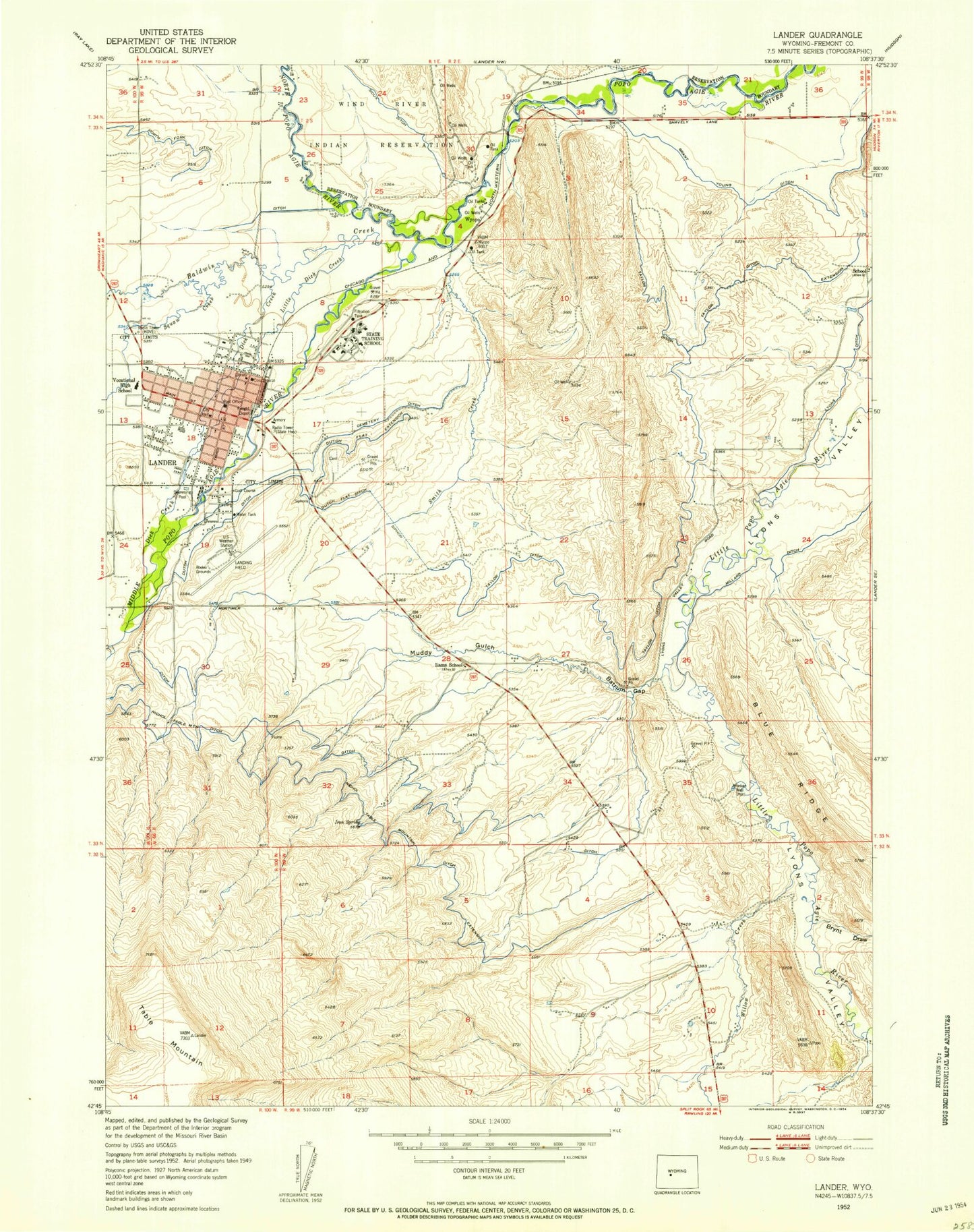
Classic USGS Lander Wyoming 7.5'x7.5' Topo Map
Couldn't load pickup availability
Historical USGS topographic quad map of Lander in the state of Wyoming. Map scale may vary for some years, but is generally around 1:24,000. Print size is approximately 24" x 27"
This quadrangle is in the following counties: Fremont.
The map contains contour lines, roads, rivers, towns, and lakes. Printed on high-quality waterproof paper with UV fade-resistant inks, and shipped rolled.
Contains the following named places: Anesi Draw, Baldwin Creek, Batrum Gap, Brynt Draw, Cemetery Ditch, Chittim Gulch, Coal Gulch, Deadman Gulch, Dickinson Creek, Dutch Flat Extension, Flat Ditch, Fort McGraw, Fremont County Fire Protection District Battalion 3 Lander Rural Station 1, Fremont County Sheriff's Office, Grant Young Ditch, Hornecker Creek, Hudson Siding, Hunt Field, Iiams Creek, Iron Spring, KOVE-AM (Lander), Lander, Lander Area Number One Mine, Lander Hudson Oil Field, Lander Police Department, Lander Post Office, Lander Volunteer Fire Department, Little Dickinson Creek, Middle Popo Agie River, Mount Hope Cemetery, Nicol Table Mountain Ditch, North Popo Agie River, Northside School, Paralda Ditch, Pathfinder High School, Robinson Gulch, SageWest Lander Health Care, Shoshone National Forest Washakie Ranger District Fire Engine Crew, Showboat Retirement Center, Smith Creek, Southside School, Squaw Creek, Squaw Creek Shopping Center, Table Mountain Community Hall, Table Mountain Ditch, Table Mountain Ditch Extension, Taylor Ditch, Taylor Ditch Extension, Tonys Gulch, Westside School, Westward Heights Nursing Home, Willow Creek, Wind River, Wyoming State Training School Cemetery, Wyopo