MyTopo
Classic USGS Landis Arkansas 7.5'x7.5' Topo Map
Couldn't load pickup availability
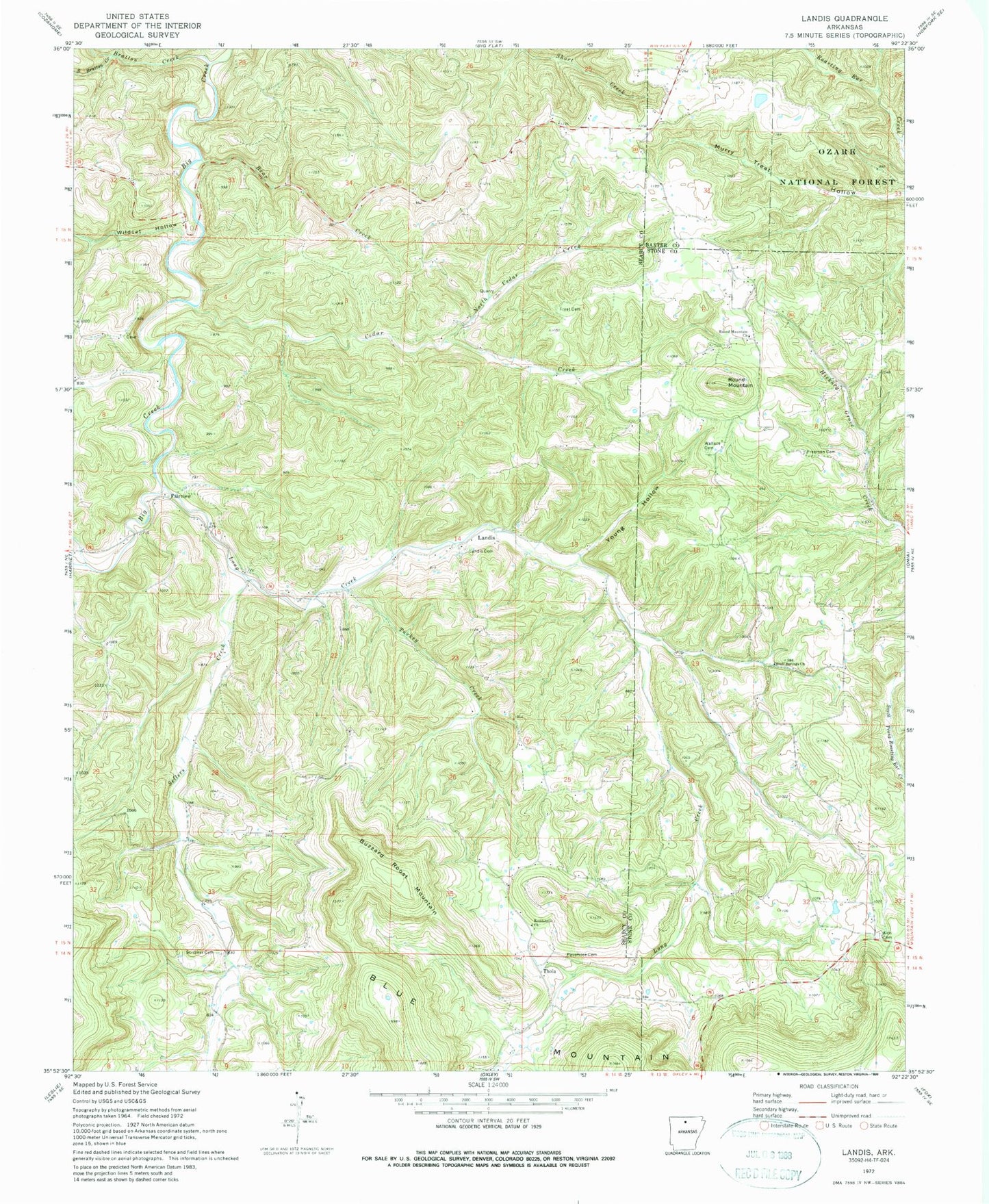
Historical USGS topographic quad map of Landis in the state of Arkansas. Map scale may vary for some years, but is generally around 1:24,000. Print size is approximately 24" x 27"
This quadrangle is in the following counties: Baxter, Searcy, Stone.
The map contains contour lines, roads, rivers, towns, and lakes. Printed on high-quality waterproof paper with UV fade-resistant inks, and shipped rolled.
Contains the following named places: Alco Cemetery, Bear Creek, Bethlehem Church, Big Flat Lake, Big Flat Lake Dam, Bluff Springs Church, Bluff Springs School, Bratton Creek, Buzzard Roost Mountain, Cedar Creek, Cellar Creek, Elm Hollow, Fairview, Freeman Cemetery, Hickory Hollow, Landis, Landis Cemetery, Landis Fire Station, Lee Mountain, Long Creek, May, North Cedar Creek, Passmore Cemetery, Round Mountain, Round Mountain Church, Scribner Cemetery, South Bratton Creek, Thola, Township of Clark, Township of Locust Grove, Township of Long Creek, Treat Cemetery, Turkey Creek, Wallace Cemetery, Wildcat Hollow, Young Hollow