MyTopo
Classic USGS Landisburg Pennsylvania 7.5'x7.5' Topo Map
Couldn't load pickup availability
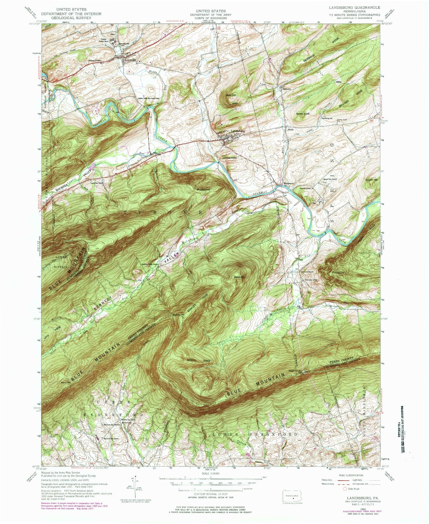
Historical USGS topographic quad map of Landisburg in the state of Pennsylvania. Typical map scale is 1:24,000, but may vary for certain years, if available. Print size: 24" x 27"
This quadrangle is in the following counties: Cumberland, Perry.
The map contains contour lines, roads, rivers, towns, and lakes. Printed on high-quality waterproof paper with UV fade-resistant inks, and shipped rolled.
Contains the following named places: Alinda, Barkley Ridge, Bells Hill, Berrys Gap, Bixler Run, Bridgeport, Mount Dempsey, Green Valley Run, Hidden Valley Boy Scout Camp, Kennedy Valley, Kennedy Valley Church, Landisburg, Landisburg Cemetery, Laurel Run, Laurel Run Church, Little Indian Hollow, Loysville, McCabe Run, McClures Gap, McClures Gap Cemetery, McClures Gap Church, McClures Gap School, Middle Ridge, Milltown, Montour Creek, Mount Zion Church, Muddy Run, Oak Grove Church, Quaker Hill, Restland Cemetery, Round Top, Sheaffer Valley, Spotts Knob, Stilhouse Hollow, Tressler Orphan Home, Trout Run, Waggoners Gap, Welch Hill, Germany Ridge, Wolf Hollow, Frankford Airport (historical), Shulls Airport, Egolf Airport, Metz Airport (historical), Spruce Bank School, Kennedy Valley School, Baken Creek, Oakgrove, Entlerville, Hidden Valley Boy Scouts East Camp, Oak Grove School, Pine Hill School, Spring Dale School, Borough of Landisburg, Township of Spring, Township of Tyrone, Landisburg Volunteer Fire Company Station 4, Landisburg Ambulance Association Station 49, Stambaugh Farm Run, Landisburg Post Office, Loysville Post Office