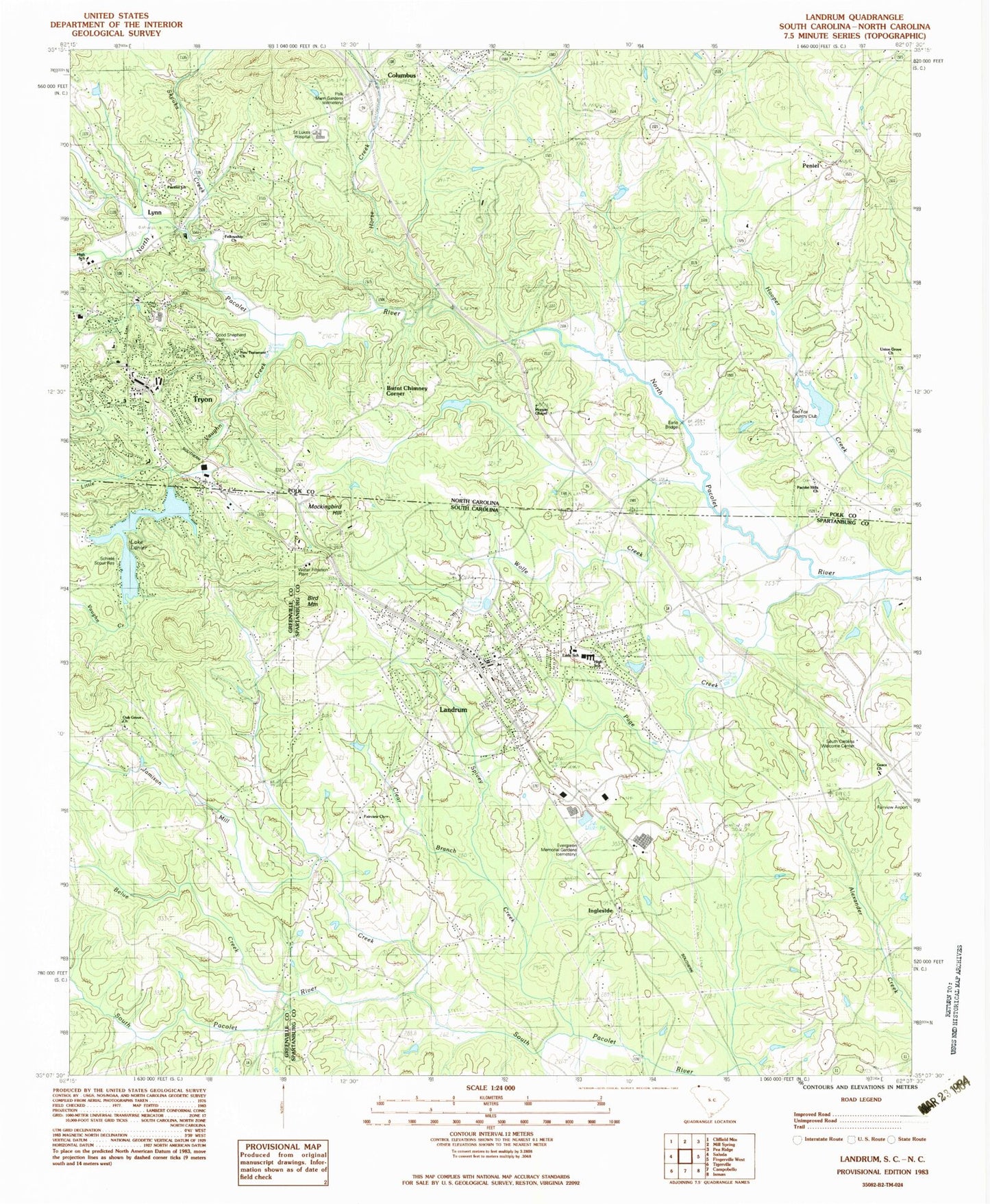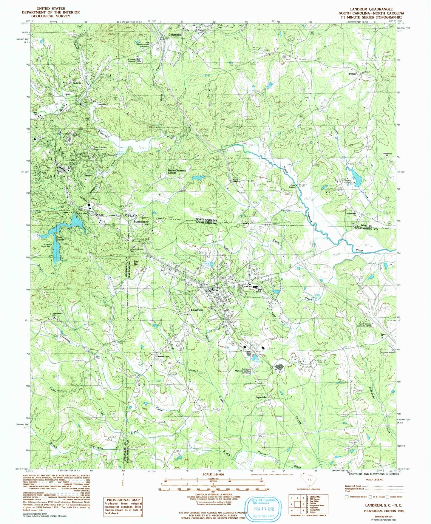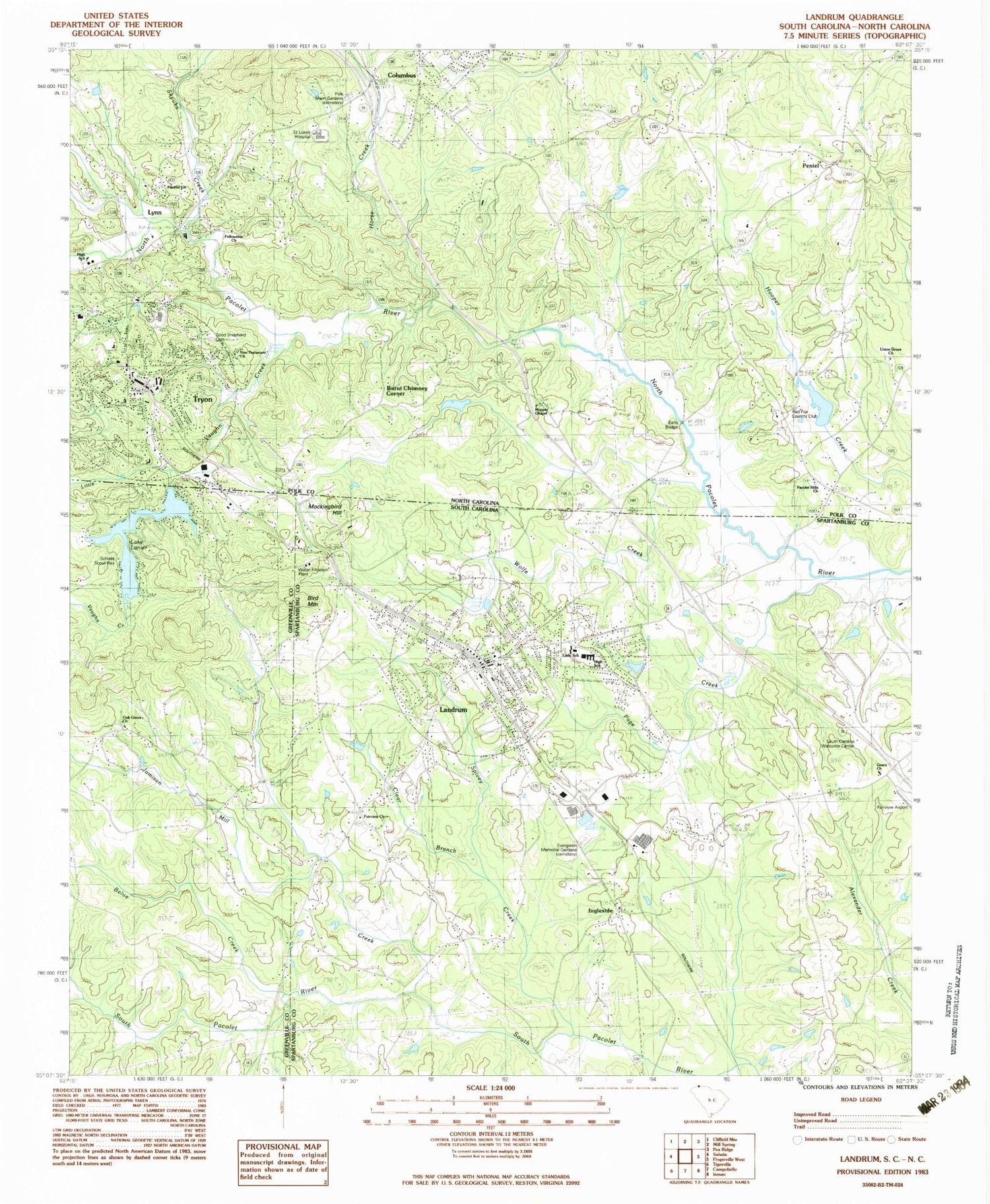
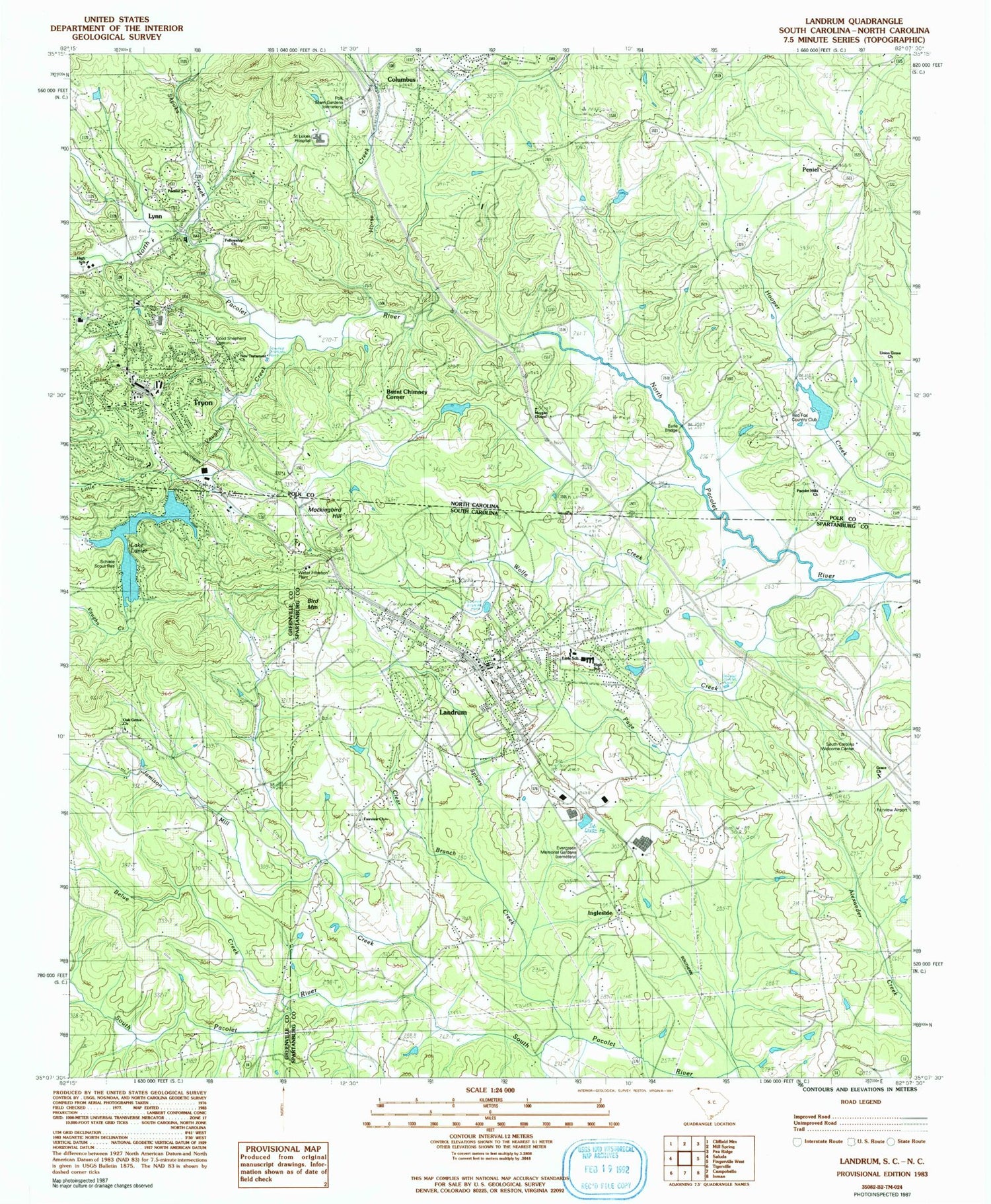
MyTopo
Classic USGS Landrum South Carolina 7.5'x7.5' Topo Map
Couldn't load pickup availability
Historical USGS topographic quad map of Landrum in the states of South Carolina, North Carolina. Map scale may vary for some years, but is generally around 1:24,000. Print size is approximately 24" x 27"
This quadrangle is in the following counties: Greenville, Polk, Spartanburg.
The map contains contour lines, roads, rivers, towns, and lakes. Printed on high-quality waterproof paper with UV fade-resistant inks, and shipped rolled.
Contains the following named places: Belue Creek, Bennetts, Bird Mountain, Blackstock School, Brookwood Trailer Park, Burnt Chimney Corner, C Earley Pond Dam D-3300, C Earley Pond One, City of Landrum, Clear Branch, Columbus Presbyterian Church Graveyard, Earle Bridge, Evergreen Memorial Gardens, Fairview Church, Fellowship Church, Five Oaks, Glassy Mountain Fire Department Station 36, Good Shepherd Cemetery, Grace Church, Green Creek, Guthrie Bridge, Harmon Field, Hooper Creek Dam, Hooper Creek Lake, Horse Creek, Ingleside, Ingleside Baptist Church Graveyard, Ingleside Church, Jamison Mill Creek, Joe Walker School, Johnson Development Number One Pond Dam D-3305, Johnson Development Pond Number Two Dam, Johnson Development Pond Number Two Dam D-3304, La Plaza, Lake Lanier, Landrum, Landrum Cemetery, Landrum Division, Landrum Fire Department, Landrum High School, Landrum Police Department, Landrum Rescue Squad, Little Creek, Lynn, Lynn Post Office, Mahler Pond, Mahlers Pond Dam, Mockingbird Hill, Morgan Chapel, Morgan Chapel Baptist Church Graveyard, Mountain View Berry Farms, New Testament Church, O P Earle Elementary School, Oak Grove Baptist Church Graveyard, Oak Grove Church, Old Grove Church, Pacelot Church, Pacolet Hills Baptist Church Graveyard, Pacolet Hills Church, Page Creek, Peniel, Polk County Emergency Medical Services, Polk County Rescue Squad, Polk Memorial Gardens, Red Fox Country Club, Saint Luke's Hospital, Schiete Scout Reservation, Skyuka Creek, South Carolina Noname 23001 Dam, South Carolina Welcome Center, Spivey Creek, Springdale, Town of Campobello, Town of Columbus, Town of Tryon, Township of Columbus, Tryon, Tryon Cemetery, Tryon Fire Department, Tryon Plaza, Tryon Police Department, Tryon Post Office, Union Grove Church, Vaughn Creek, Wolfe Creek, WTYN-AM (Tryon), ZIP Code: 28782