MyTopo
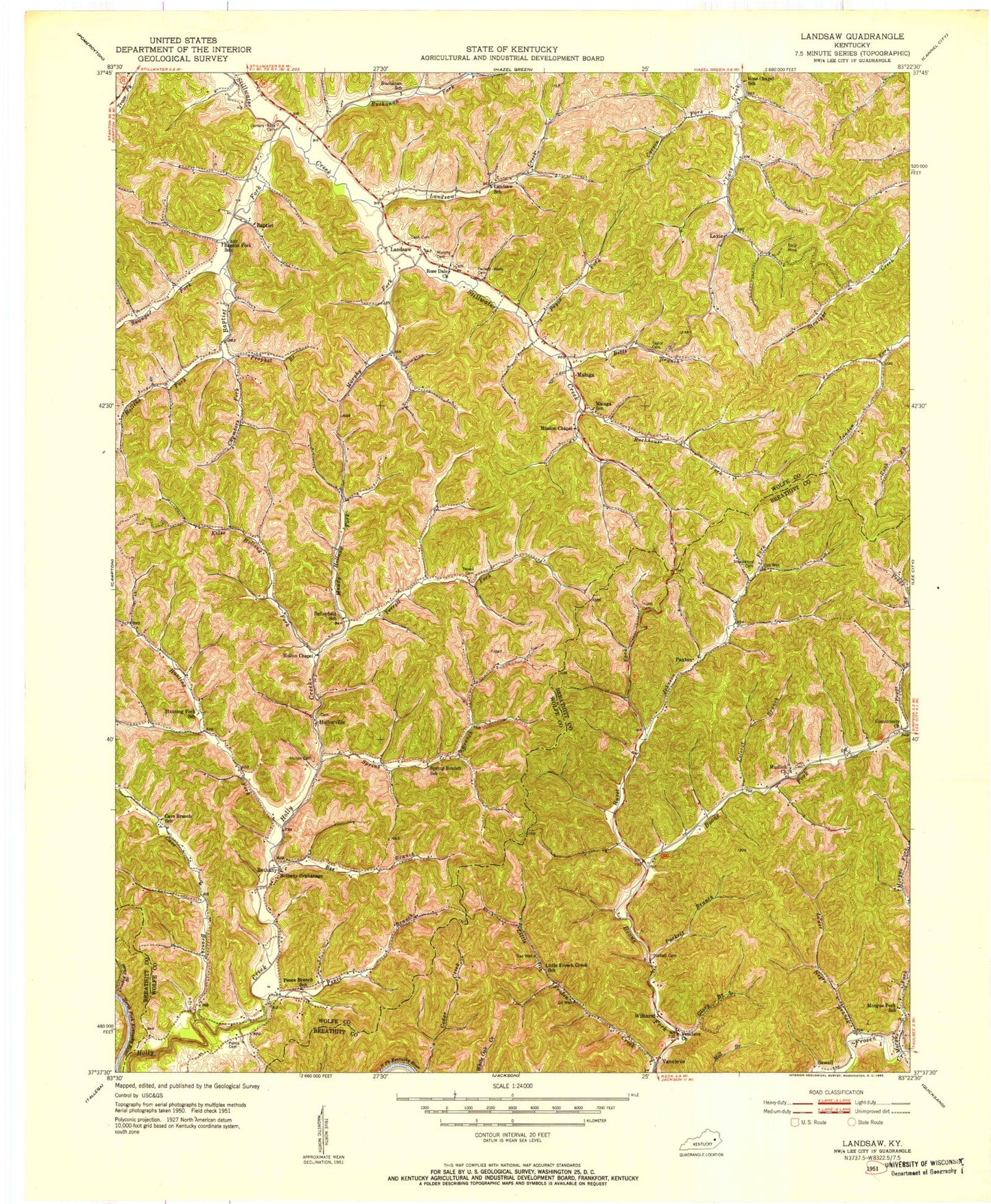
Classic USGS Landsaw Kentucky 7.5'x7.5' Topo Map
Couldn't load pickup availability
Historical USGS topographic quad map of Landsaw in the state of Kentucky. Map scale may vary for some years, but is generally around 1:24,000. Print size is approximately 24" x 27"
This quadrangle is in the following counties: Breathitt, Wolfe.
The map contains contour lines, roads, rivers, towns, and lakes. Printed on high-quality waterproof paper with UV fade-resistant inks, and shipped rolled.
Contains the following named places: Baileyfield, Baileyfield School, Baptist, Baptist Fork, Baptist Fork School, Baptist Post Office, Bee Branch, Bethany, Bethany Children's Home, Bethany Post Office, Betts Branch, Buchanan Fork, Buchanan School, Carson Fork, Cash Cemetery, Cave Branch, Cave Branch School, Cedar Ridge, Centers-Rose Cemetery, Chamber Fork, Chambers Fork, Dunn Cemetery, Faith Pentecostal Church, Glory Branch, Hollins Fork, Hollon Cemetery, Hollon Chapel, Hollonville, Hour of Harvest Church, Hunting Fork, Hurst Cemetery, Hurst Fork, Johnson Fork, Kelse Holland Fork, Lacey Post Office, Landsaw, Landsaw Church, Landsaw Creek, Landsaw Post Office, Landsaw School, Lane Post Office, Leslie Hollow, Lexie, Lexie Post Office, Little Frozen Creek, Lower Negro Branch, Malaga, Malaga Division, Malaga School, Mandy Holland Fork, Mission Chapel, Morgue Fork, Mudlick Church, Murphy Cemetery, Murphy Fork, Paxton, Peggs Fork, Pence, Pence Branch, Pence Cemetery, Pence Post Office, Pence School, Polecat Branch, Prophet Branch, Pryce Fork, Pryor Fork, Puckett Branch, Puckett Cemetery, Rockhouse Fork, Rose Chapel, Rose Chapel School, Rose Dale Church, Rosedale, Sewell, Shackaford Cemetery, Spring Branch, Spring Branch School, Stillwater Old Baptist Church, Swango Fork, Tackett-Wells Cemetery, Taylor Cemetery, Terrell Cemetery, Terrell Fork, Tom Rose Branch, Turnip Fork, Upper Crooked Shoal Branch, Vancleve, Vancleve Church, Whetstone Branch, Wilhurst, Wolfe County, ZIP Code: 41301


