MyTopo
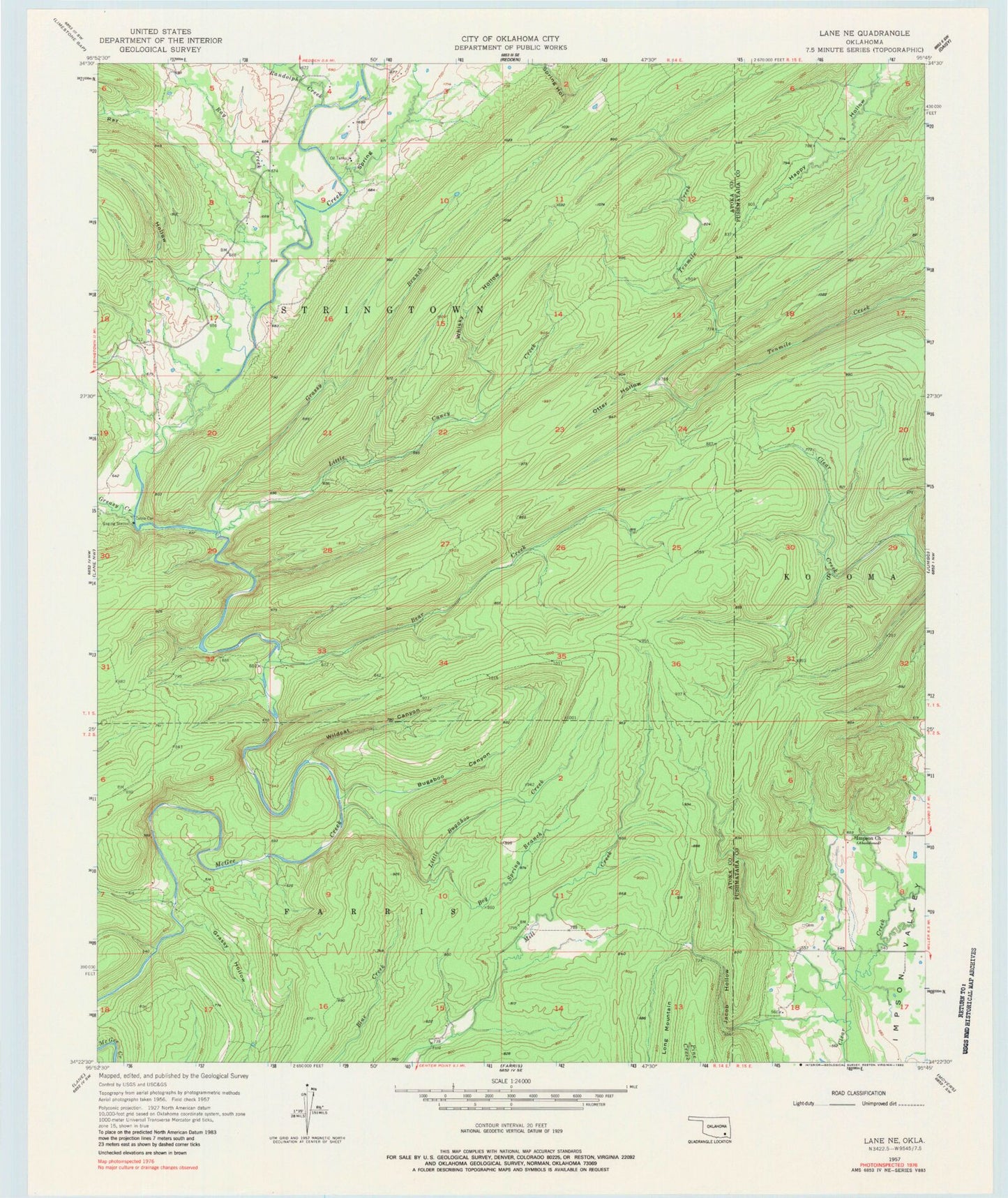
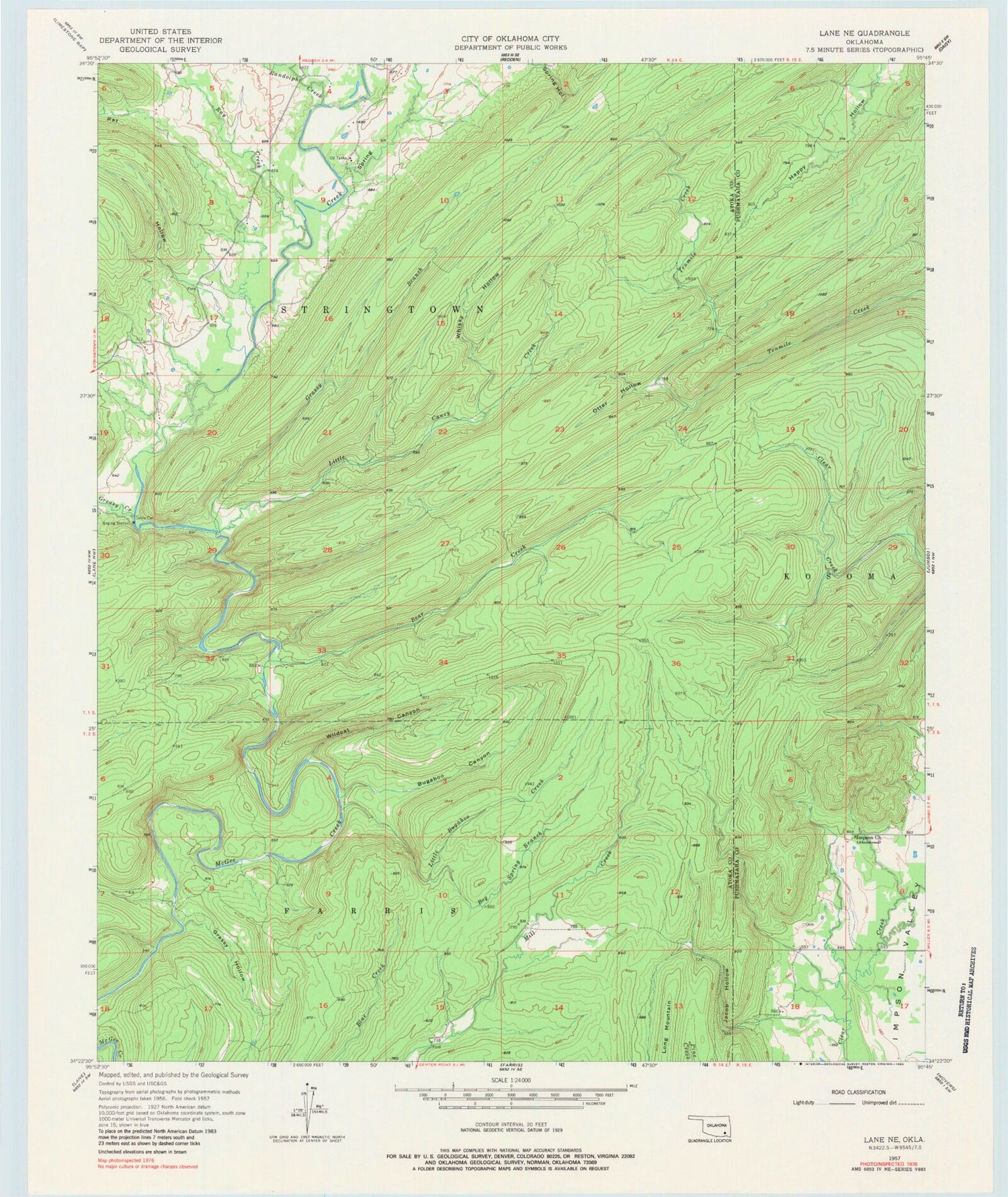
Classic USGS Lane NE Oklahoma 7.5'x7.5' Topo Map
Couldn't load pickup availability
Historical USGS topographic quad map of Lane NE in the state of Oklahoma. Typical map scale is 1:24,000, but may vary for certain years, if available. Print size: 24" x 27"
This quadrangle is in the following counties: Atoka, Pushmataha.
The map contains contour lines, roads, rivers, towns, and lakes. Printed on high-quality waterproof paper with UV fade-resistant inks, and shipped rolled.
Contains the following named places: Bear Creek, Bog Spring Branch, Bugaboo Canyon, Grassy Branch, Grassy Hollow, Greasy Creek, Impson Church, Jacob Hollow, Little Bugaboo Creek, Little Caney Creek, McGee Valley, Otter Hollow, Randolph Creek, Ray Creek, Ray Hollow, Whisky Hollow, Whisky Hollow, Wildcat Canyon, Natural Scenic Recreation Area