MyTopo
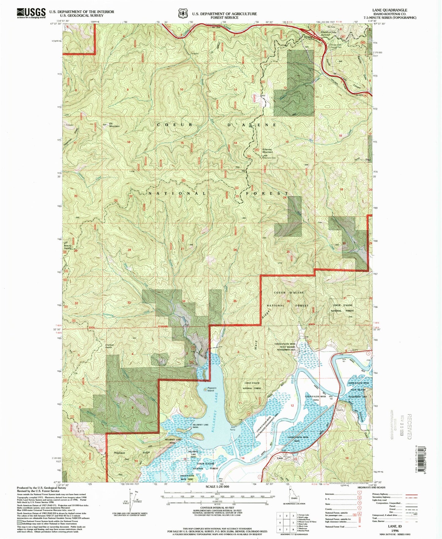
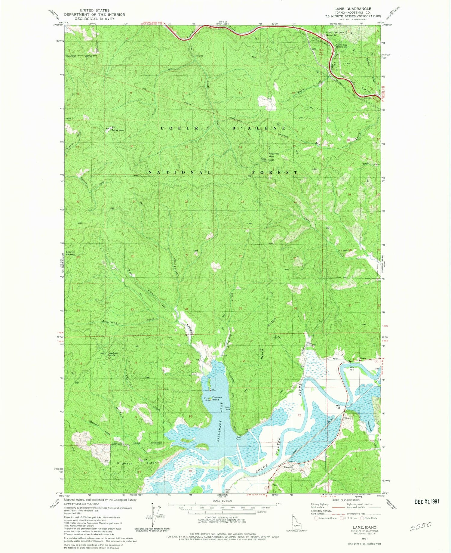
Classic USGS Lane Idaho 7.5'x7.5' Topo Map
Couldn't load pickup availability
Historical USGS topographic quad map of Lane in the state of Idaho. Typical map scale is 1:24,000, but may vary for certain years, if available. Print size: 24" x 27"
This quadrangle is in the following counties: Kootenai.
The map contains contour lines, roads, rivers, towns, and lakes. Printed on high-quality waterproof paper with UV fade-resistant inks, and shipped rolled.
Contains the following named places: Killarney Lake, Rodney Draw, Armstrong Creek, Blackrock Gulch, Chatfield Creek, Elk Mountain, Fortier Creek, Hogback Ridge, Killarney Creek, Lane Cemetery, Lane Creek, McGinnis Creek, Mountain Tree Historic Site, Reserve Creek, South Fork Cedar Creek, Ward Ridge, West Fork Fortier Creek, Killarney Lake Picnic Area, Popcorn Island, Beauty Saddle, Chatfield Saddle, Killarney Mountain, Lane, Harrison Division