MyTopo
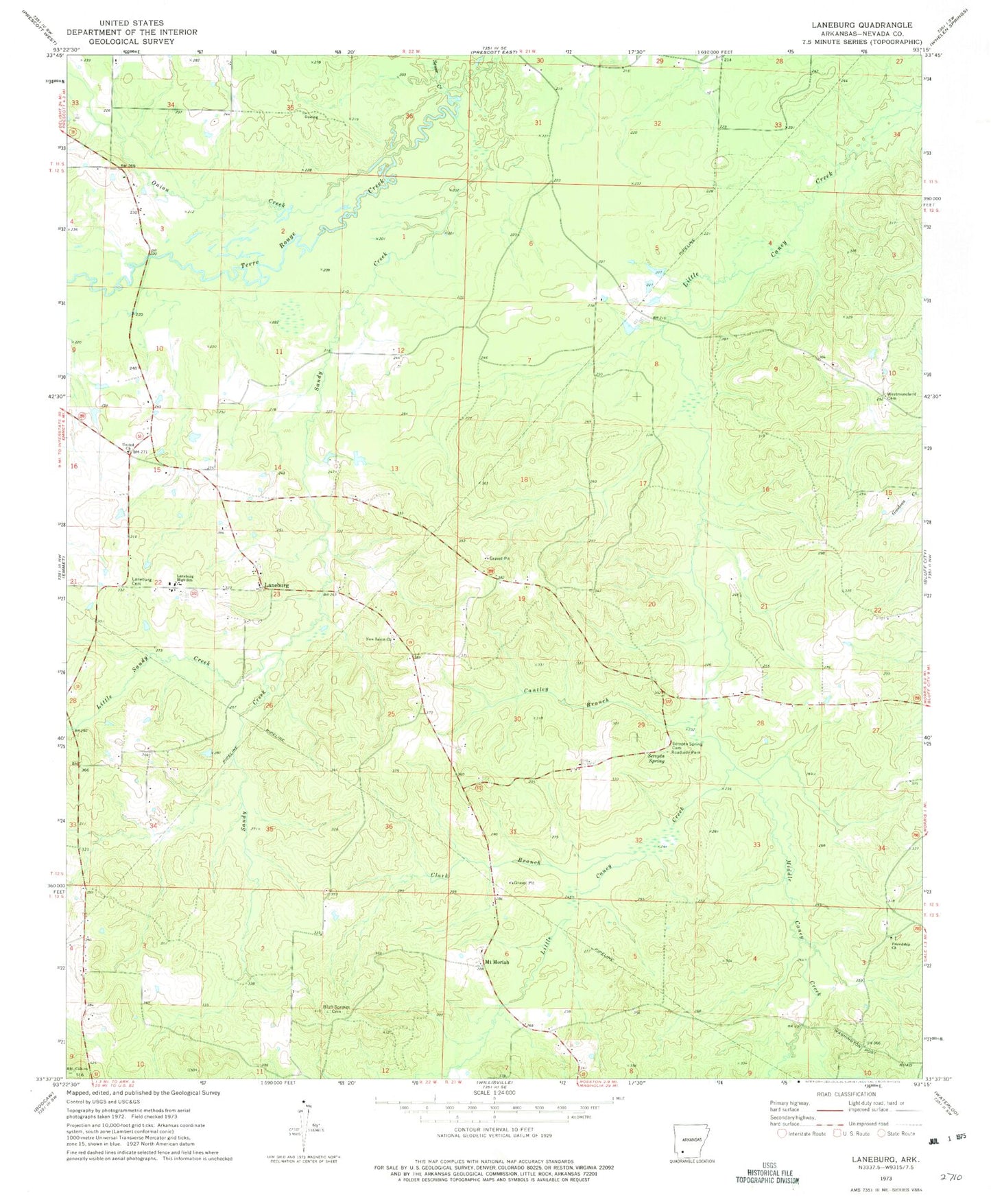
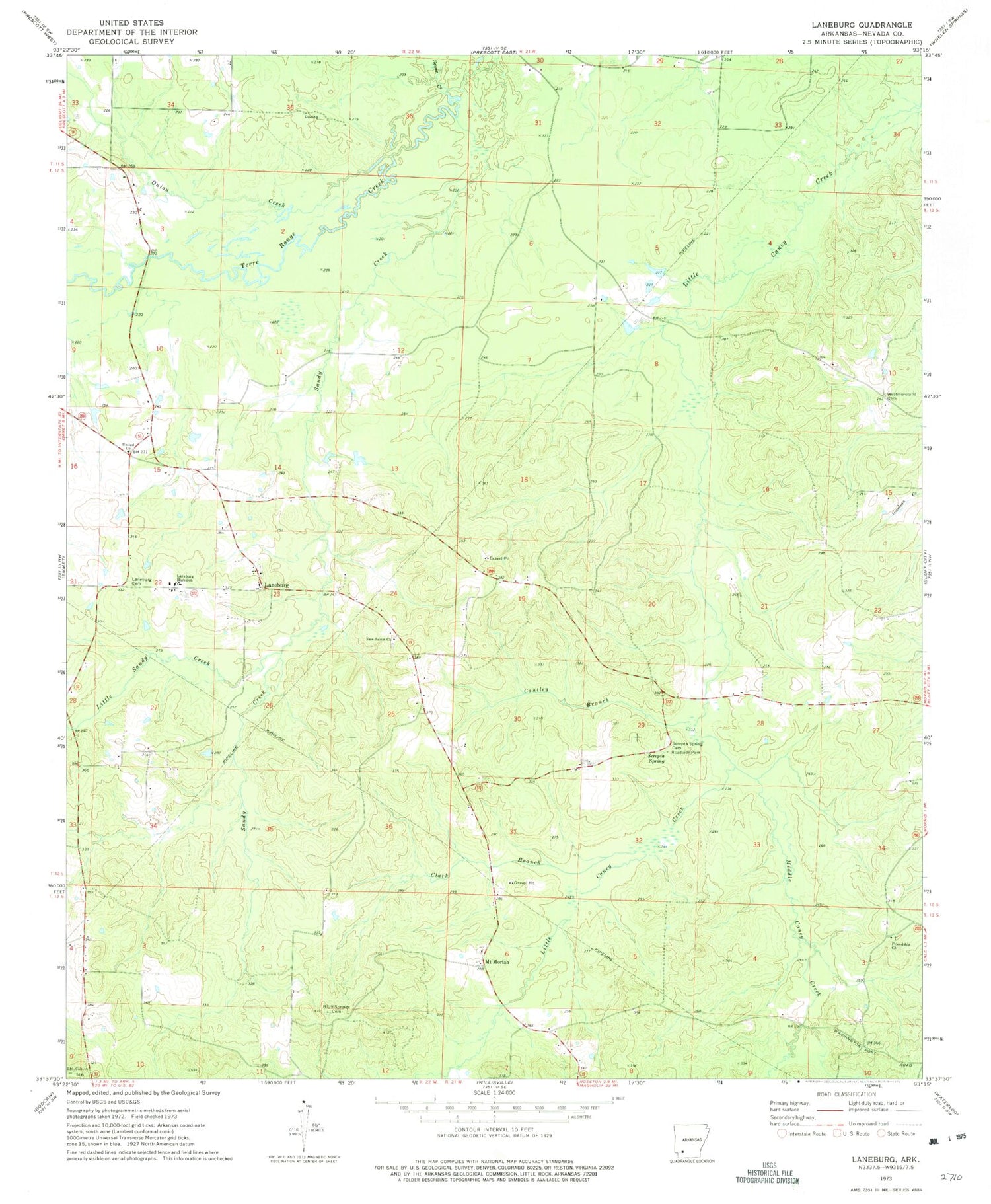
Classic USGS Laneburg Arkansas 7.5'x7.5' Topo Map
Couldn't load pickup availability
Historical USGS topographic quad map of Laneburg in the state of Arkansas. Map scale may vary for some years, but is generally around 1:24,000. Print size is approximately 24" x 27"
This quadrangle is in the following counties: Nevada.
The map contains contour lines, roads, rivers, towns, and lakes. Printed on high-quality waterproof paper with UV fade-resistant inks, and shipped rolled.
Contains the following named places: Bluff Springs Cemetery, Cantley Branch, Clark Branch, Friendship Church, Friendship Church Cemetery, Laneburg, Laneburg Cemetery, Laneburg Church Cemetery, Laneburg High School, Laneburg Volunteer Fire Department Station 1, Laneburg Volunteer Fire Department Station 2, Little Sandy Creek, Middle Caney Creek, Mount Canaan Church, Mount Moriah, Mount Moriah United Methodist Church, Nevada County, New Mount Moriah, New Salem Church, New Salem Church Cemetery, Onion Creek, Rocky Mound School, Salem School, Sandy Creek, Serepta Spring, Serepta Spring Cemetery, Serepta Springs, Sewer Creek, Thomasville School, Township of Georgia, United Church, Westmoreland Cemetery, Westmoreland Church