MyTopo
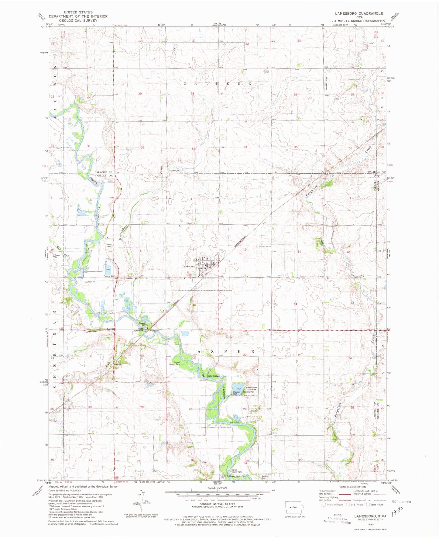
Classic USGS Lanesboro Iowa 7.5'x7.5' Topo Map
Couldn't load pickup availability
Historical USGS topographic quad map of Lanesboro in the state of Iowa. Map scale may vary for some years, but is generally around 1:24,000. Print size is approximately 24" x 27"
This quadrangle is in the following counties: Calhoun, Carroll, Greene.
The map contains contour lines, roads, rivers, towns, and lakes. Printed on high-quality waterproof paper with UV fade-resistant inks, and shipped rolled.
Contains the following named places: Artesian Lake, Artesian Lake County Park, Bishop Cemetery, Buck Run, Buck Run Creek Area, Carroll County Park, City of Lanesboro, Elk Run, Farmers Co-op Company Elevator, Hobbs County Park, Jasper Post Office, Lanesboro, Lanesboro Cemetery, Lanesboro Fire Department and First Responders, Lanesboro Post Office, Marrowbone Creek, Merritt County Park, North Racoon - Andrews Access, Russell White Nature Trail, Salisbury Cemetery, Township of Jasper, United Methodist Church, Vador Bridge, ZIP Code: 51451