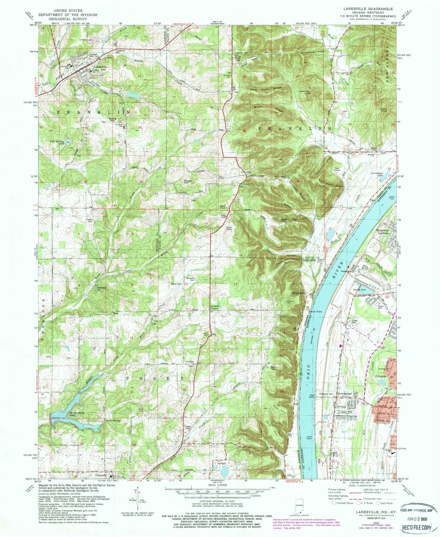
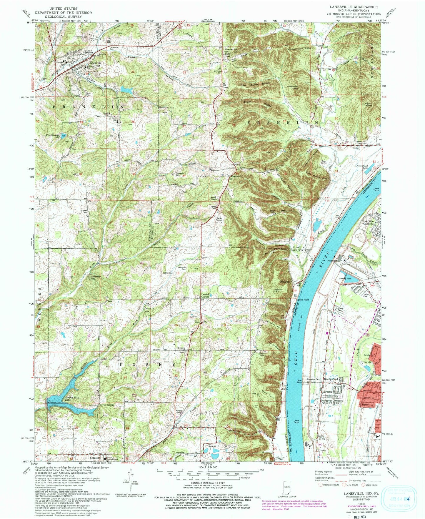
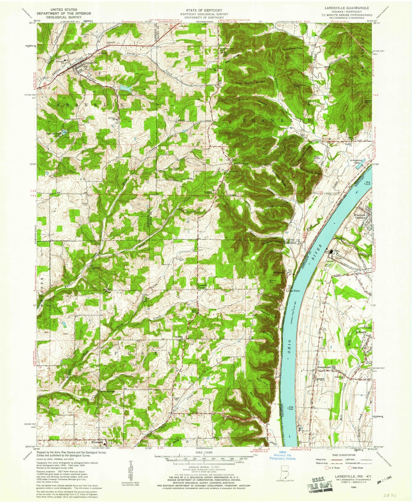
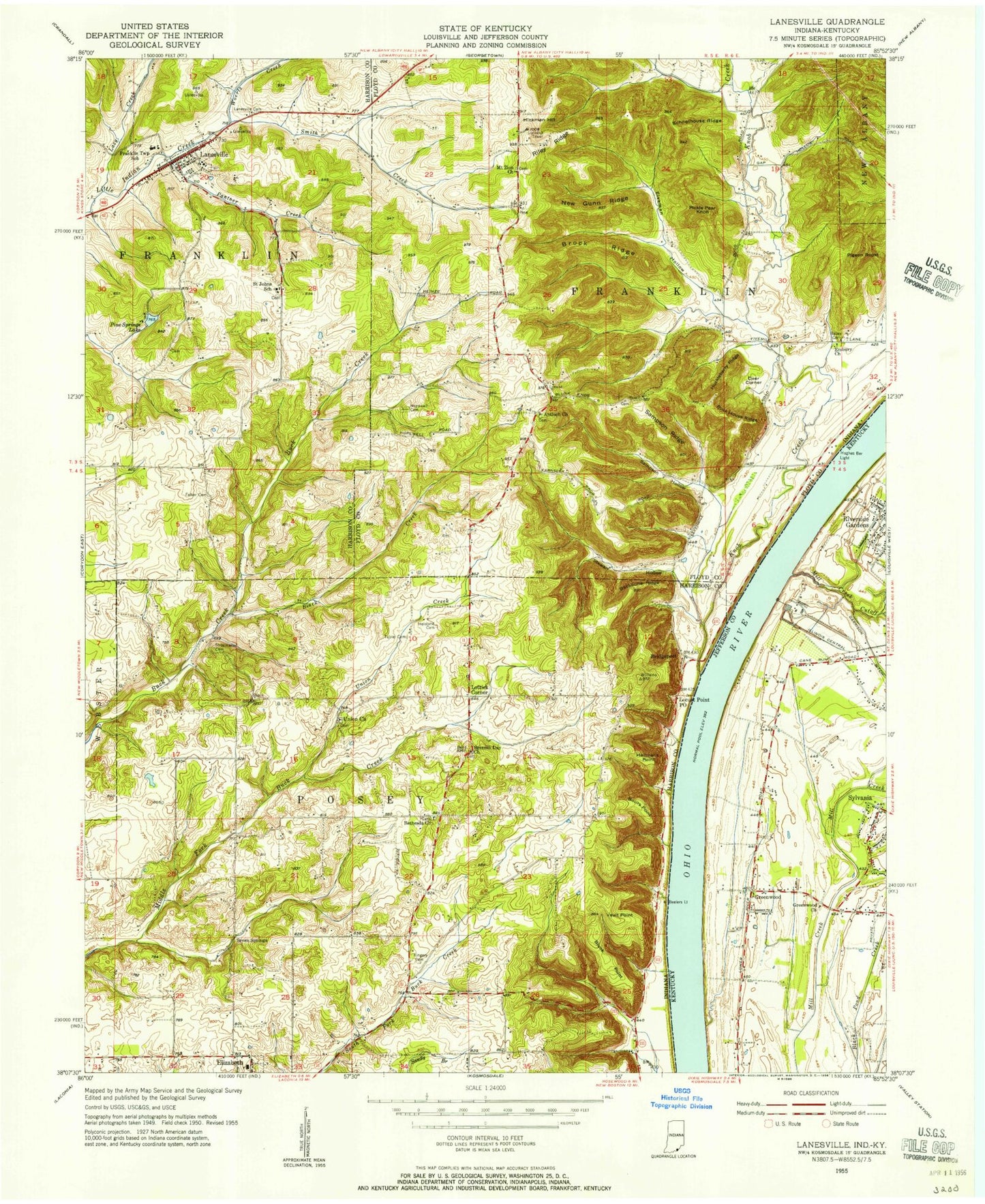
MyTopo
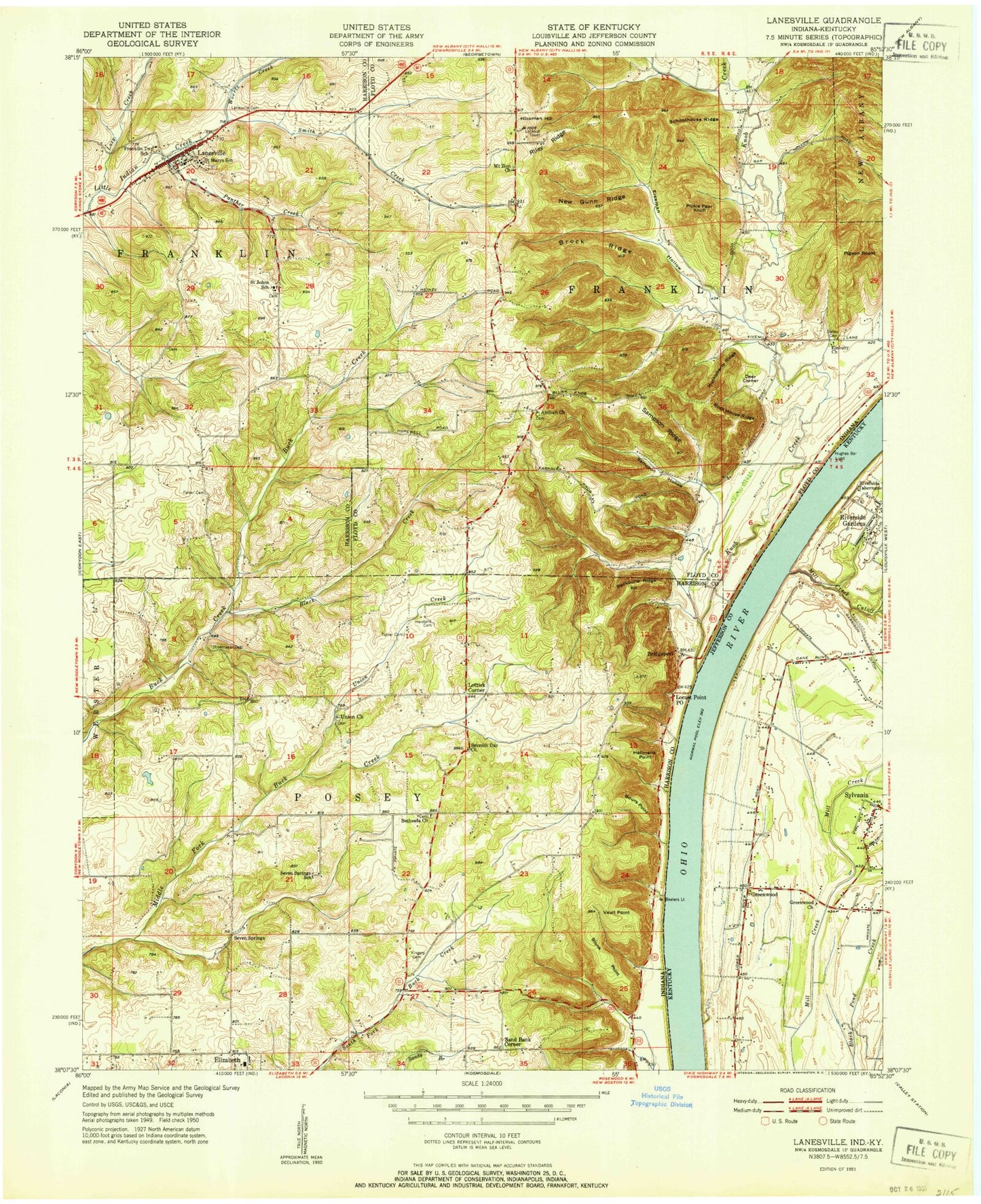
Classic USGS Lanesville Indiana 7.5'x7.5' Topo Map
Couldn't load pickup availability
Historical USGS topographic quad map of Lanesville in the states of Indiana, Kentucky. Map scale may vary for some years, but is generally around 1:24,000. Print size is approximately 24" x 27"
This quadrangle is in the following counties: Floyd, Harrison, Jefferson.
The map contains contour lines, roads, rivers, towns, and lakes. Printed on high-quality waterproof paper with UV fade-resistant inks, and shipped rolled.
Contains the following named places: Antioch Church, Arrowhead Lake, Backbone Ridge, Bailey Cemetery, Bethesda Church, Black Creek, Blunk Point, Bours Points, Bridgeport, Brock Ridge, Buchanan, Center at Riverport School, Deer Corner, Eiseman Hollow, Elizabeth Elementary School, Embury Church, Franklin Township Elementary School, Franklin Township Junior-Senior High School, Garrison Ditch, Greenwood, Greenwood Church, Heistand Cemetery, Hellmans Point, Hickman Hill, Hopewell Cemetery, Huckleberry Ridge, Kingery Cemetery, Knob Creek, Lanesville, Lanesville Post Office, Lanesville Protestant Cemetery, Lanesville Reservoir Dam, Lanesville Skyways Airport, Lanesville Town Marshal's Office, Lanesville Volunteer Fire Department, Lazy Creek, Little Indian Creek, Locust Point, Lottick Corner, Lutheran Laymans League Lake, Lutheran Laymans League Lake Dam, Mill Creek Cutoff, Neely Pit Number 2, New Gunn Ridge, New Restoration Church of God, Pickle Pear Knob, Pigeon Roost, Pine Springs Lake, Pine Springs Lake Dam, Pleasure Ridge Park Fire Department Training Facility, Riley Ridge, Robinson Airpark, Rock House Ridge, Rutledge Road Baptist Church, Saint John Lutheran School, Saint Marys Catholic Cemetery, Saint Marys Elementary School, Salina, Sampson Hollow, Sampson Ridge, Schoolhouse Ridge, Seven Springs, Seven Springs Lake Dam, Shoemaker - Tuell Cemetery, Smith Creek, Stewart Hollow, Tabler Cemetery, Town of Lanesville, Township of Franklin, Township of Posey, Union Church Cemetery, Union Creek, Vault Point, Woertz Creek, WQMF-FM (Jeffersonville), ZIP Codes: 40258, 47136