MyTopo
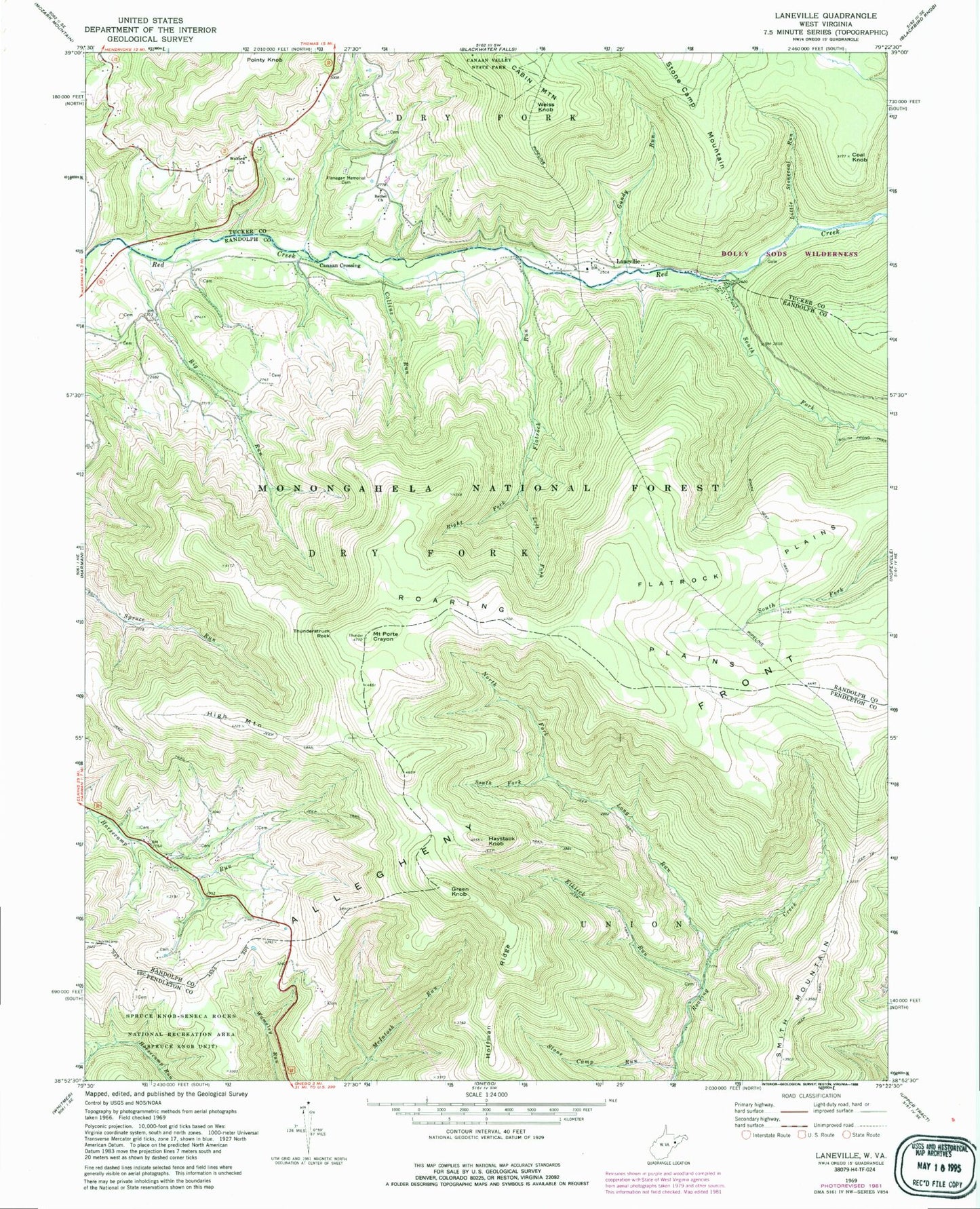
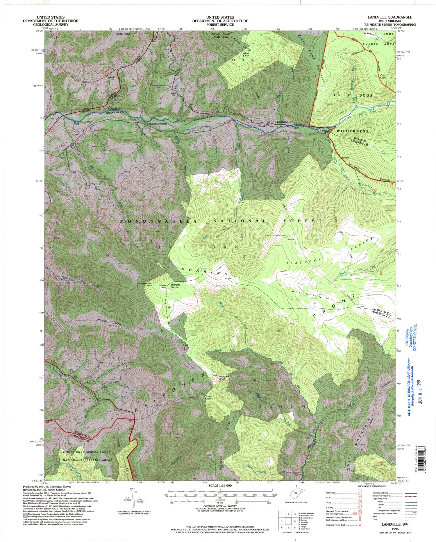
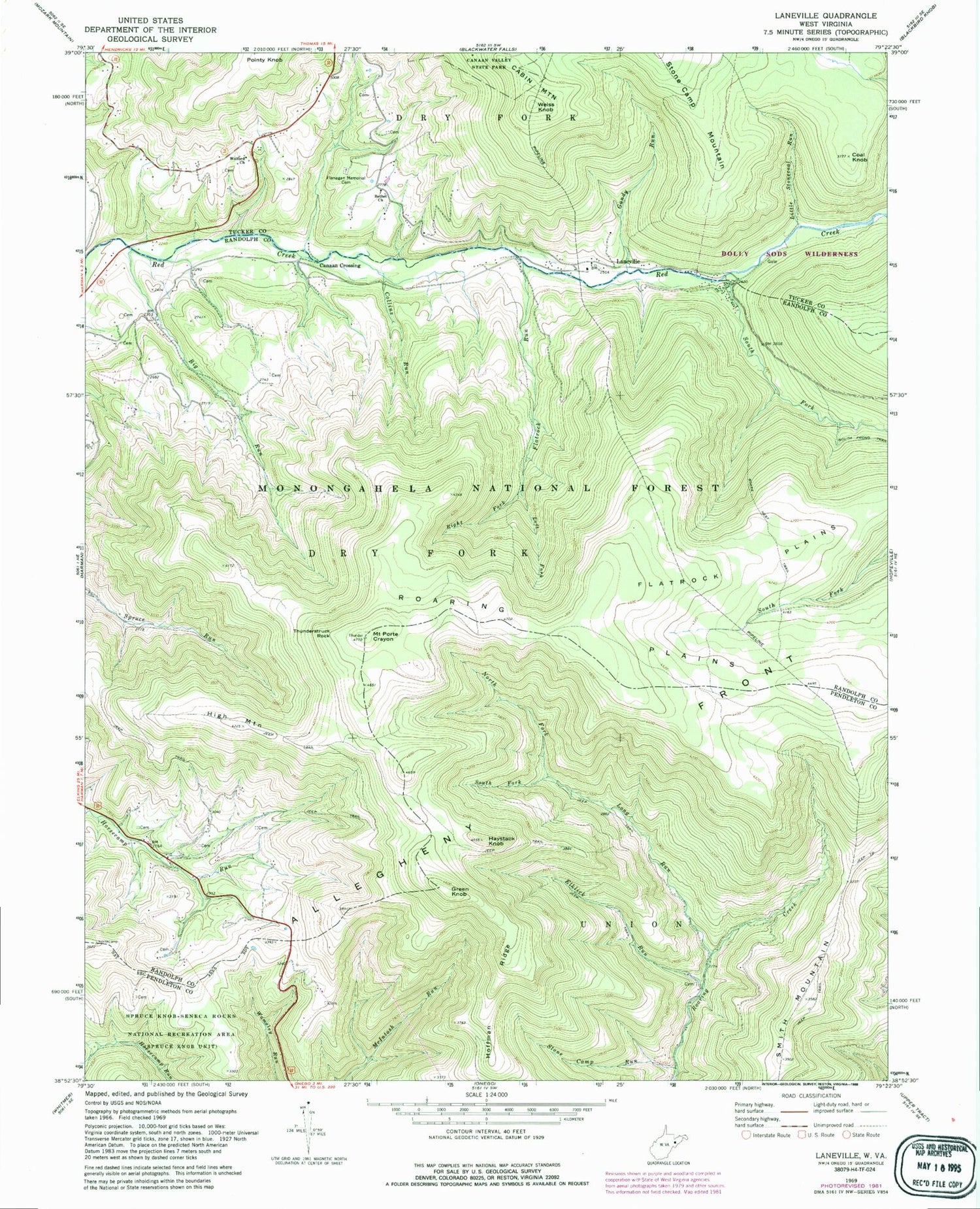
Classic USGS Laneville West Virginia 7.5'x7.5' Topo Map
Couldn't load pickup availability
Historical USGS topographic quad map of Laneville in the state of West Virginia. Typical map scale is 1:24,000, but may vary for certain years, if available. Print size: 24" x 27"
This quadrangle is in the following counties: Pendleton, Randolph, Tucker.
The map contains contour lines, roads, rivers, towns, and lakes. Printed on high-quality waterproof paper with UV fade-resistant inks, and shipped rolled.
Contains the following named places: Bethel Church, Big Run, Boars Nest Trail, Coal Knob, Collins Run, Dolly Run, Elklick Run, Flanagan Memorial Cemetery, Flatrock Plains, Flatrock Run, Gandy Run, Haystack Knob, High Mountain, Hoffman Ridge, Left Fork Flatrock Creek, Little Stonecoal Run, Long Run, North Fork Long Run, Mount Porte Crayon, Right Fork Flatrock Creek, Roaring Plains, South Fork Long Run, South Fork Red Creek, Stone Camp Run, Thunderstruck Rock, Wolford Church, Mount Porte Crayon Point of Interest, Canaan Crossing, Green Knob, Laneville, Smith Mountain, Weiss Knob, Roaring School (historical), Hoyt Pennington Spring, Hoyt Pennington Spring, Pennington Farm Spring, Guy Harper Spring, Harperton, Bonner Mountain School (historical), Snoden Yokum Spring, Snoden Yokum Spring, Hartman Farm Spring, Arbogast Farm Spring, Flat Top School (historical), Wolford School (historical), Wyatt Farm Spring, Nelson Spring, Lee Ullery Spring, Addie Judy Spring, Laneville Mennonite Church, Stringtown (historical), Wyoming (historical), Days Mill (historical), Dryfork Post Office, Roaring Plains West Wilderness