MyTopo
Classic USGS Lang Kansas 7.5'x7.5' Topo Map
Regular price
$16.95
Regular price
Sale price
$16.95
Unit price
per
Couldn't load pickup availability
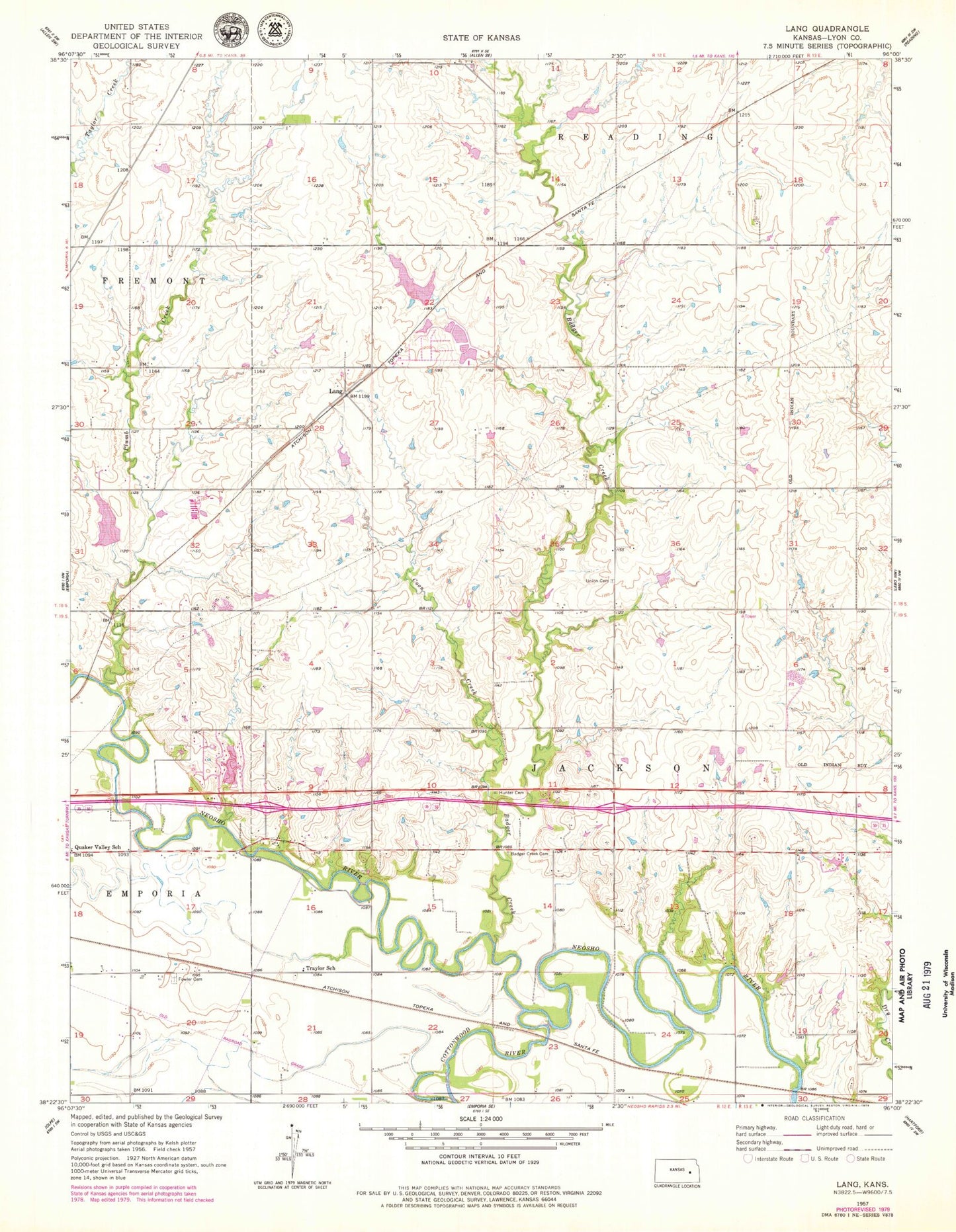
Historical USGS topographic quad map of Lang in the state of Kansas. Map scale may vary for some years, but is generally around 1:24,000. Print size is approximately 24" x 27"
This quadrangle is in the following counties: Lyon.
The map contains contour lines, roads, rivers, towns, and lakes. Printed on high-quality waterproof paper with UV fade-resistant inks, and shipped rolled.
Contains the following named places: Badger Creek, Badger Creek Cemetery, Coon Creek, Cottonwood River, Flint Hills Feedlot, Forest Hill Cemetery, Forest Ville, Fowler Cemetery, Fowler Farms, Lang, New Life Christian Church, Plumb Creek, Quaker Valley School, Sickler Airstrip, Township of Jackson, Traylor School, Union Cemetery