MyTopo
Classic USGS Langley Arkansas 7.5'x7.5' Topo Map
Couldn't load pickup availability
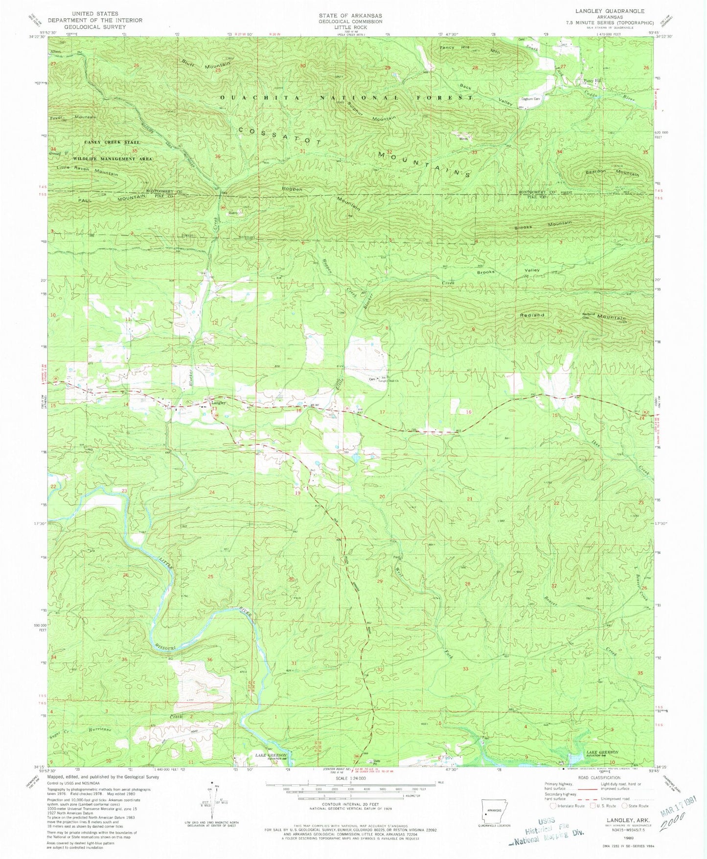
Historical USGS topographic quad map of Langley in the state of Arkansas. Map scale may vary for some years, but is generally around 1:24,000. Print size is approximately 24" x 27"
This quadrangle is in the following counties: Montgomery, Pike.
The map contains contour lines, roads, rivers, towns, and lakes. Printed on high-quality waterproof paper with UV fade-resistant inks, and shipped rolled.
Contains the following named places: Albert, Back Valley, Beardon Mountain, Blocker Creek, Bluff Mountain, Brooks Mountain, Brooks Valley, Cossatot Mountains, Dempsey Cog Bur Barite Mine, Fancy Hill, Fancy Hill Cemetery, Fancy Hill Mountain, Fancy Hill School, Hogpen Creek, Hogpen Mountain, Hurricane Creek, Langley, Langley Post Office, Langley Volunteer Fire Department, Little Blocker Creek, Little Raven Mountain, McKnight Barite Mine, Paul Mountain, Pryor Mountain, Redland Gap, Redland Mountain, Sugar Creek, Sulphur Mountain, Township of Mountain, ZIP Code: 71952