MyTopo
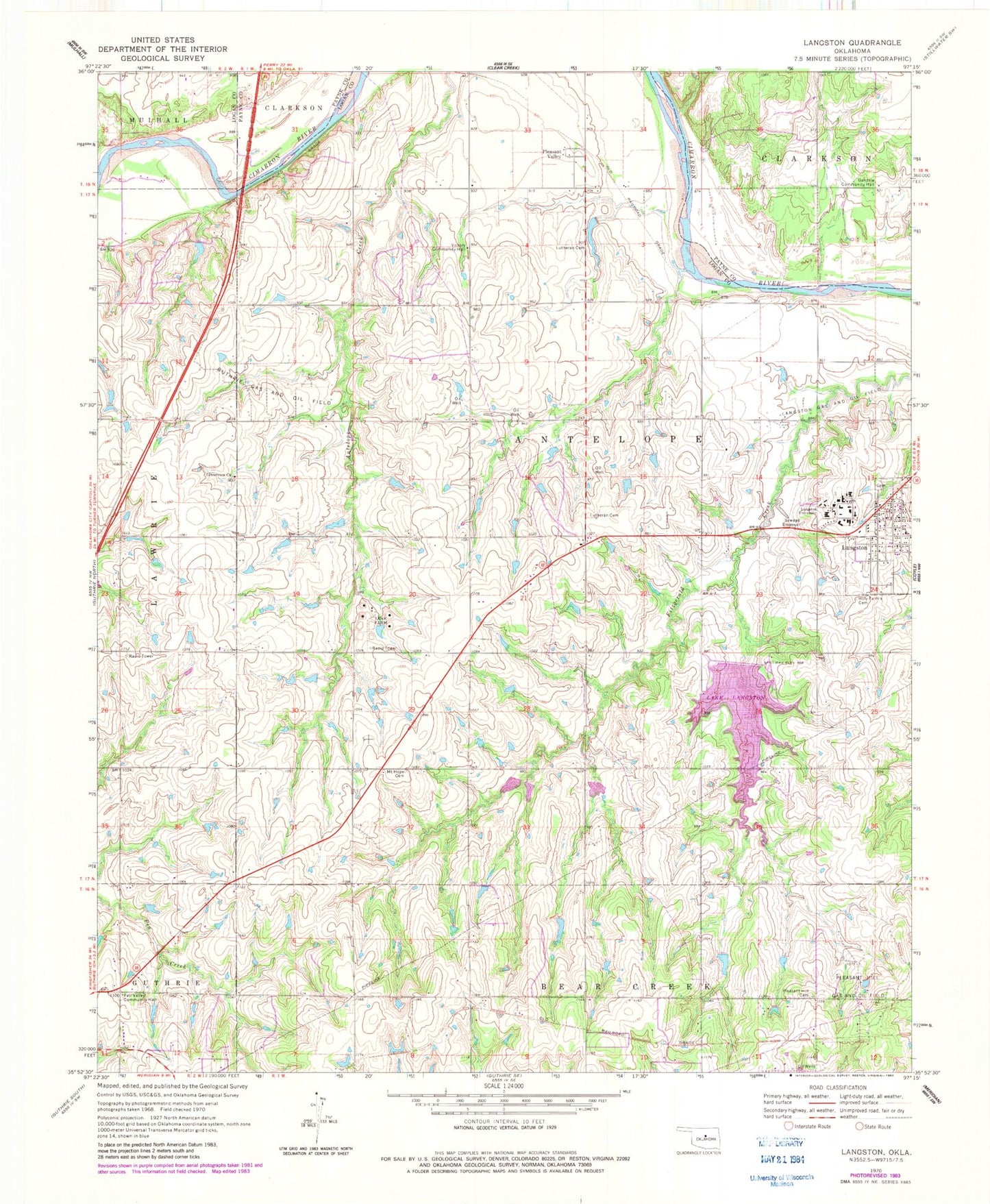
Classic USGS Langston Oklahoma 7.5'x7.5' Topo Map
Couldn't load pickup availability
Historical USGS topographic quad map of Langston in the state of Oklahoma. Map scale may vary for some years, but is generally around 1:24,000. Print size is approximately 24" x 27"
This quadrangle is in the following counties: Logan, Payne.
The map contains contour lines, roads, rivers, towns, and lakes. Printed on high-quality waterproof paper with UV fade-resistant inks, and shipped rolled.
Contains the following named places: Beulah Land Cemetery, Centerview Church, Coulter School, Coyle Cemetery, Davis and Balls Cemetery, Fair Valley Community Hall, Fitzgerald-Soldier Creek Site 2 Dam, Fitzgerald-Soldier Creek Site 2 Reservoir, Guthrie Gas and Oil Field, Holy Family Cemetery, KALU-FM (Langston), Lake Langston, Langston, Langston Dam, Langston Fire Station, Langston Gas and Oil Field, Langston Police Department, Langston Post Office, Langston University, Langston University Police Department, Lutheran Cemetery, Mount Hope, Mount Hope Cemetery, Mount Hope Church, Oakdale Community Hall, Oknoname 083007 Dam, Oknoname 083007 Reservoir, Oknoname 083008 Dam, Oknoname 083008 Reservoir, Oknoname 083011 Dam, Oknoname 083011 Reservoir, Pleasant Hill Cemetery, Pleasant Hill Gas and Oil Field, Pleasant Valley, Soldier-Fitzgerald Site 3m Dam, Soldier-Fitzgerald Site 3m Reservoir, Town of Langston, Township of Antelope, Victory Community Hall, ZIP Codes: 73027, 73050