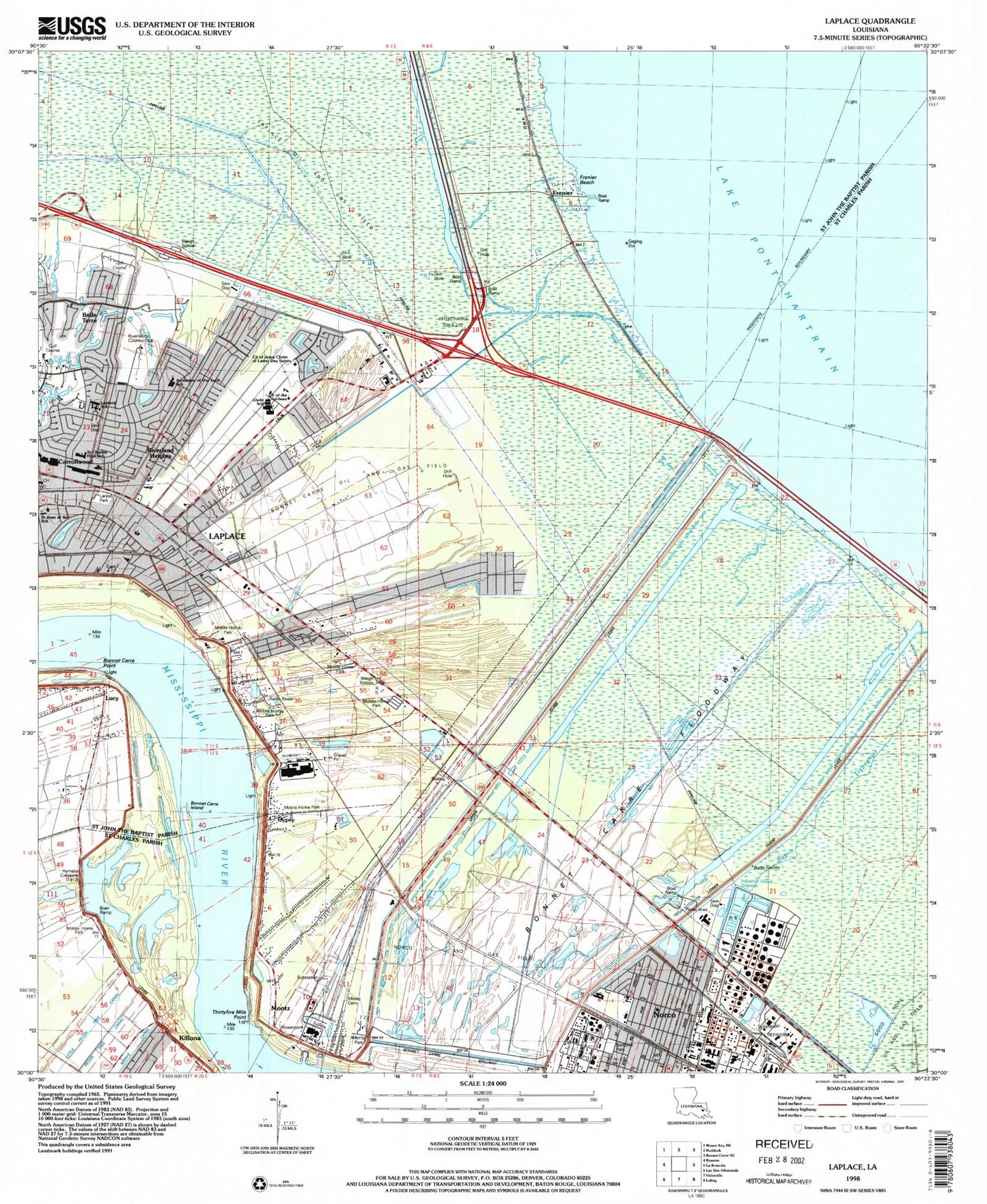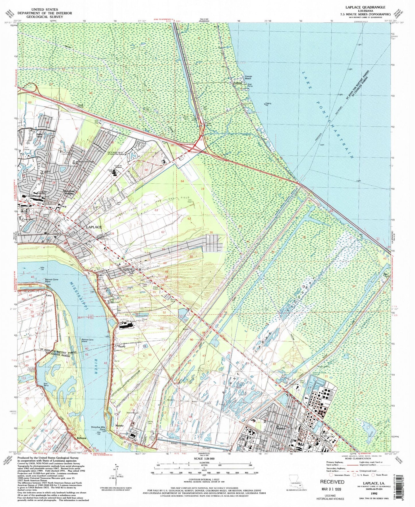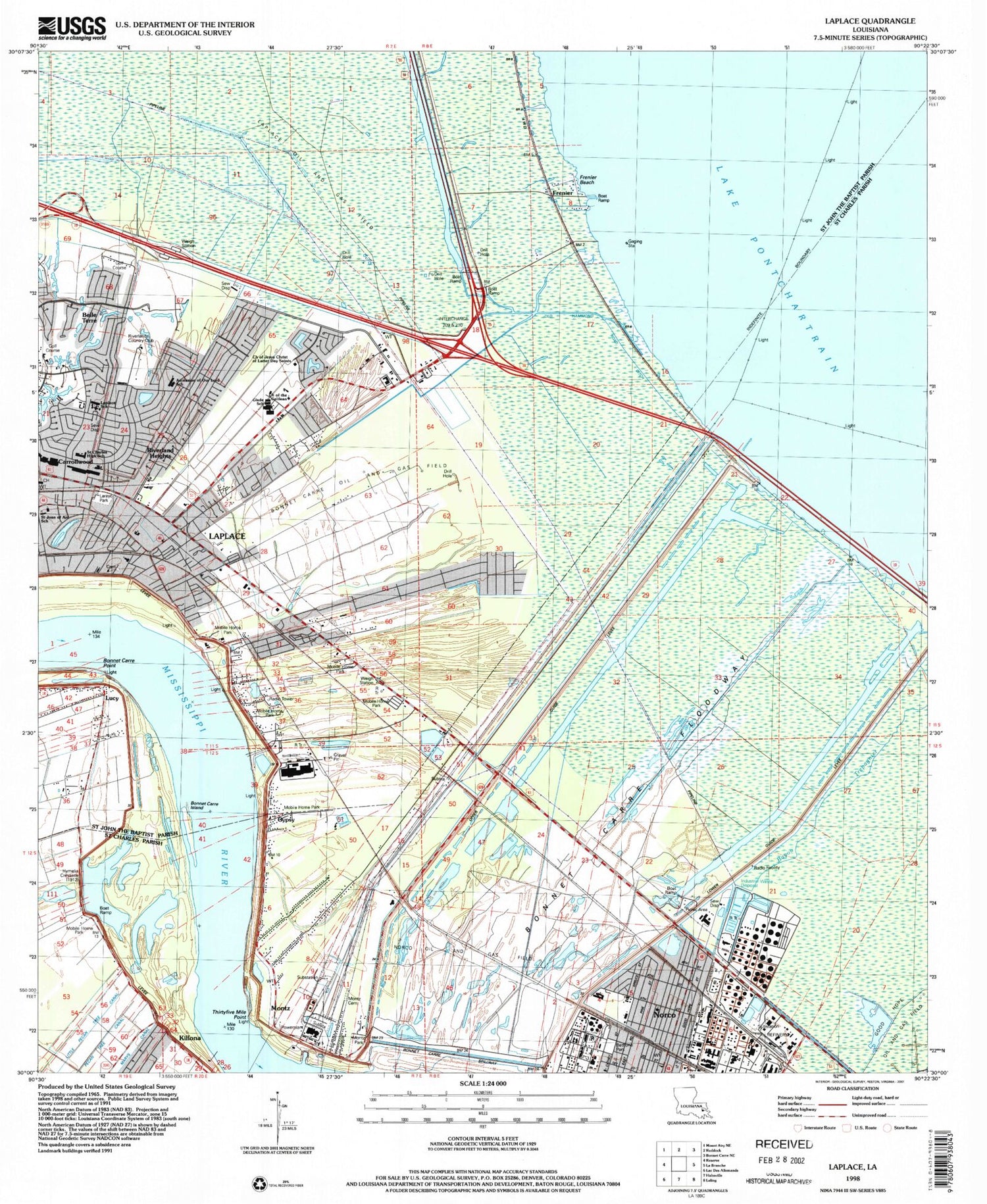

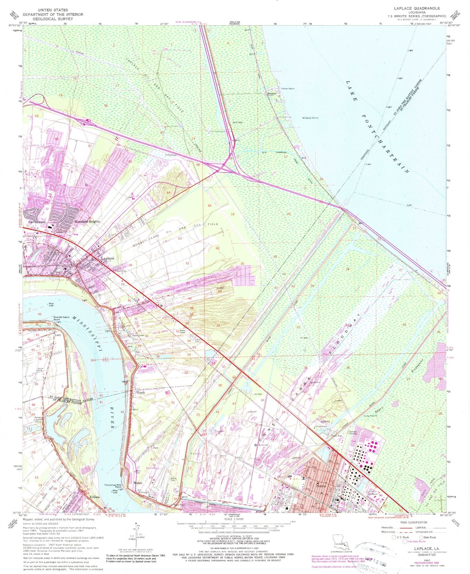
MyTopo
Classic USGS Laplace Louisiana 7.5'x7.5' Topo Map
Couldn't load pickup availability
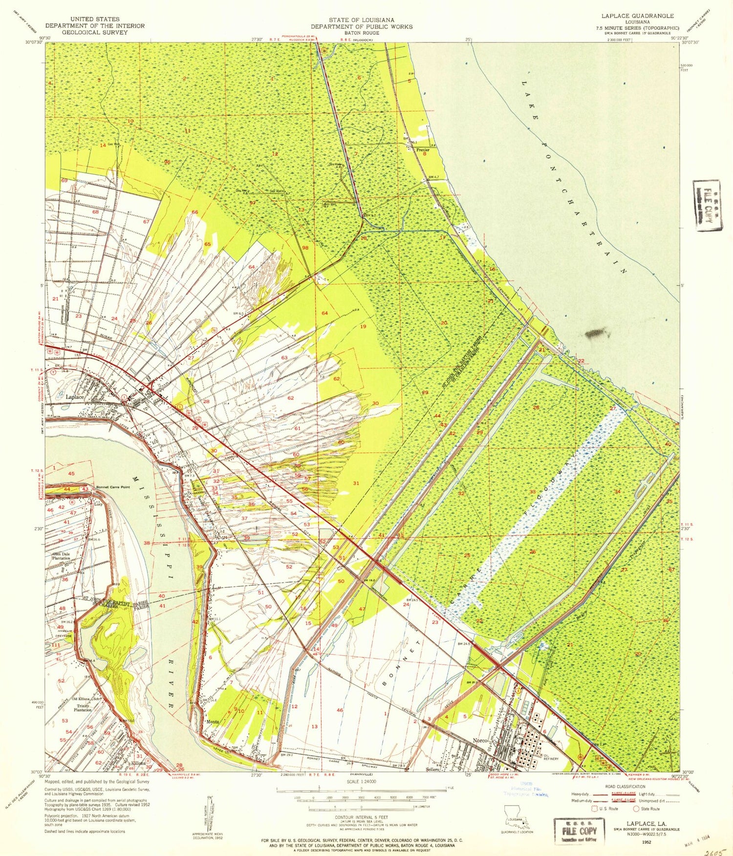
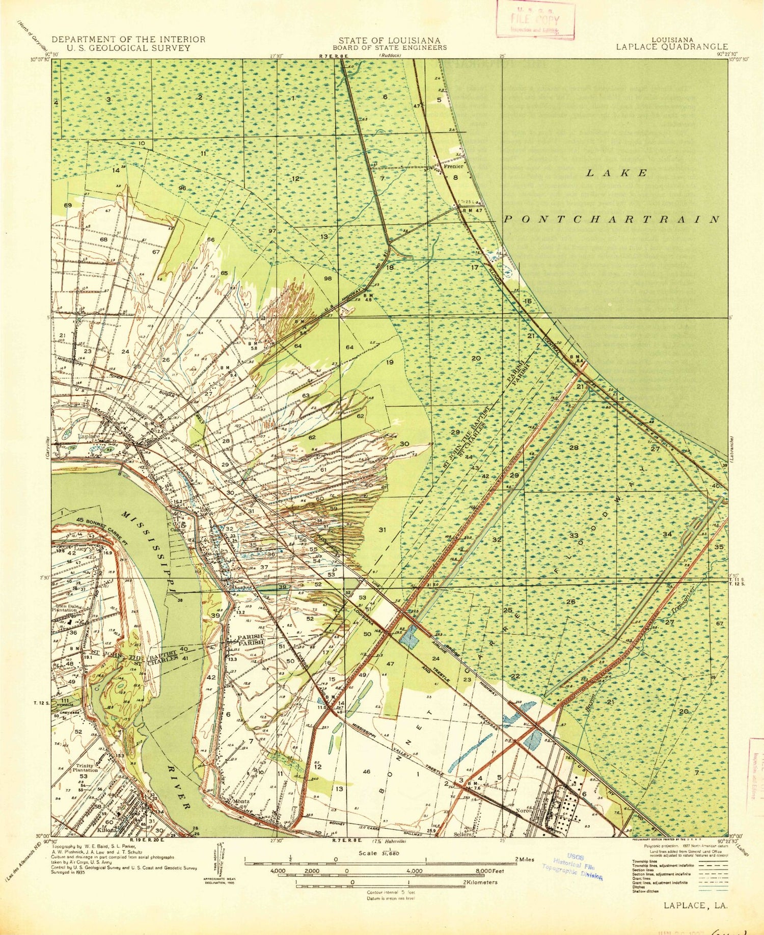
Historical USGS topographic quad map of Laplace in the state of Louisiana. Map scale may vary for some years, but is generally around 1:24,000. Print size is approximately 24" x 27"
This quadrangle is in the following counties: St. Charles, St. John the Baptist.
The map contains contour lines, roads, rivers, towns, and lakes. Printed on high-quality waterproof paper with UV fade-resistant inks, and shipped rolled.
Contains the following named places: Anchor Plantation, Ascension of Our Lord Catholic Church, Ascension of Our Lord Catholic School, Belle Terre, Bethune High School, Bethune Park, Bonnet Carre Crevasse, Bonnet Carre Floodway, Bonnet Carre Island, Bonnet Carre Oil and Gas Field, Bonnet Carre Point, Bonnet Carre Spillway, Carrollwood, Church of the Galilean, Colonial Mobile Home Park, Faith Healing and Deliverance Church, First Baptist Church of La Place, First United Methodist Church, Frenier, Frenier Beach, Glade Junior High School, Glendale Plantation, Greater Good Hope Baptist Church, Gypsy, Gypsy Plantation, Hymelia Crevasse, Hymelia Plantation, John L Ory Communication Arts Magnet School, Killona, Killona Landing, Killona Post Office, Killona School, Killona Volunteer Fire Department, Kingdom Hall of Jehovahs Witnesses, Lake Pontchartrain Elementary School, Laplace, Laplace Census Designated Place, Laplace Elementary School, Laplace Oil and Gas Field, Laplace Volunteer Fire Department, Laplace Volunteer Fire Department Station 2, Larayo Youth Park, Living Way Church, Lower Guide Levee, Lutheran Church of the Galilean, Maison Oaks Assisted Living Community, Mary Plantation, Montz, Montz Census Designated Place, Montz Park, Mount Calvary Baptist Church, Mount Nebo Baptist Church, New Foundation for Life Church, New Home Ministries, New Hope Plantation, Norco Area Volunteer Fire Department, Norco Elementary School, Norco Elementary School K - 3, Norco Oil and Gas Field, Norco Post Office, Norco School, Old Hammond Road Ditch, Parish Governing Authority District 6, Parish Governing Authority District 7, Perfecting of the Saints Church, Providence Baptist Church, Providence Baptist Church 2 Cemetery, Provident Church, Rising Star Baptist Church, Riverland Heights, Riverlands Country Club, Riverlands Shopping Center, Riverwood Shopping Center, Sacred Heart of Jesus Catholic School, Sacred Heart of Jesus Church, Saint Charles Catholic High School, Saint Charles Parish Library Norco Branch, Saint Isadore Church, Saint Joan of Arc Catholic Church, Saint Joan of Arc School, Saint John Day Developmental Training Center, Saint John Parish Sheriff's Office, Saint John Parish Sheriff's Office - Bureau of Narcotics, Saint John Presbyterian Church, Saint John the Baptist Parish Library, Saint Michael Baptist Church, Saint Timothys Episcopal Church, Sarpy, Specialty Rehabilitation Hospital of LaPlace, The Church of Jesus Christ of Latter Day Saints, Thirtyfive Mile Point, Trinity Plantation, Twin Oaks Nursing Home, Upper Guide Levee, WADU-AM (Norco), Ward Four, Ward Six, WCKW-AM (Laplace), Woodland Community Church, Woodland Plantation, Zion Travelers Baptist Church, ZIP Code: 70079