MyTopo
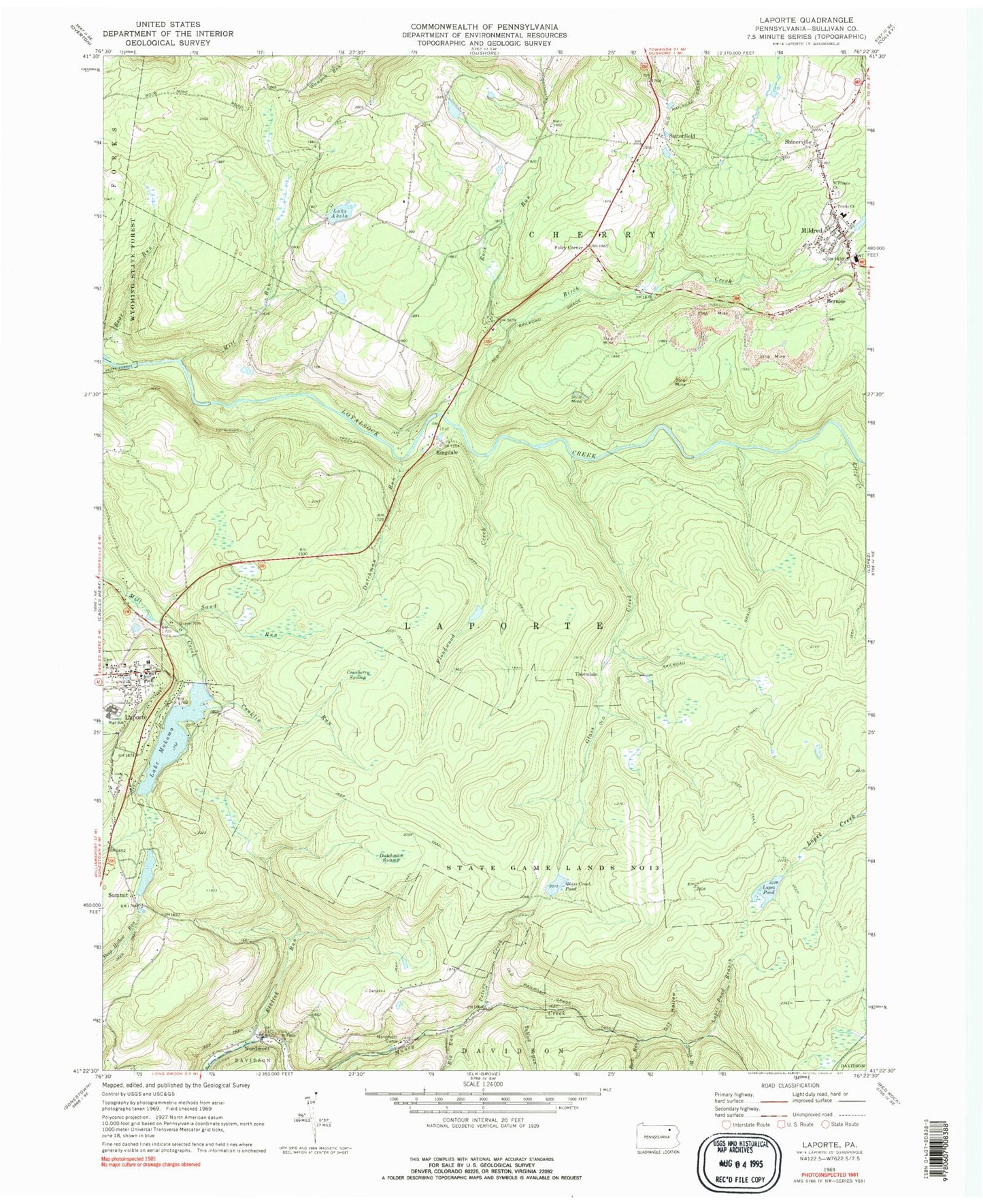
Classic USGS Laporte Pennsylvania 7.5'x7.5' Topo Map
Couldn't load pickup availability
Historical USGS topographic quad map of Laporte in the state of Pennsylvania. Map scale may vary for some years, but is generally around 1:24,000. Print size is approximately 24" x 27"
This quadrangle is in the following counties: Sullivan.
The map contains contour lines, roads, rivers, towns, and lakes. Printed on high-quality waterproof paper with UV fade-resistant inks, and shipped rolled.
Contains the following named places: Bernice, Big Run, Birch Creek, Black Hollow, Borough of Laporte, Conklin Run, Cranberry Swamp, Dry Hollow, Dutchman Falls, Dutchman Run, Dutchman Swamp, Elklick Run, Ellis Creek, Floodwood Creek, Foley Corner, Glass Creek, Glass Creek Club, Glass Creek Dam, Glass Creek Pond, Haystacks Rapids, Lake Akela, Lake Mokoma Dam, Laporte, Laporte Post Office, Laporte Volunteer Fire Company Station 50, Lopez Pond, Lopez Pond Branch, Mildred, Mildred Fire Department - Station 58, Mildred Post Office, Mill Run, Mokoma Lake, Muncy Creek, Nordmont, Nordmont Camp, Pennsylvania State Police Troop P Laporte Station, Peters Creek, Ringdale, Rock Run, Saint Francis Church, Saint Pauls Church, Sand Run, Satterfield, Shinerville, South Branch Rock Run, Sullivan Dam, Summit, Thorndale, Township of Laporte, Trinity Church, Tublick Run, ZIP Code: 18632