MyTopo
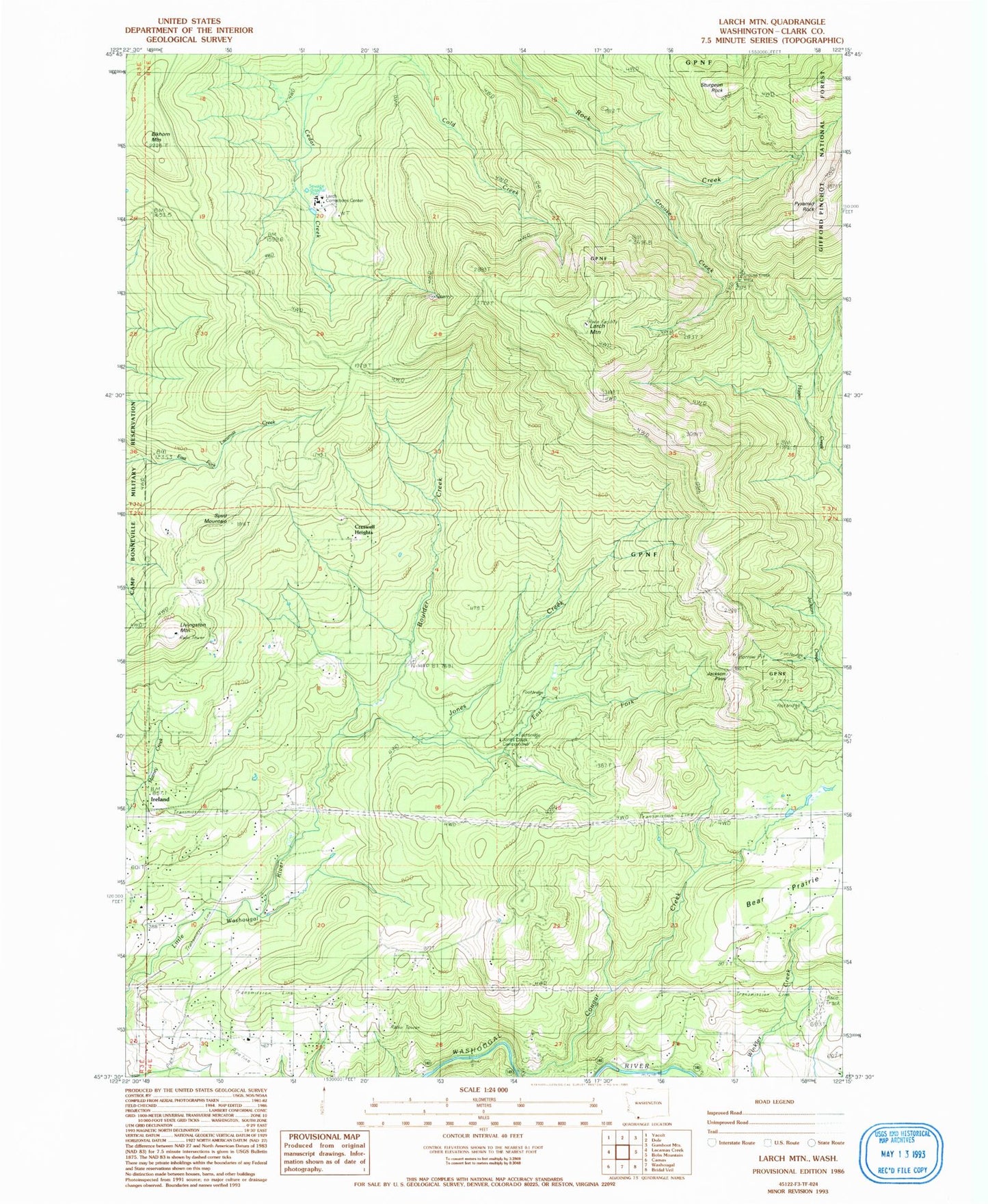
Classic USGS Larch Mountain Washington 7.5'x7.5' Topo Map
Couldn't load pickup availability
Historical USGS topographic quad map of Larch Mountain in the state of Washington. Typical map scale is 1:24,000, but may vary for certain years, if available. Print size: 24" x 27"
This quadrangle is in the following counties: Clark.
The map contains contour lines, roads, rivers, towns, and lakes. Printed on high-quality waterproof paper with UV fade-resistant inks, and shipped rolled.
Contains the following named places: Cougar Creek, Creswell Heights, East Fork Little Washougal River, Elkhorn Mountain, Grouse Creek, Ireland, Jones Creek, Larch Mountain, Livingston Mountain, Pyramid Rock, Silver Star Mine, Spud Mountain, Sunnyside School, Jones Creek Campground, Jackson Pass, Larch Corrections Center, Grouse Creek Vista, Grouse Vista Picnic Site, Larch Mountain Picnic Site, Washougal Lake, Sunnyside, Camas Division, East County Fire and Rescue Station 92