MyTopo
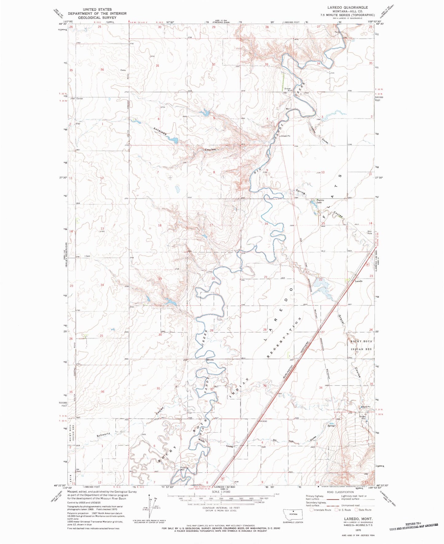
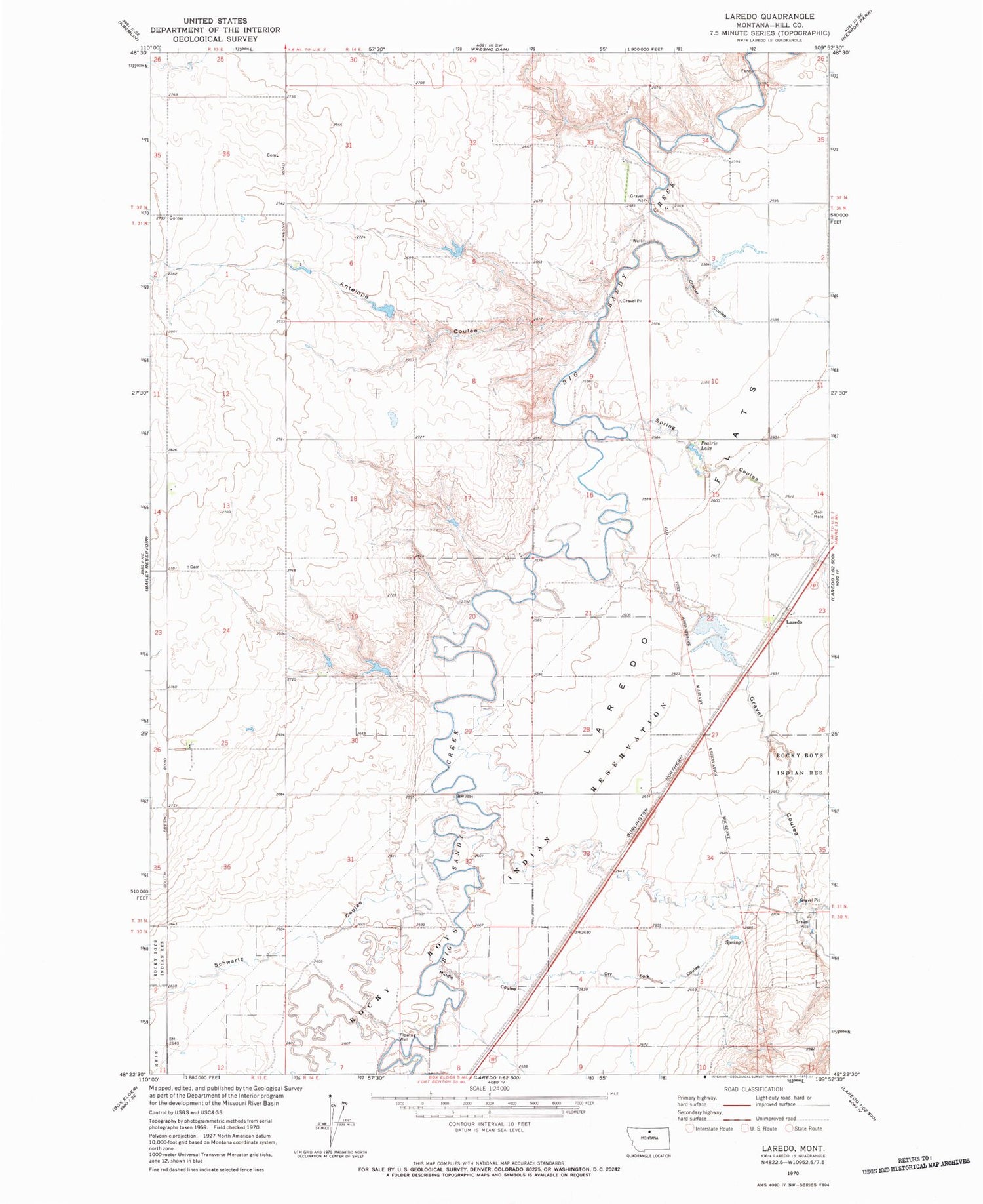
Classic USGS Laredo Montana 7.5'x7.5' Topo Map
Couldn't load pickup availability
Historical USGS topographic quad map of Laredo in the state of Montana. Map scale may vary for some years, but is generally around 1:24,000. Print size is approximately 24" x 27"
This quadrangle is in the following counties: Hill.
The map contains contour lines, roads, rivers, towns, and lakes. Printed on high-quality waterproof paper with UV fade-resistant inks, and shipped rolled.
Contains the following named places: 31N14E02BA__01 Well, 31N14E03CDDC01 Well, 31N14E15BA__01 Well, 31N14E15DD__01 Well, 31N14E23BC__01 Well, 31N14E23BC__02 Well, 31N14E23CC__01 Well, 31N14E32DC__01 Well, 31N14E33BC__01 Well, 31N14E34AA__01 Well, 32N14E33DD__01 Well, Antelope Coulee, Big Gravel Dam Number 1, Big Jugs Dam, Boyer Dam, Conner Coulee, Daniel Number 1 Dam, Daniel Number 2 Dam, Daniel Number 3 Dam, Dry Fork Coulee, Gravel Coulee, Laredo, Laredo Census Designated Place, Laredo Flats, Laredo Post Office, Laredo School, Middle Coulee, Prairie Lake, Schwartz Coulee, Spring Coulee, Wilfred Tow Dam