
MyTopo
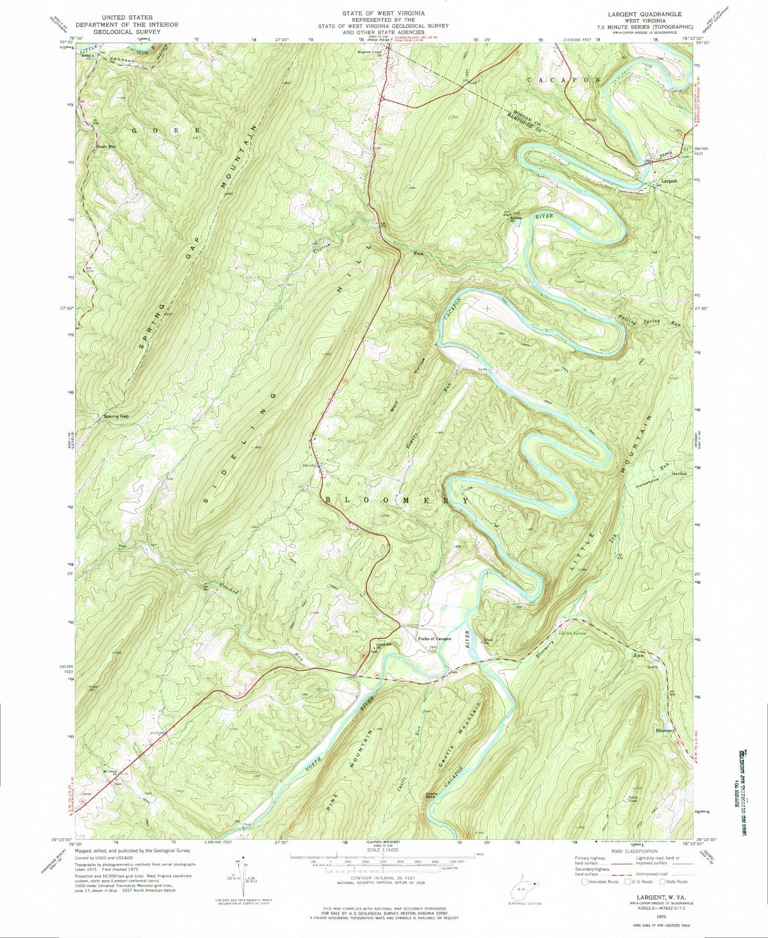
Classic USGS Largent West Virginia 7.5'x7.5' Topo Map
Couldn't load pickup availability
Historical USGS topographic quad map of Largent in the state of West Virginia. Typical map scale is 1:24,000, but may vary for certain years, if available. Print size: 24" x 27"
This quadrangle is in the following counties: Hampshire, Morgan.
The map contains contour lines, roads, rivers, towns, and lakes. Printed on high-quality waterproof paper with UV fade-resistant inks, and shipped rolled.
Contains the following named places: Bethel Church, Bloomery Run, Bowers Run, Castle Rock, Castle Run, Critton Run, Crooked Run, Eubulus Church, Falling Spring Run, Forks of Cacapon, Horsebone Hollow, Island Hill Church, Ivy Run, Johnson Hollow, Largent, Mount Union Church, Spring Gap, Spring Gap Mountain, Stony Creek, Wolf Hollow, Woodrow Union Church, North River, Castle Mountain, Neals Run, Critton School (historical), Furnace School (historical), Mount Union School (historical), Pinoak School (historical), Victory School (historical), Woodrow School (historical), Enon School (historical), Woodrow, Enon Cemetery, Old Enon Primitive Baptist Church Cemetery, Linnie Hiett Spring, Cacapehon, Diamond Ridge, Woodrow Church Cemetery, Bloomery District, Island Hill Cemetery, Mount Union Church Cemetery, Old Bethel Church Cemetery


