MyTopo
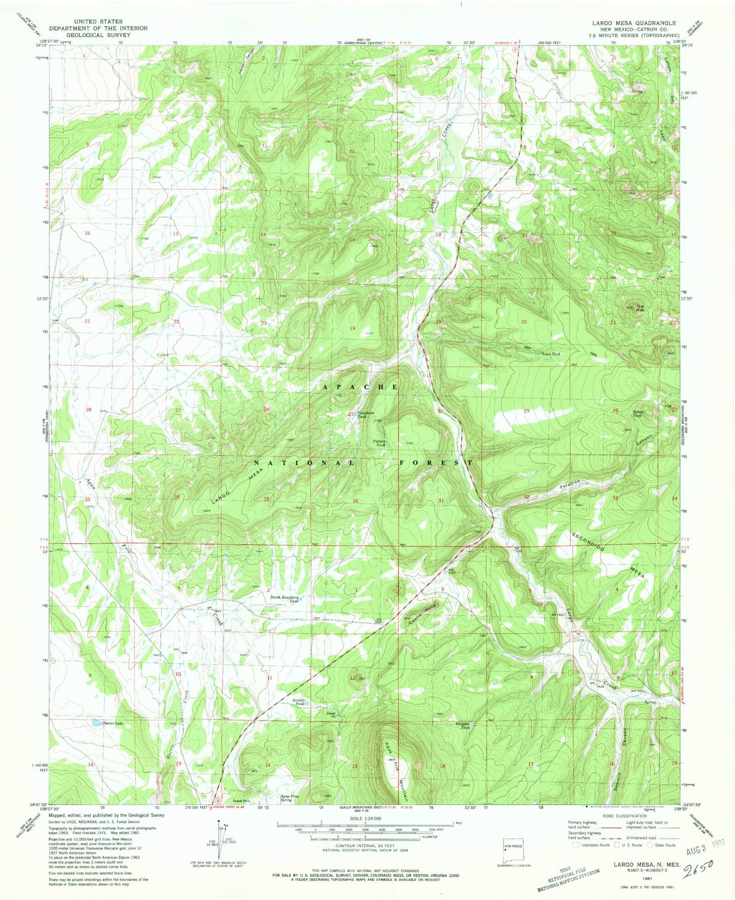
Classic USGS Largo Mesa New Mexico 7.5'x7.5' Topo Map
Couldn't load pickup availability
Historical USGS topographic quad map of Largo Mesa in the state of New Mexico. Map scale may vary for some years, but is generally around 1:24,000. Print size is approximately 24" x 27"
This quadrangle is in the following counties: Catron.
The map contains contour lines, roads, rivers, towns, and lakes. Printed on high-quality waterproof paper with UV fade-resistant inks, and shipped rolled.
Contains the following named places: Agua Fria Mountain, Agua Fria Spring, Agua Fria Tank, Armijo Tank, Bobcat Tank, Castle Rock, Chavez Lake, Division Tank, Escondido Mesa, Harris Creek, Largo Mesa, Leon Tank, North Boundary Tank, Paradise Canyon, Picture Tank, Quemado Lake Fire Department, Sawmill Canyon, Telephone Tank, The Hub, William Tank, Williams Pit - ID Number 2901685