MyTopo
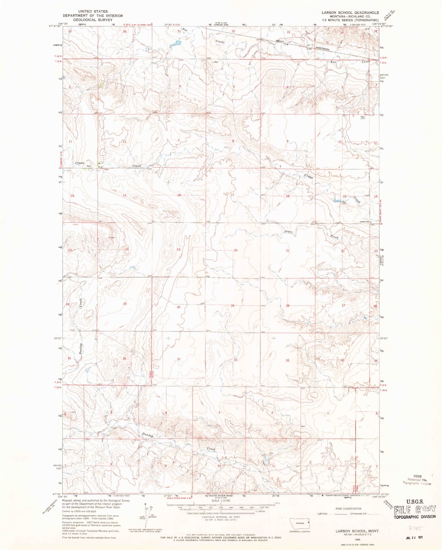
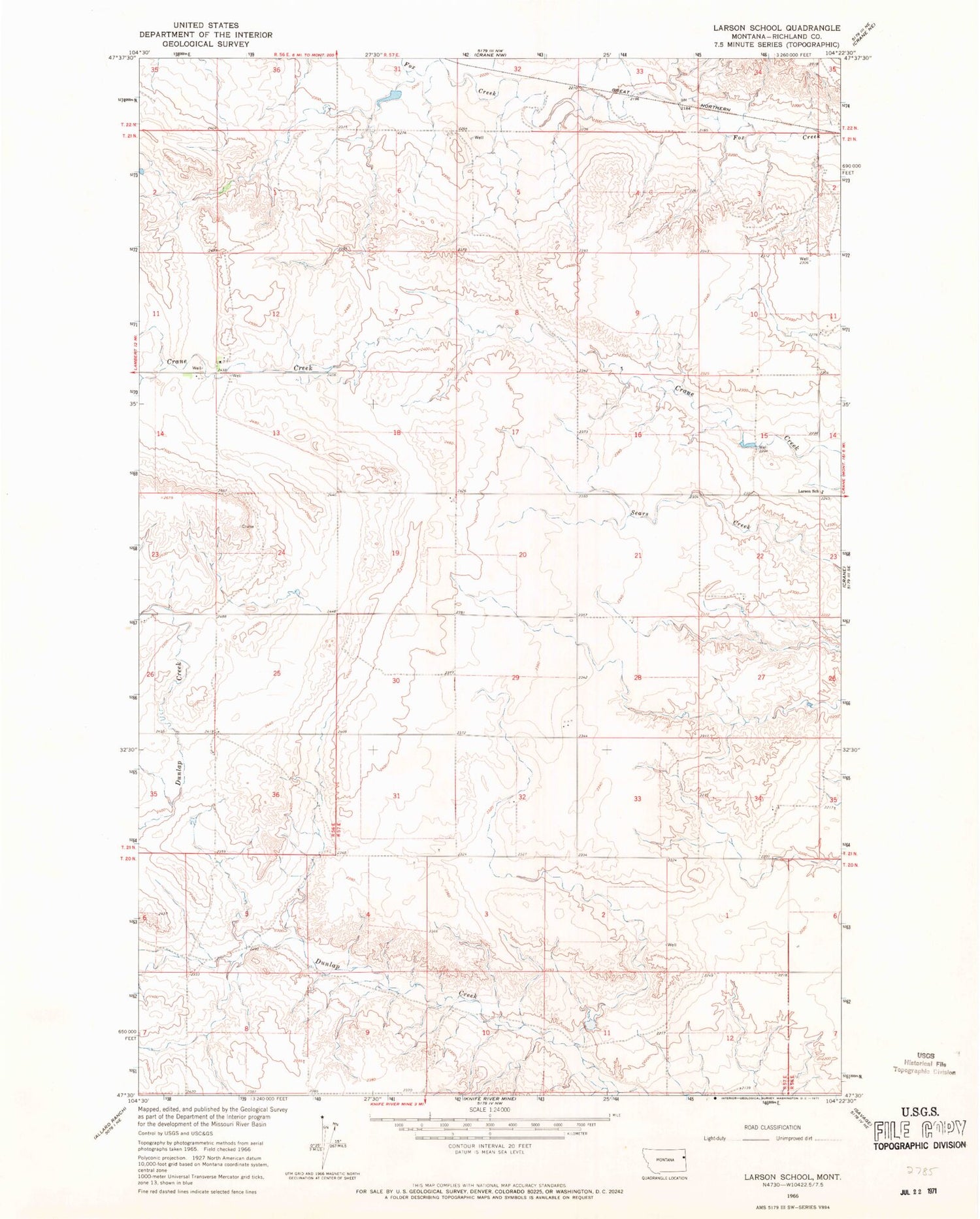
Classic USGS Larson School Montana 7.5'x7.5' Topo Map
Regular price
$16.95
Regular price
Sale price
$16.95
Unit price
per
Couldn't load pickup availability
Historical USGS topographic quad map of Larson School in the state of Montana. Map scale may vary for some years, but is generally around 1:24,000. Print size is approximately 24" x 27"
This quadrangle is in the following counties: Richland.
The map contains contour lines, roads, rivers, towns, and lakes. Printed on high-quality waterproof paper with UV fade-resistant inks, and shipped rolled.
Contains the following named places: 21N56E24BADC01 Well, 21N56E26BAAC01 Well, 21N57E16DCCB01 Well, 21N57E19AAAA01 Well, 21N57E35CB__01 Well, Dunlap Dam, Gettysburg School, Larson School, Lyle Dam