MyTopo
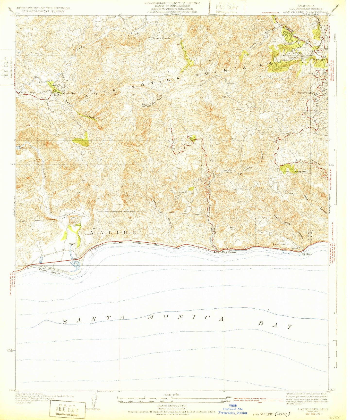
Classic USGS Las Flores California 7.5'x7.5' Topo Map
Couldn't load pickup availability
Historical USGS topographic quad map of Las Flores in the state of California. Typical map scale is 1:24,000, but may vary for certain years, if available. Print size: 24" x 27"
This quadrangle is in the following counties: Los Angeles.
The map contains contour lines, roads, rivers, towns, and lakes. Printed on high-quality waterproof paper with UV fade-resistant inks, and shipped rolled.
Contains the following named places: Big Rock Beach, Greenleaf Canyon, Piedra Gorda Canyon, Carbon Beach, Carbon Canyon, Crater Camp, Dark Canyon, Hondo Canyon, Kellers Shelter, La Costa Beach, Las Flores Canyon, Little Las Flores Canyon, Malibu Creek, Malibu Point, Malibu Reservoir, Webster School, Monte Nido, Los Angeles County Fire Department Station 67, Old Topanga Canyon, Saddle Peak, Stunts Ranch, Topanga Lookout, Malibu Administrative Center Heliport, Camp 8 Heliport, Hughes-Malibu Heliport, Fernwood, Las Flores, Malibu Beach, Serra Retreat, Topanga, Big Rock, Malibu Beach, Barton School (historical), Circle E Ranch (historical), Las Flores Ranch, Randge Ranch, Cold Creek Canyon Preserve, Malibu Lagoon, Malibu Lagoon Museum, Malibu Lagoon State Beach, Malibu Pier, Malibu Branch County of Los Angeles Public Library, Saddle Creek Ranch, Topanga Elementary School, Nike Site LA-78C (historical), Nike Site LA-78L (historical), Topanga Census Designated Place, Los Angeles County Fire Department Station 69, Los Angeles County Fire Department Station 70, Los Angeles County Fire Department Station 88, La Costa Malibu Post Office, Malibu Post Office, Topanga Post Office