MyTopo
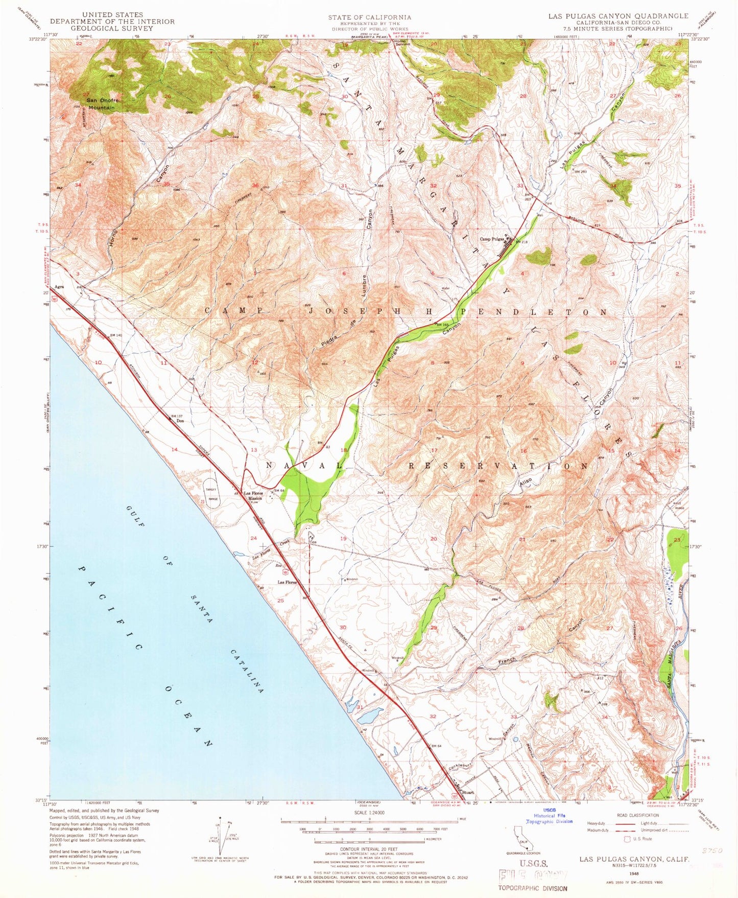
Classic USGS Las Pulgas Canyon California 7.5'x7.5' Topo Map
Couldn't load pickup availability
Historical USGS topographic quad map of Las Pulgas Canyon in the state of California. Typical map scale is 1:24,000, but may vary for certain years, if available. Print size: 24" x 27"
This quadrangle is in the following counties: San Diego.
The map contains contour lines, roads, rivers, towns, and lakes. Printed on high-quality waterproof paper with UV fade-resistant inks, and shipped rolled.
Contains the following named places: Asistencia de Las Flores, Cockleburr Canyon, French Canyon, Horno Canyon, Horno Hill, Las Flores Creek, Piedra de Lumbre Canyon, Pulgas Lake, San Onofre Mountain, Aliso Canyon, Las Pulgas Canyon, Santa Margarita Y Las Flores, Las Flores, Stuart, Stuart Mesa, Pulgas Lake Dam, Las Flores Marsh, Don (historical), Camp Pendleton Division, Marine Corps Base Camp Pendleton, Marine Corps Outlying Field Camp Pendleton (Red Beach) (historical), Camp Pendleton Fire Department Station 2, Camp Pendleton Fire Department Station 10, Camp Pendleton Fire Department Station 6, Asistencia de Las Flores, Cockleburr Canyon, French Canyon, Horno Canyon, Horno Hill, Las Flores Creek, Piedra de Lumbre Canyon, Pulgas Lake, San Onofre Mountain, Aliso Canyon, Las Pulgas Canyon, Santa Margarita Y Las Flores, Las Flores, Stuart, Stuart Mesa, Pulgas Lake Dam, Las Flores Marsh, Don (historical), Camp Pendleton Division, Marine Corps Base Camp Pendleton, Marine Corps Outlying Field Camp Pendleton (Red Beach) (historical), Camp Pendleton Fire Department Station 2, Camp Pendleton Fire Department Station 10, Camp Pendleton Fire Department Station 6