MyTopo
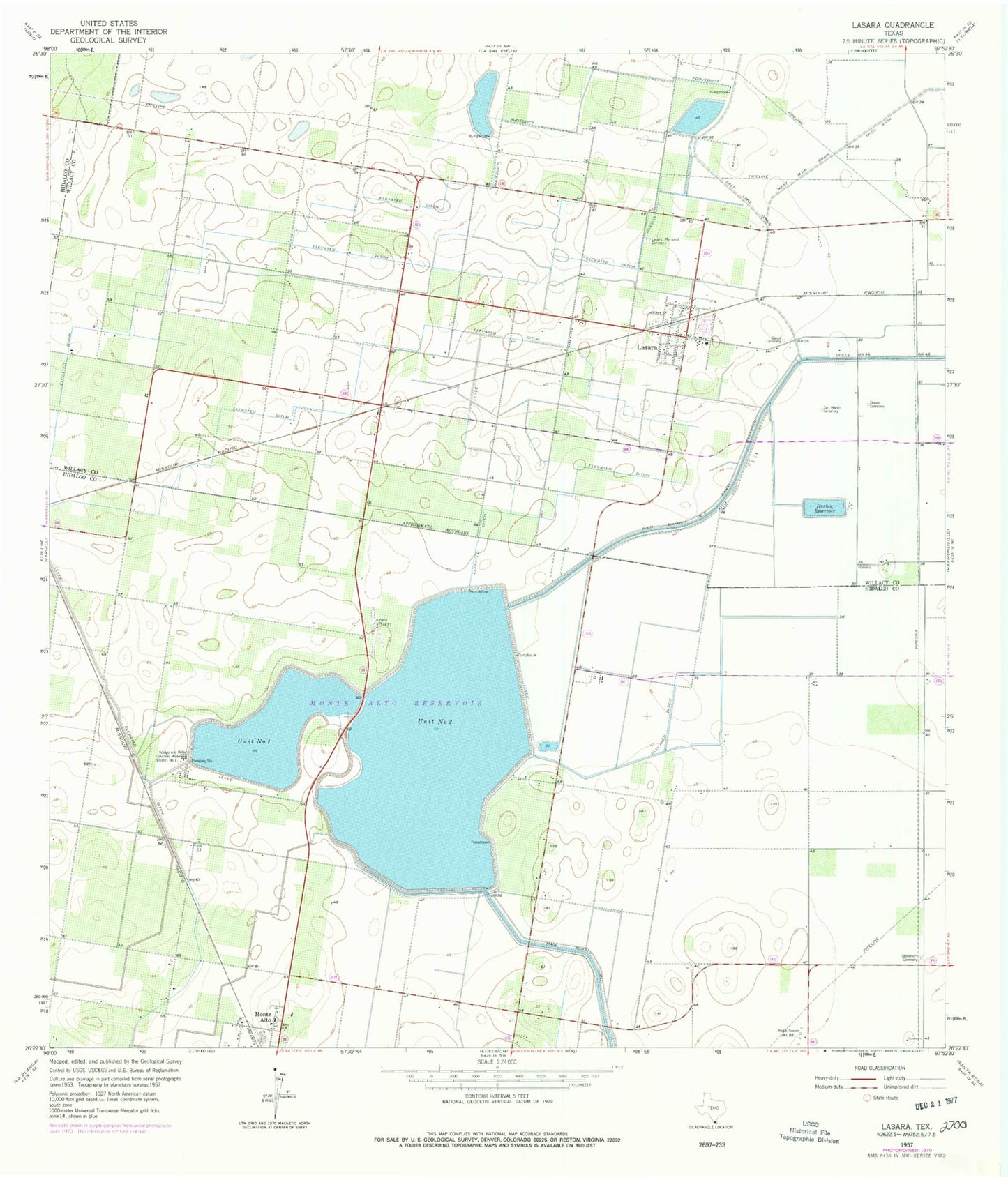
Classic USGS Lasara Texas 7.5'x7.5' Topo Map
Couldn't load pickup availability
Historical USGS topographic quad map of Lasara in the state of Texas. Map scale may vary for some years, but is generally around 1:24,000. Print size is approximately 24" x 27"
This quadrangle is in the following counties: Hidalgo, Willacy.
The map contains contour lines, roads, rivers, towns, and lakes. Printed on high-quality waterproof paper with UV fade-resistant inks, and shipped rolled.
Contains the following named places: Chavez Cemetery, Delta Lake, Delta Lake Dam 2, Delta Unit 1 Dam, Garcia Cemetery, Harbin Levee, Harbin Reservoir, Hargill Division, Hidalgo and Willacy Counties Water District, KGBT-AM (Harlingen), Lasara, Lasara Census Designated Place, Lasara Memorial Cemetery, Lasara Post Office, Lasara Volunteer Fire Department, Main Branch Northeast Canal, Main Supply Canal, Reservoir Unit Number One, Reservoir Unit Number Two, Salt Lake Drain, San Martin Cemetery, Stockholm, Teniente Wid Number 1 Lake, Teniente Wid Number 1 Lake Dam, ZIP Code: 78561