MyTopo
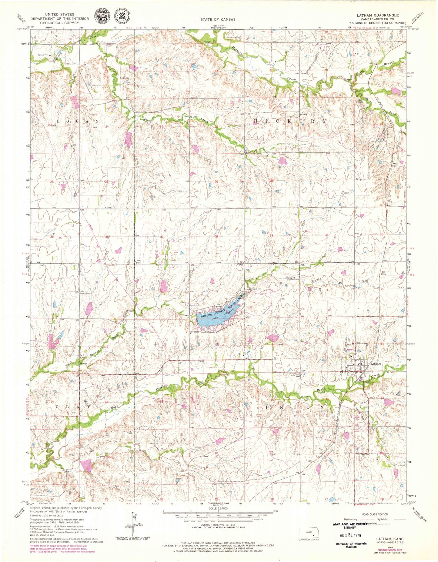
Classic USGS Latham Kansas 7.5'x7.5' Topo Map
Couldn't load pickup availability
Historical USGS topographic quad map of Latham in the state of Kansas. Map scale may vary for some years, but is generally around 1:24,000. Print size is approximately 24" x 27"
This quadrangle is in the following counties: Butler.
The map contains contour lines, roads, rivers, towns, and lakes. Printed on high-quality waterproof paper with UV fade-resistant inks, and shipped rolled.
Contains the following named places: Brownlow Cemetery, Bryant Cemetery, Butler County Fire District 6 Latham, Butler County State Lake Dam, Butler State Fishing Lake and Wildlife Area, City of Latham, Honey Creek, Lake Clymer, Latham, Latham Cemetery, Latham Oil Field, Latham Post Office, Latham United Methodist Church, Latham Wastewater Plant, North Branch Hickory Creek, Ophir, Plum Creek, South Branch Hickory Creek