MyTopo
Classic USGS Laton California 7.5'x7.5' Topo Map
Couldn't load pickup availability
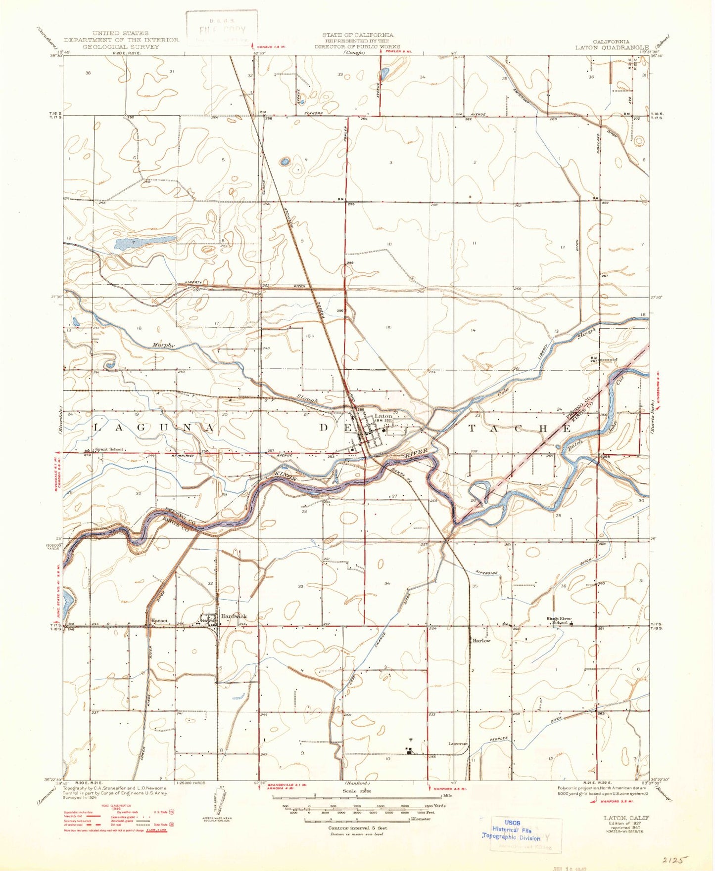
Historical USGS topographic quad map of Laton in the state of California. Map scale may vary for some years, but is generally around 1:24,000. Print size is approximately 24" x 27"
This quadrangle is in the following counties: Fresno, Kings.
The map contains contour lines, roads, rivers, towns, and lakes. Printed on high-quality waterproof paper with UV fade-resistant inks, and shipped rolled.
Contains the following named places: Adamscows Dairy, Areias Brothers Dairy, Cole Slough, Crossout Waste, Cunha Dairy East, De Groot and Visser Dairy, Double N Dairy, Dutch John Cut, Grant School, Hardwick, Hardwick Census Designated Place, Hasset, Kings County Country Club, Kings County Fire Department Station 2 Hardwick, Kings River Cemetery, Kings River School, Kingston, Kingston Historical Marker, Last Chance Weir 723, Laton, Laton Census Designated Place, Laton Division, Laton Elementary School, Laton High School, Laton Post Office, Laton Volunteer Fire Department, Laton-Kingston Park, Lemoore Diversion Weir 722, Leonardo Brothers Dairy, Lillis, Lu-Ar Dairy, Lucerne, Mussel Slough Tragedy Historical Marker, Oak View Continuation High School, Peoples Ditch, Reynolds Weir 80, Shirley, Stryd Brothers Ranch, Swanson Ranch Nr 1 Airport, Warmerdam Orchards, Whitmores Ferry, ZIP Code: 93242