
MyTopo
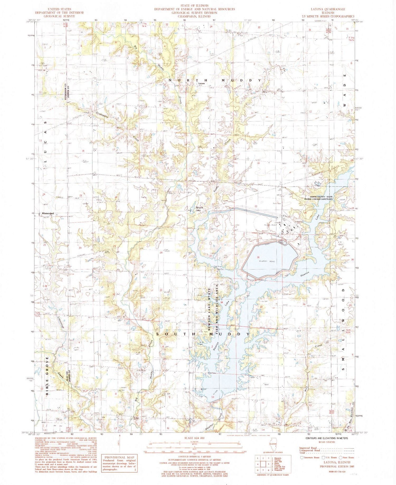
Classic USGS Latona Illinois 7.5'x7.5' Topo Map
Couldn't load pickup availability
Historical USGS topographic quad map of Latona in the state of Illinois. Map scale may vary for some years, but is generally around 1:24,000. Print size is approximately 24" x 27"
This quadrangle is in the following counties: Clay, Effingham, Jasper.
The map contains contour lines, roads, rivers, towns, and lakes. Printed on high-quality waterproof paper with UV fade-resistant inks, and shipped rolled.
Contains the following named places: Abbott Cemetery, Bailey Cemetery, Boone Post Office, Burgett Lake, Burgett Lake Dam, Crabapple Creek, Devore Cemetery, Foster Cemetery, Freeman Cemetery, Fulk - Pierce Cemetery, Galloway School, Headyville Cemetery, Headyville Church, Jasper County State Prairie Chicken Sanctuary, Johnson Farms, Kedron Cemetery, Kedron School, Kedron United Methodist Church, Lancaster Cemetery, Latona, Latona Church of Christ, Laws Creek, Long Branch, Newton Lake, Newton Lake State Fish and Wildlife Area, Newton Power Plant, Newton Power Station Lake, Newton Power Station Lake Dam, Pleasant Valley Cemetery, Sandy Creek, South Muddy Cemetery, South Muddy Church, Tate Cemetery, Township of South Muddy, Trexler Cemetery, Union School, Worthey Cemetery, Worthy Cemetery


