MyTopo
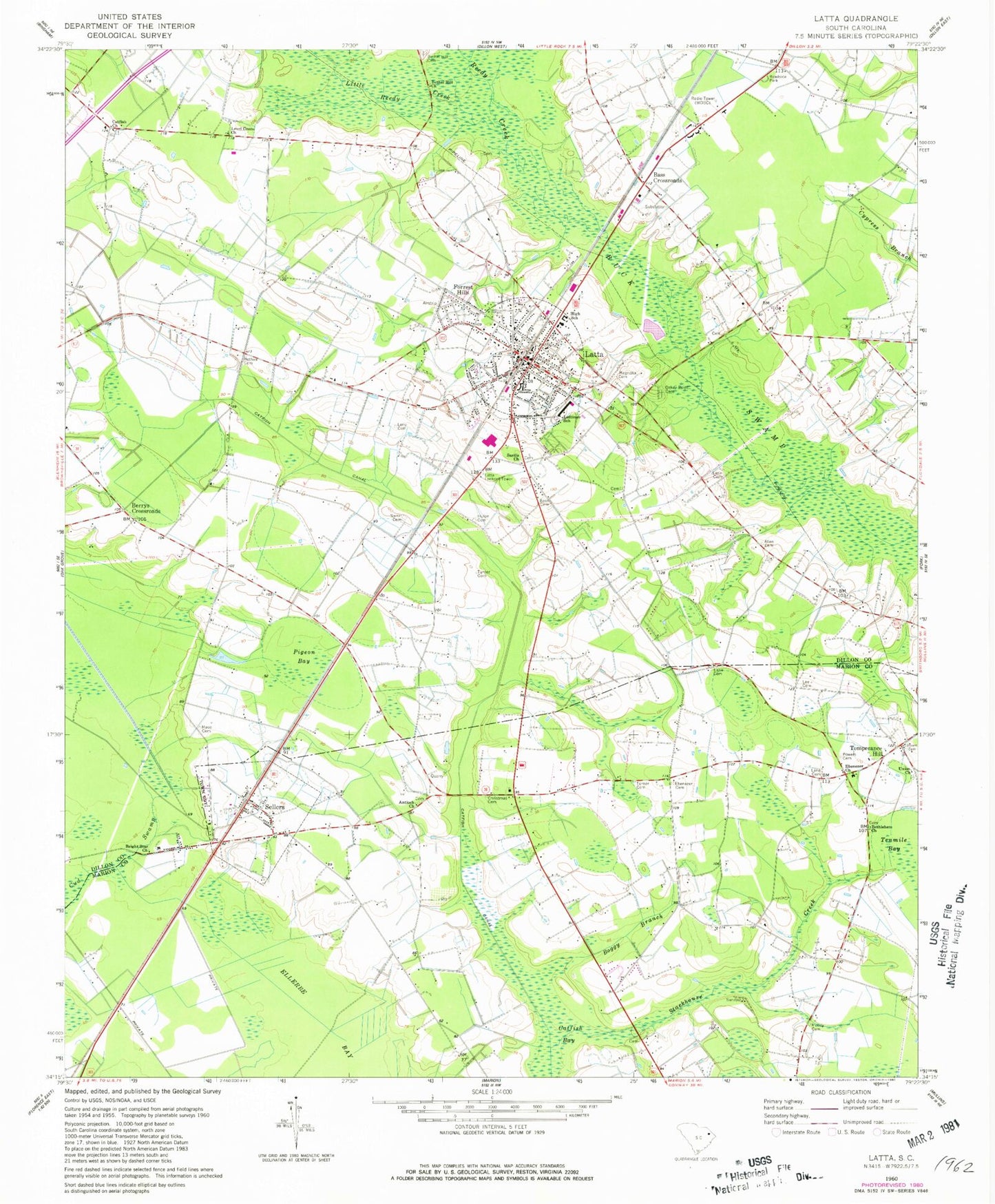
Classic USGS Latta South Carolina 7.5'x7.5' Topo Map
Couldn't load pickup availability
Historical USGS topographic quad map of Latta in the state of South Carolina. Map scale may vary for some years, but is generally around 1:24,000. Print size is approximately 24" x 27"
This quadrangle is in the following counties: Dillon, Marion.
The map contains contour lines, roads, rivers, towns, and lakes. Printed on high-quality waterproof paper with UV fade-resistant inks, and shipped rolled.
Contains the following named places: Allen Cemetery, Antioch Baptist Church, Bass Cemetery, Bass Crossroads, Berean Church of Christ, Berrys Crossroads, Bethea Cemetery, Bethea Cross Roads, Betheas Crossroads, Bethel Hill Cemetery, Bethel Hill Church, Bethlehem Church, Bethlehem School, Boggy Branch, Bright Star Church, Bryant Cemetery, Catfish Church, Catfish Creek Baptist Church Cemetery, Christmas Cemetery, Dalcho, Dalcho High School, Dillon County Fire Department Station 2, Dillon County Library, Ebenezer Cemetery, Ebenezer Church, Forrest Hills, Holiness Church, Hulon Cemetery, Lane Cemetery, Latta, Latta Division, Latta High School, Latta Historic District Number 1, Latta Historic District Number 2, Latta Logan Pond Dam D-3604, Latta Lookout Tower, Latta Police Department, Latta Post Office, Latta Presbyterian Church, Latta Primary School, Lattimer School, Lee Cemetery, Level Green Church, Level Green School, Little Reedy Creek, Mace Cemetery, Magnolia Cemetery, Manning School, Meadow Hill School, Moody Cemetery, New Hope Baptist Church, New Hope School, New Mount Zion African Methodist Episcopal Church, Oakey Point Cemetery, Old Ebenezer Church, Pigeon Bay, Powers Cemetery, Reedy Creek, Saint John Baptist Church, Sardis Baptist Church, Sardis Baptist Church Cemetery, Sardis Indian School, Sellers, Sellers Chapel Baptist Church, Sellers Indian School, Stackhouse Creek, Sweat Cemetery, Temperance Hill, Temperance Hill Fire Department, Town of Latta, Town of Sellers, Turner Cemetery, Union Church, Vidalia Academy, WDSC-AM (Dillon), ZIP Codes: 29565, 29592


