MyTopo
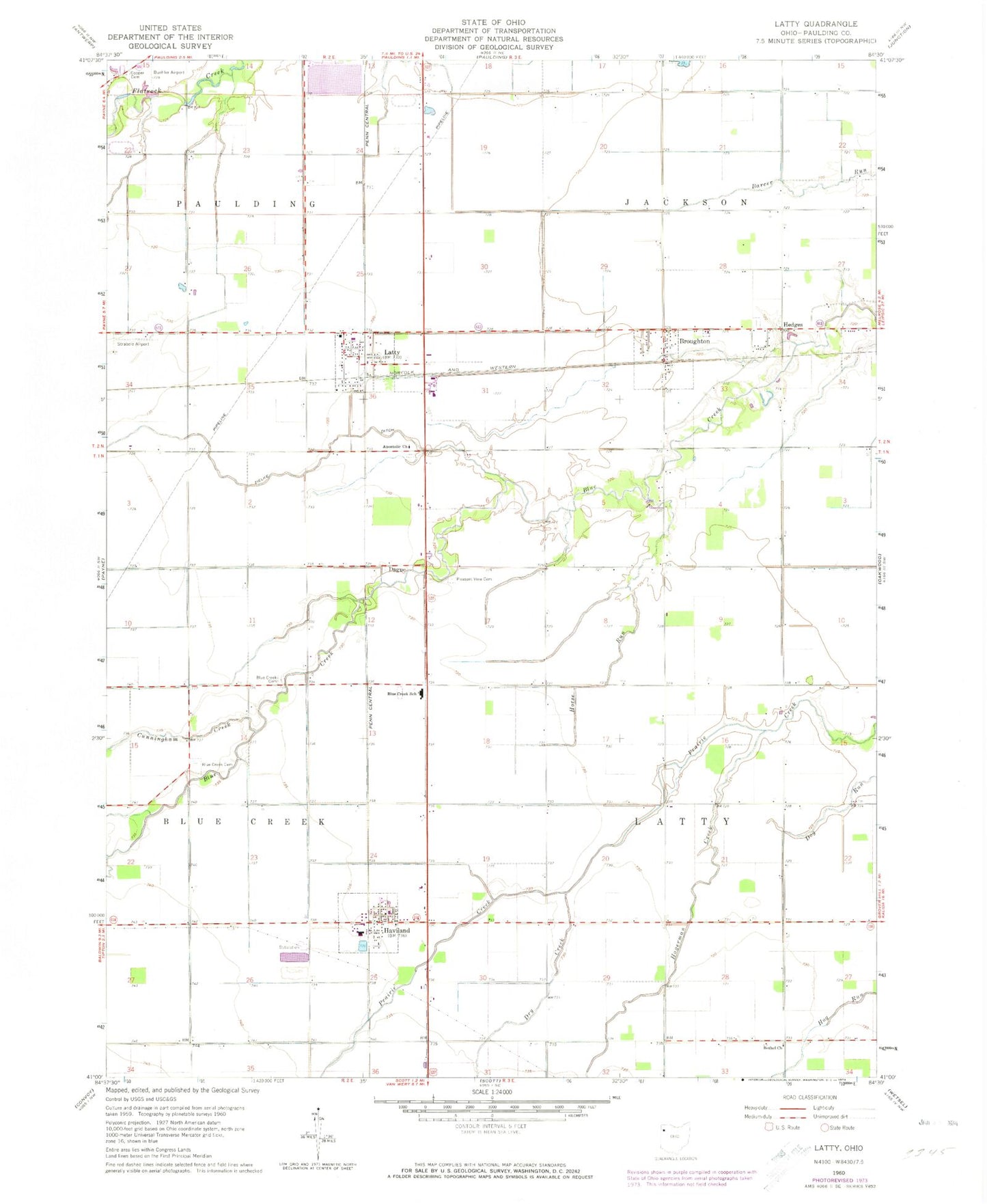
Classic USGS Latty Ohio 7.5'x7.5' Topo Map
Couldn't load pickup availability
Historical USGS topographic quad map of Latty in the state of Ohio. Map scale may vary for some years, but is generally around 1:24,000. Print size is approximately 24" x 27"
This quadrangle is in the following counties: Paulding.
The map contains contour lines, roads, rivers, towns, and lakes. Printed on high-quality waterproof paper with UV fade-resistant inks, and shipped rolled.
Contains the following named places: Allen School, Apostolic Cemetery, Apostolic Church, Bethel Church, Blue Creek Cemetery, Broughton, Broughton Post Office, Buehler Airport, Cook Dairy Farm, Cooper Cemetery, Cunningham Creek, Dague, Dague Post Office, Dry Creek, Follmer, Follmer Post Office, Hagerman Creek, Haviland, Haviland Post Office, Hedges, Hedges Cemetery, Hedges Post Office, Horse Run, Jackson Township Hall, Keppler School, Latty, Latty Center School, Latty Post Office, Latty Town Park, Mason School, McDonald School, Paulding County, Paulding Upground Reservoir, Paulding Upground Reservoir Dam, Paulding Water Treatment Plant, Pink School, Pleasant View Cemetery, Roebuck School, Strabele Airport, Taylor School, Thurston School, Tigner School, Township of Jackson, Township of Latty, Village of Broughton, Village of Haviland, Village of Latty, Wayne Trace High School, WKSD-FM (Paulding), Zielke Ditch, ZIP Codes: 45851, 45855