MyTopo
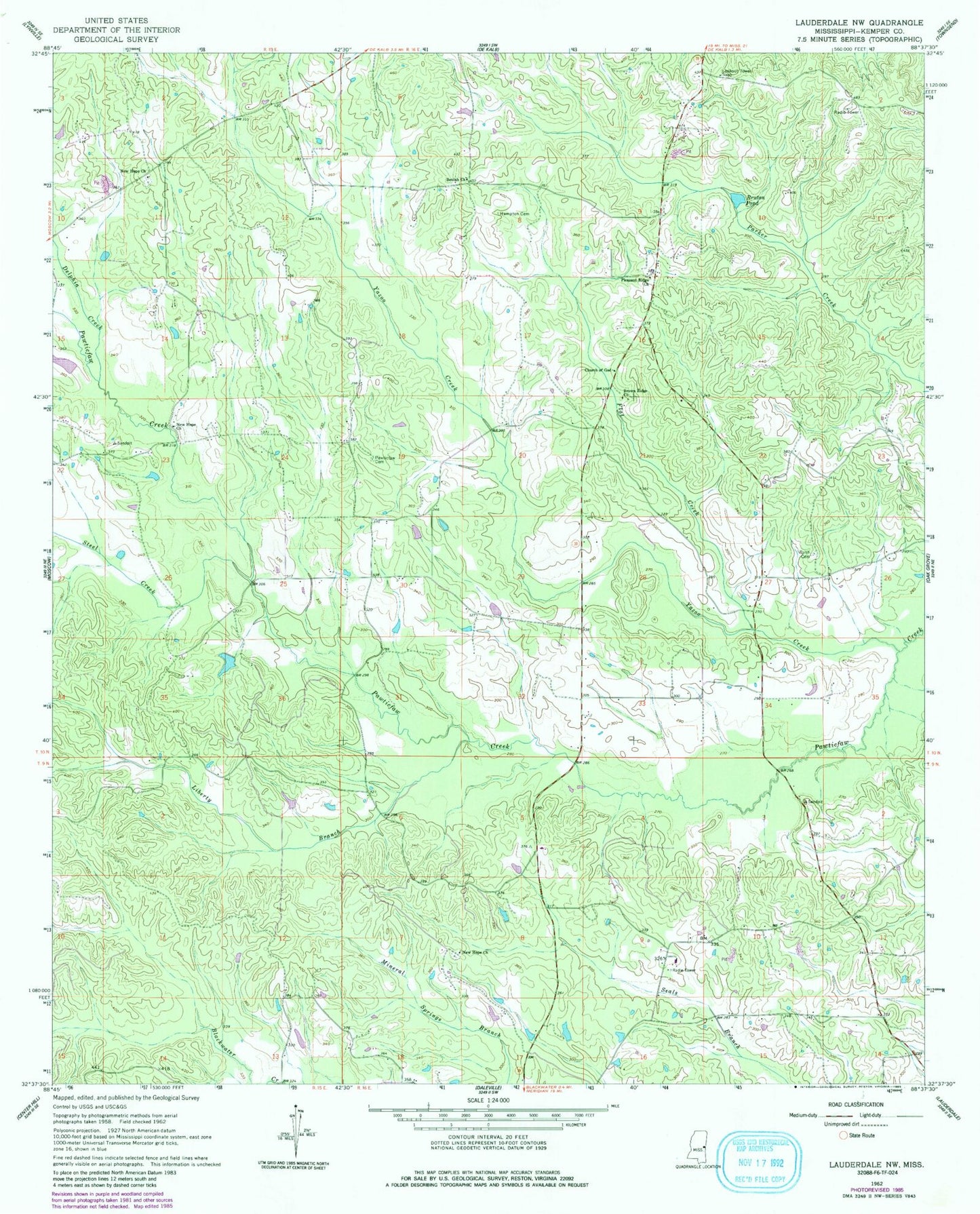
Classic USGS Lauderdale NW Mississippi 7.5'x7.5' Topo Map
Couldn't load pickup availability
Historical USGS topographic quad map of Lauderdale NW in the state of Mississippi. Map scale may vary for some years, but is generally around 1:24,000. Print size is approximately 24" x 27"
This quadrangle is in the following counties: Kemper.
The map contains contour lines, roads, rivers, towns, and lakes. Printed on high-quality waterproof paper with UV fade-resistant inks, and shipped rolled.
Contains the following named places: Ayanabi, Beulah Church, Brown Ridge Church, Bruton Pond, Church of God, Delphia Creek, East Yazo Skatane, Flat Creek, H C Jenkins Pond Dam, Haanka Ullah, Hampton Cemetery, James Barnhanm Pond Dam, Kipling, Liberty Branch, Mount Nebo, New Hope Cemetery, New Hope Church, Pawticfaw Baptist Church, Pawticfaw Cemetery, Pleasant Ridge Church, Rush Cemetery, Steel Creek, Supervisor District 5, Yazoo Creek, ZIP Code: 39328