
MyTopo
Classic USGS Lauderdale Mississippi 7.5'x7.5' Topo Map
Couldn't load pickup availability
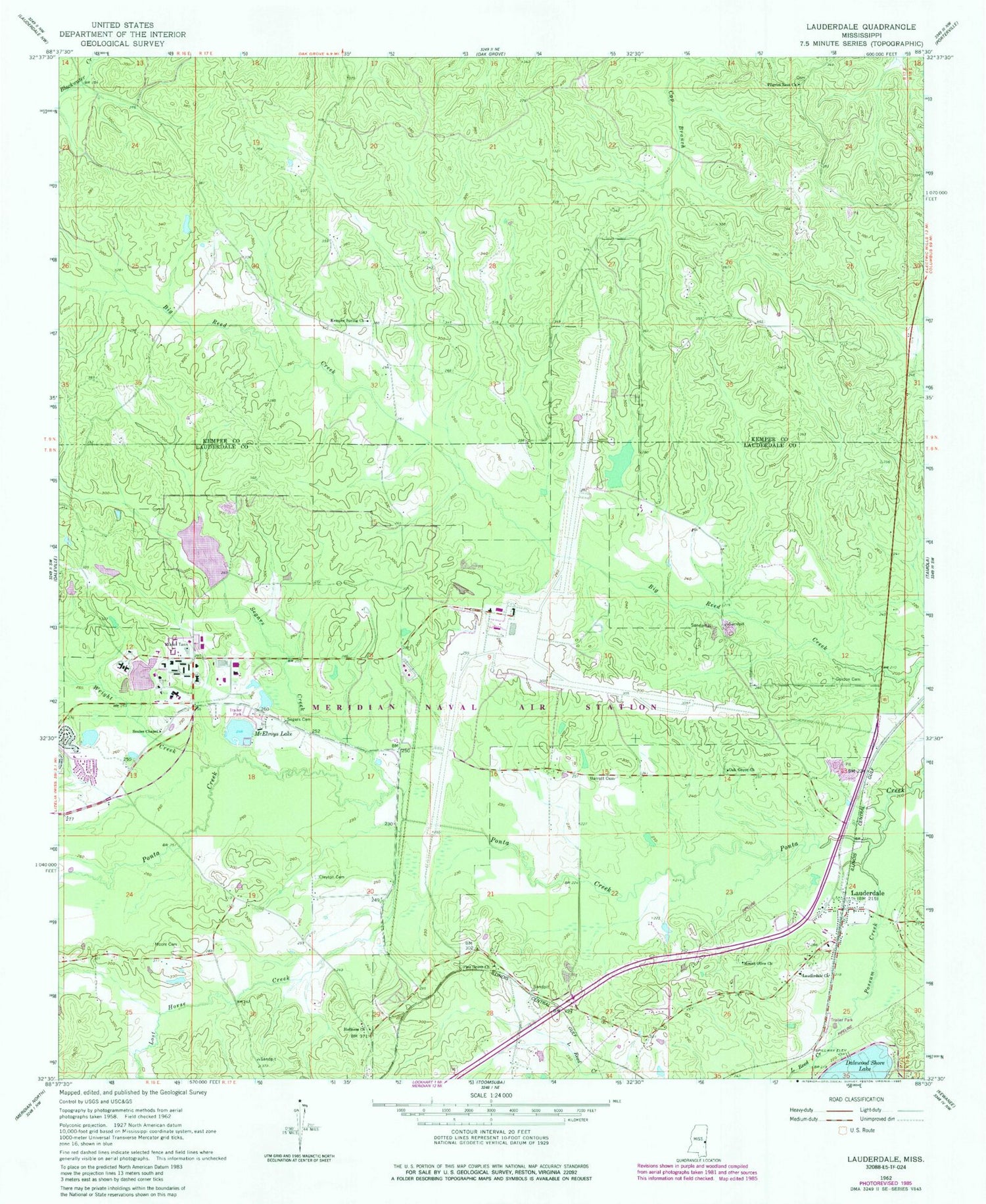
Historical USGS topographic quad map of Lauderdale in the state of Mississippi. Map scale may vary for some years, but is generally around 1:24,000. Print size is approximately 24" x 27"
This quadrangle is in the following counties: Kemper, Lauderdale.
The map contains contour lines, roads, rivers, towns, and lakes. Printed on high-quality waterproof paper with UV fade-resistant inks, and shipped rolled.
Contains the following named places: Annette Lake, Barrett Cemetery, Beatrice Lake, Caroline Lake, Charles Steele Pond Dam, Clayton Cemetery, Davis Mill, First Baptist Church of Lauderdale, Gordon Cemetery, Helen Lake, Holden Church, Holiness Church, Kemper Springs, Kemper Springs Baptist Church, Lake Helen Dam, Lake Lucille Dam, Lauderdale, Lauderdale Census Designated Place, Lauderdale Post Office, Lauderdale United Methodist Church, Lauderdale Volunteer Fire Department, Little Reed Creek, Lost Horse Creek, Maftin C Tant Lake, Martha Lake, McElroys Lake, Meridian Naval Air Station /Mc Cain Field, Meridian Station Census Designated Place, Moore Cemetery, Moores Mill, Mount Olive Church, Naval Air Station Meridian, Naval Air Station Meridian Fire Department Station 2, Naval Air Station Meridian Fire Rescue Station, Oak Grove Church, Pilgrim Rest Church, Pine Grove Church, Ponta, Possum Creek, Segars Cemetery, Segars Creek, Sonny Montgomery Recreation Park, Soules Chapel, Wild Horse Creek, Wright Creek, ZIP Code: 39309


