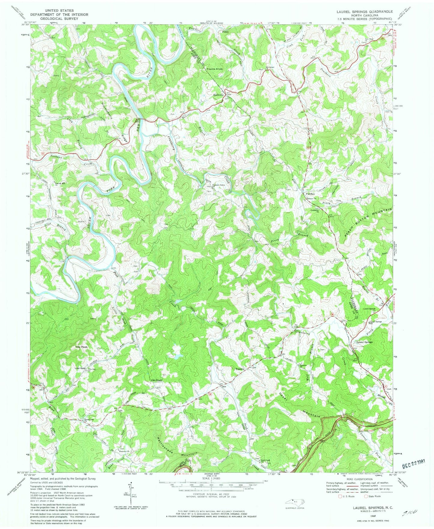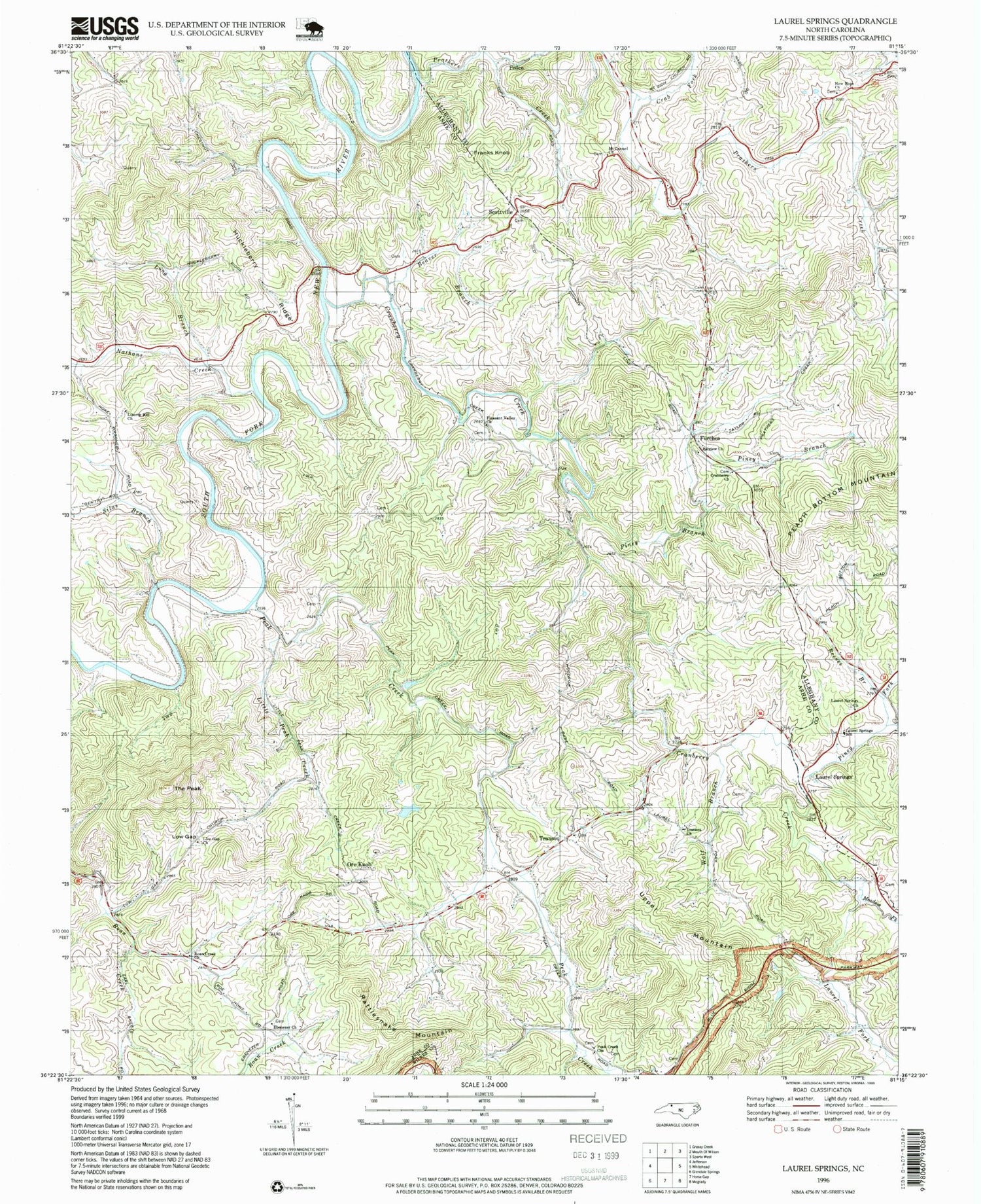
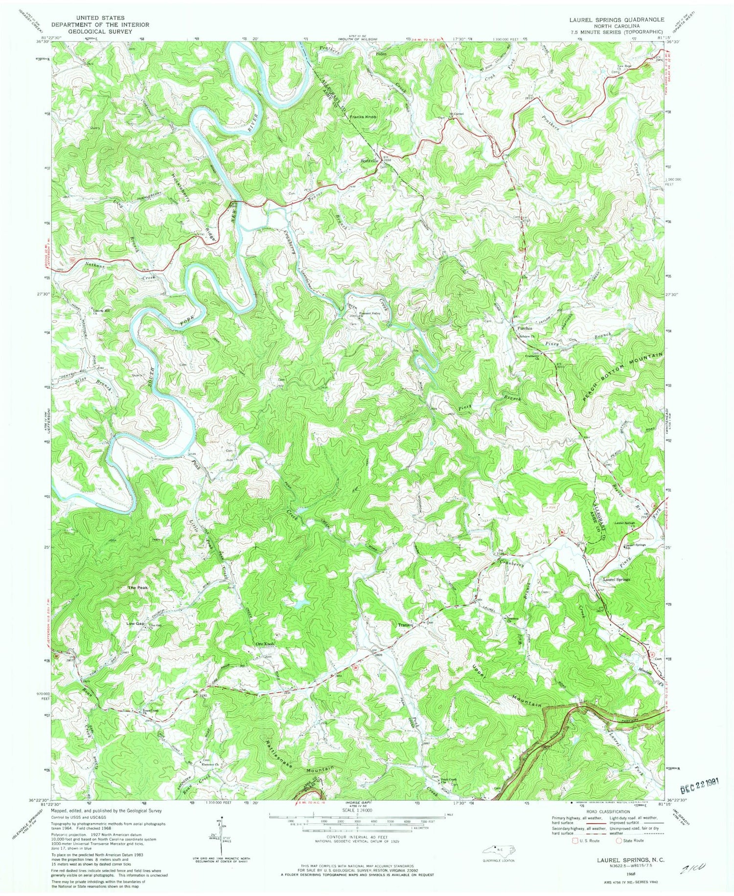
MyTopo
Classic USGS Laurel Springs North Carolina 7.5'x7.5' Topo Map
Couldn't load pickup availability
Historical USGS topographic quad map of Laurel Springs in the state of North Carolina. Map scale may vary for some years, but is generally around 1:24,000. Print size is approximately 24" x 27"
This quadrangle is in the following counties: Alleghany, Ashe, Wilkes.
The map contains contour lines, roads, rivers, towns, and lakes. Printed on high-quality waterproof paper with UV fade-resistant inks, and shipped rolled.
Contains the following named places: Beaver Branch, Belview Church, Church Mill, Crab Fork, Cranberry Creek, Cranberry Primitive Baptist Church, Ebenezer Church, Franks Knob, Furches, Huckleberry Ridge, Irwin Mill, Laurel Fork, Laurel Springs, Laurel Springs Baptist Church, Laurel Springs Post Office, Laurel Springs School, Laurel Springs Volunteer Fire Department, Liberty Hill Church, Little Peak Creek, Long Branch, Low Gap, Low Gap Church, Maines Mill, Matt Carson Cemetery, Meadow Fork, Mount Carmel Cemetery, Mount Carmel Church of the Brethren, Nathans Creek, New Hope, New Hope Baptist Church, New Hope Cemetery, New Wild and Scenic River, Ore Knob, Peak Creek, Peak Creek Church of the Brethren, Peden, Perry Mill, Piney Branch, Piney Fork, Pleasant Valley Church, Prathers Creek, Pruitt Mill, Pugh Mill, Rattlesnake Mountain, Reeves Branch, Roan Creek Church, Scottville, Silas Branch, Skyland Airport, The Peak, Township of Chestnut Hill, Township of Peak Creek, Township of Prathers Creek, Transou, Transou Church, Upper Mountain, Weaver Mill, Wolf Branch, ZIP Codes: 28617, 28644, 28672