MyTopo
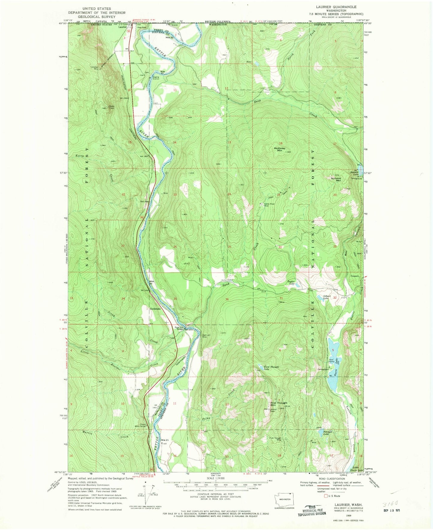
Classic USGS Laurier Washington 7.5'x7.5' Topo Map
Couldn't load pickup availability
Historical USGS topographic quad map of Laurier in the state of Washington. Map scale may vary for some years, but is generally around 1:24,000. Print size is approximately 24" x 27"
This quadrangle is in the following counties: Ferry, Stevens.
The map contains contour lines, roads, rivers, towns, and lakes. Printed on high-quality waterproof paper with UV fade-resistant inks, and shipped rolled.
Contains the following named places: Avey Field, Box Canyon, Deep Creek, First Thought Lake, First Thought Mine, First Thought Mountain, Gilbert Lake, Goldstake, Hughes, Jenny Creek, Kerry Creek, Kettle River Mine, Laurier, Laurier Census Designated Place, Laurier Port of Entry, Laurier Post Office, Little Boulder Creek, Little Pierre Lake, Martin Creek, McKinley Mountain, North Fork Deep Creek, Orient Ranger Station, Orient Work Center, Pelky Creek, Pierre Creek, Pierre Lake, Pierre Lake Campground, Pittman Lake, Red Lion Mine, Rock Cut, Rock Cut Bridge, Sand Creek, Standing Circle R Ranch Airport, Summit Lake, Summit Mountain, Talisman Mine, Taylor Lake