MyTopo
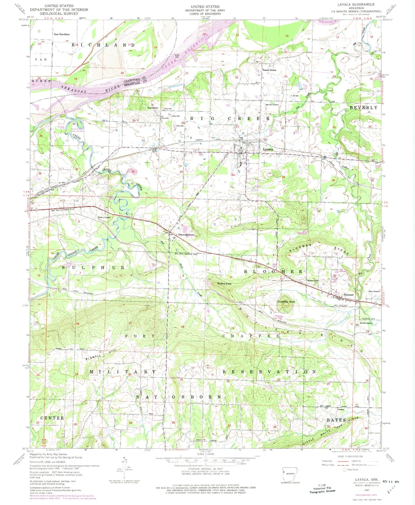
Classic USGS Lavaca Arkansas 7.5'x7.5' Topo Map
Couldn't load pickup availability
Historical USGS topographic quad map of Lavaca in the state of Arkansas. Map scale may vary for some years, but is generally around 1:24,000. Print size is approximately 24" x 27"
This quadrangle is in the following counties: Crawford, Sebastian.
The map contains contour lines, roads, rivers, towns, and lakes. Printed on high-quality waterproof paper with UV fade-resistant inks, and shipped rolled.
Contains the following named places: Arrowhead Assault Strip, Auburn, Big Creek Fire Department Station 1, Big Creek Fire Department Station 2, Biswell Hill, Bloomer, Bloomer Baptist Church, Bloomer Gas Field, Bloomer Ridge, Bloomer School, Butlers Knob, Butlers Ridge, Carnis Auburn Road Cemetery, Center Valley Cemetery, Central City Fire Station, Central City Police Department, Christmas Knob, City of Lavaca, Cox Creek, Crouch Lake, Crouch Pond Number Two Dam, Diamond Grove, Doctors Creek, Ewing Gas Field, First Baptist Church of Lavaca, Flat Rock Creek, Flying W Air Park Inc, Fort Chaffee Maneuver Training Center, Frustee Bend Cutoff, Hill Cemetery, Indian Cemetery, Jones Cemetery, Lavaca, Lavaca Elementary School, Lavaca Fire and Rescue Ambulance, Lavaca Fire Department and Rescue, Lavaca Gas Field, Lavaca High School, Lavaca Middle School, Lavaca Police Department, Lavaca Post Office, Little Vache Grasse Creek, Marietta Cemetery, Mayberry Cemetery, Measles Memorial Cemetery, Morris Cemetery, Mosark Church, New Haroldton, Number Name Lake, Number Name Lake Dam, Oak Valley Cemetery, Red Oak Cemetery, Speegle Cemetery, Town of Central City, Township 1, Township of Big Creek, Township of Nat Osborn, Unorganized Territory of Fort Chaffee, Vache Grasse Creek, Vache Grasse Public Use Area, Ward Cemetery, William Teague Cemetery, ZIP Code: 72941