MyTopo
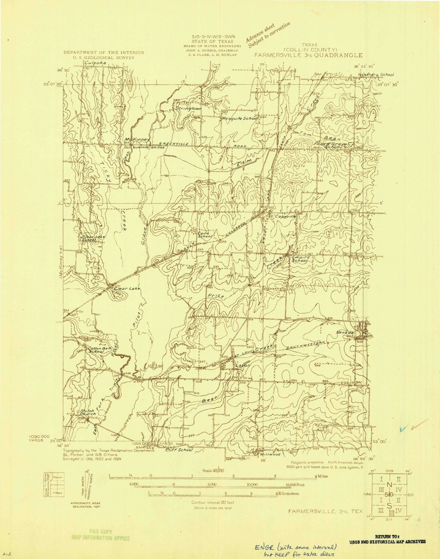
Classic USGS Lavon Texas 7.5'x7.5' Topo Map
Couldn't load pickup availability
Historical USGS topographic quad map of Lavon in the state of Texas. Map scale may vary for some years, but is generally around 1:24,000. Print size is approximately 24" x 27"
This quadrangle is in the following counties: Collin.
The map contains contour lines, roads, rivers, towns, and lakes. Printed on high-quality waterproof paper with UV fade-resistant inks, and shipped rolled.
Contains the following named places: Avalon Park, Backbone Cemetery, Bear Creek Cemetery, Bell Lake, Bell Lake Dam, Beverly Hill, Boyd Lake, Boyd Lake Dam, City of Lavon, Clear Lake, Clear Lake Cemetery, Clear Lake Park, Copeville, Copeville Post Office, Cottonwood Park, Culleoka Park, Deep Water Point Estates, Elm Creek, George Creek, Kudlacek Field, Lakeland Park, Lavon, Lavon Beach Estates, Lavon City Hall, Lavon Dam, Lavon Lake, Lavon Police Department, Lavon Post Office, Lavon Shores Estates, Lavon Volunteer Fire Department, Lavonia Park, Lazy Dog Ranch Airpark, Little Ridge, Little Ridge Park, Mallard Park, Moores Lake, Nevada Division, Nevada Volunteer Fire Department, New Mesquite, Pebble Beach Park, Pebble Beach Sunset Acres, Pleasant Hill Cemetery, Price Creek, Soil Conservation Service Site 2 Dam, Thompson Cemetery, Ticky Creek, Ticky Creek Park, Tom Bean Creek, Twisted JS Airport, Wilson Lake, Yucote Acres, ZIP Codes: 75166, 75173