MyTopo
Classic USGS Lawler Minnesota 7.5'x7.5' Topo Map
Couldn't load pickup availability
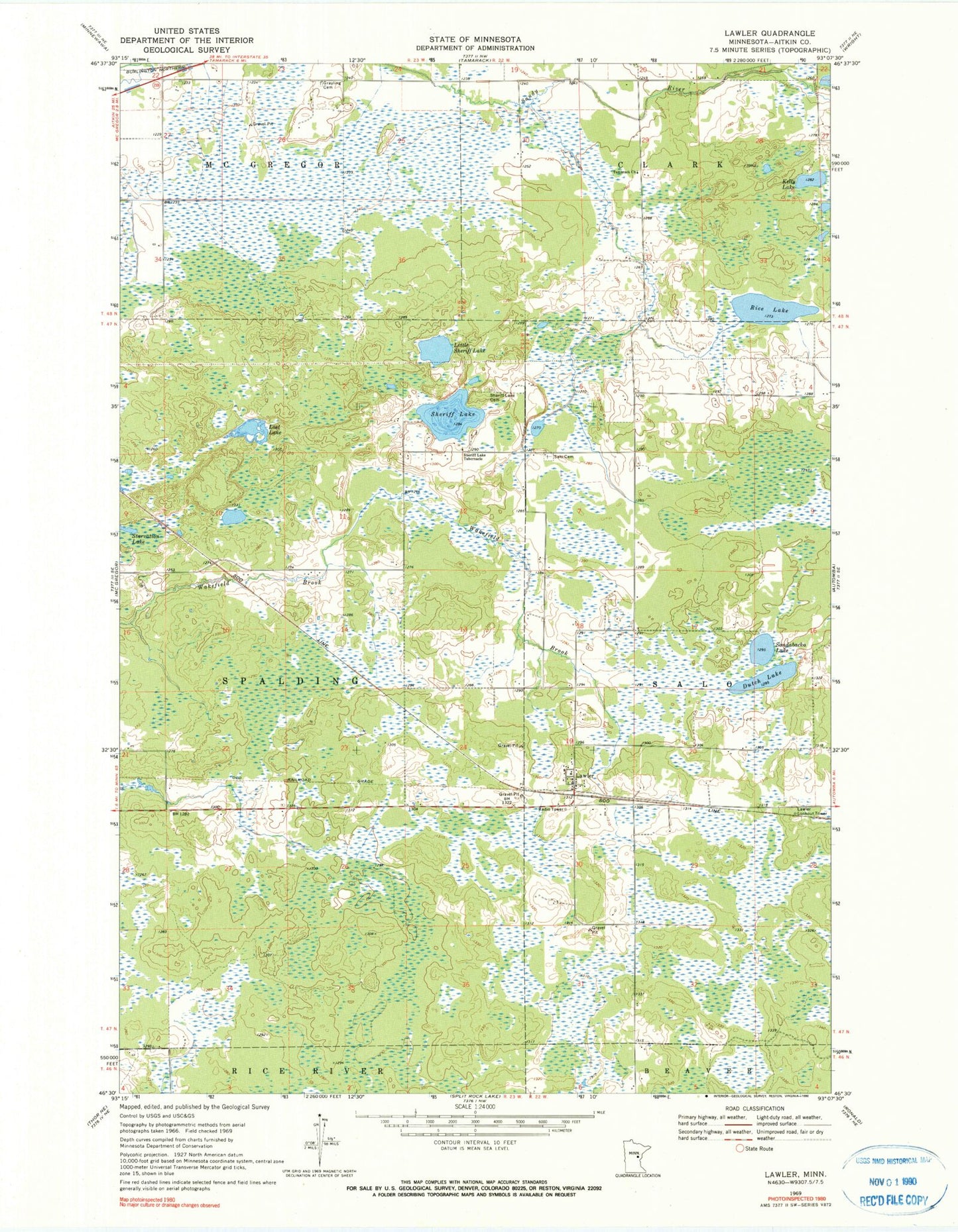
Historical USGS topographic quad map of Lawler in the state of Minnesota. Map scale may vary for some years, but is generally around 1:24,000. Print size is approximately 24" x 27"
This quadrangle is in the following counties: Aitkin.
The map contains contour lines, roads, rivers, towns, and lakes. Printed on high-quality waterproof paper with UV fade-resistant inks, and shipped rolled.
Contains the following named places: Dutch Lake, Finnish Apostolic Cemetery, Grayling Cemetery, Kelly Lake, Lawler, Lawler Lookout Tower, Lawler Post Office, Lawler Wildlife Management Area, Little Sheriff Lake, Lost Lake, Rice Lake, Salo Cemetery, Sandabacka Lake, Sheriff Lake, Sheriff Lake Cemetery, Sheriff Lake Tabernacle, Tamarack Church, Township of Spalding