MyTopo
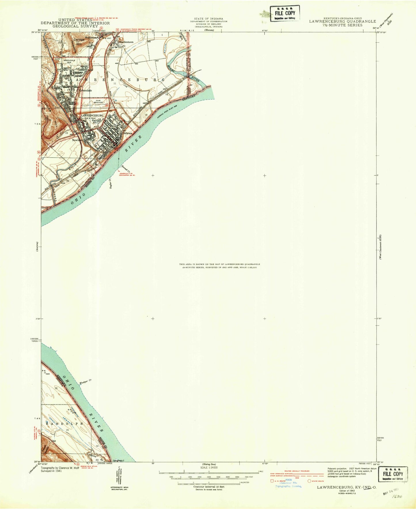
Classic USGS Lawrenceburg Indiana 7.5'x7.5' Topo Map
Couldn't load pickup availability
Historical USGS topographic quad map of Lawrenceburg in the states of Indiana, Kentucky, Ohio. Map scale may vary for some years, but is generally around 1:24,000. Print size is approximately 24" x 27"
This quadrangle is in the following counties: Boone, Dearborn, Hamilton, Ohio.
The map contains contour lines, roads, rivers, towns, and lakes. Printed on high-quality waterproof paper with UV fade-resistant inks, and shipped rolled.
Contains the following named places: Allen Fork, Ashbys Fork, Barnard Cemetery, Botts Cemetery, Brandywine Creek, Brown Cemetery, Bullitsburg Church, City of Greendale, City of Lawrenceburg, College Hill, Commissary Corner, Dark Hollow, Dark Hollow Run, Dearborn County Sheriff's Office, Dearborn County Water Rescue, Dinsmore Cemetery, Double Lick, Double Lick Creek, Doublelick Run, Finney, Fort Hill, Fort Hill Station, Foster Cemetery, French Hollow, Garrison Creek, Garrison Landing, Graves Cemetery, Great Miami River, Greendale, Greendale Cemetery, Greendale Emergency Medical Services, Greendale Fire Department, Greendale Police Department, Hardinsburg, Hebron Division, Homestead, Idlewild, Idlewild Post Office, Island Branch, John Tanners Station, Johnson Cemetery, Lake Jeanclia, Lawrenceburg, Lawrenceburg Emergency Medical Services, Lawrenceburg Ferry, Lawrenceburg Fire Department, Lawrenceburg Fire Department Station 1, Lawrenceburg Police Department, Ludlow Hill, McMurry Cemetery, Miami Fort Power Plant, Miami River Public Access Site, Moore Cemetery, Mosby Cemetery, Old Channel Lake, Oldtown, Peaks Branch, Petersburg, Petersburg Cemetery, Petersburg Census Designated Place, Petersburg Fire Protection Distrct, Petersburg Post Office, Piatt Cemetery, School Number Fifteen, School Number Four, School Number Three, Scott Cemetery, Second Creek, Steep Creek, Sunrise Acres Airport, Tanners Creek, Tanners Station Historical Marker, Taylor Creek, Tousey Cemetery, Touseytown Post Office, Township of Lawrenceburg, Walton Cemetery, Whitaker Cemetery, White Oak Lick, Woolper Creek, ZIP Codes: 41005, 41080