
MyTopo
Classic USGS Laws Hill Mississippi 7.5'x7.5' Topo Map
Couldn't load pickup availability
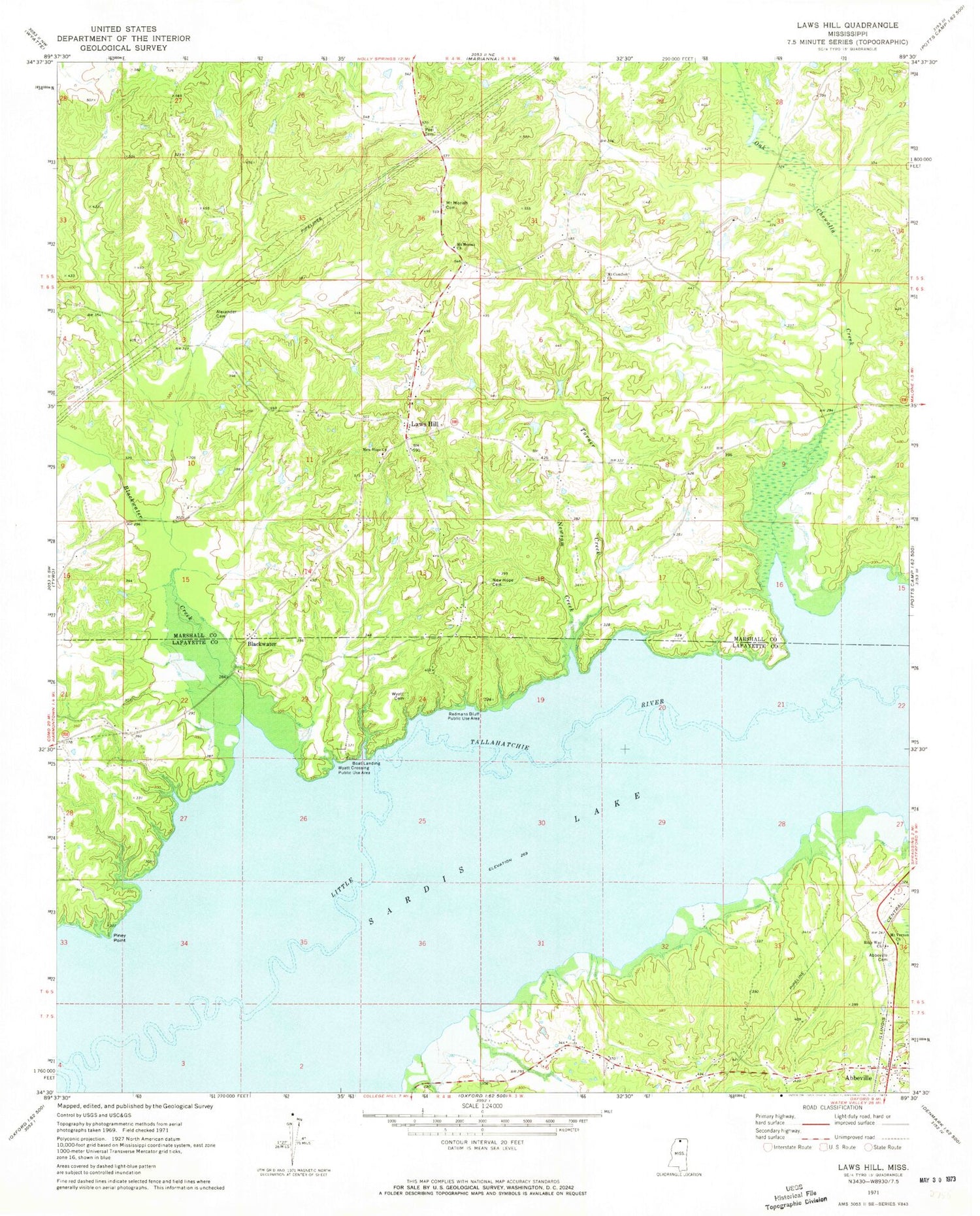
Historical USGS topographic quad map of Laws Hill in the state of Mississippi. Map scale may vary for some years, but is generally around 1:24,000. Print size is approximately 24" x 27"
This quadrangle is in the following counties: Lafayette, Marshall.
The map contains contour lines, roads, rivers, towns, and lakes. Printed on high-quality waterproof paper with UV fade-resistant inks, and shipped rolled.
Contains the following named places: Abbeville, Abbeville Cemetery, Abbeville Post Office, Abbeville School, Alexander Cemetery, Bible Way Church, Blackwater, Blackwater Creek, Dunnovants Ferry, Gallegley Store, Graham Lake, Harris Chapel, Laws Hill, Laws Hill School, Mount Comfort Cemetery, Mount Comfort Christian Methodist Episcopal Church, Mount Comfort School, Mount Maria Church, Mount Moriah Cemetery, Mount Moriah Church, Mount Vernon Church, Mount Vernon School, New Hope Cemetery, New Hope Church, Newsom Creek, Oak Chewalla Creek, Pauls Chapel, Peel Cemetery, Pigeon Roost Watershed Y-5-124 Dam, Piney Point, Redmans Bluff Public Use Area, Smith School, Smith Store, Town of Abbeville, Turner Creek, Wyatt, Wyatt Bridge, Wyatt Cemetery, Wyatt Crossing Public Use Area


